
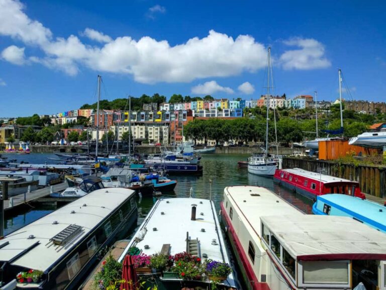
Walking the Norfolk Coast Path: An In-Depth Guide
Articles on this site contain affiliate links, meaning I may be compensated if you buy a product or service after clicking them. The full privacy & disclosure policy is here.I’ve said it before and I’m sure I’ll say it again before I’m much older: when it comes to walking, it’s hard to go past the UK. A vast network of public footpaths and bridleways crosses the entire country, and you can make up your own route through fields and woodlands almost anywhere you happen to be.
That network of paths also makes it much easier for enthusiastic amateurs and government bodies alike to put together multi-day walking routes, ranging from overgrown dirt tracks to official National Trails. Despite now living on the other side of the world, I still find myself back in the UK each year, and try to walk one of these routes whenever I’m there.
Having tackled the likes of the Cotswold Way, Hadrian’s Wall, and the South Downs Way in the past, this year it was time to head to England’s eastern edge. The Norfolk Coast Path is another of those roughly week-long wanders that the country excels in, running for 84 miles along the north and east coast of the county.
The route, and coastal Norfolk in general, felt quite different to other long walks I’ve done in the UK. It’s famously flat, of course, which makes for big skies and empty horizons, but it’s also remarkably diverse.
From vast salt marshes to brash holiday towns, lovely historic villages to empty clifftops quietly eroding into the pounding ocean below, I was surprised at just how much things changed over the course of six days.
If this sounds like the kind of walk that appeals to you as well, and want to know things like how hard it is, where to stay, distances, costs, what the food and drink options are like, and other logistical details, read the first part of the guide below.
If you prefer pretty photos, or want a route summary, daily distances, or a detailed day-by-day description of the walk, check out the second section.
Or, if you’d rather, just read it all!
Planning and Logistics
Where Does It Start and Finish?

More than most major paths like this, the Norfolk Coast Path has changed a bit over the years. Starting in the northwestern corner of Norfolk at Hunstanton (or “Sunny Hunny”, as locals apparently call it and I will never say again), the path used to finish 46 miles later at Cromer.
In 2014, the route was pushed out another 18 miles to Sea Palling, and two years later it was extended again to its current finishing point at Hopton-on-Sea.
To add to the confusion, the path can be combined with the Peddars Way, a 46-mile trail that follows the route of an old Roman road almost straight up from Knettishall Heath to Holme-next-the Sea, where it connects with the Norfolk Coast Path.
Together, the two paths form the Peddars Way and Norfolk Coast Path National Trail: you’ll need to backtrack a few miles from Holme to Hunstanton if you want to walk every step of that trail. For the sake of clarity, I’ll reiterate that I only walked the Norfolk Coast section: the Peddars Way awaits!
In terms of which direction to walk, the trail is waymarked in both directions, but most people choose to head west to east. That’s the logical option if you’ve just walked the Peddars Way from the south, but even if you haven’t, heading east means you’re more likely than not to have the wind at your back.
How Long Is It?

Like I say above, the Norfolk Coast Path now officially runs for 84 miles (135 km), from beside a wooden sign on the Hunstanton seafront to an innocuous signpost on a nondescript beach access road at Hopton-on-Sea.
If you were ever looking for proof that it’s about the journey, not the destination, the start and end of the Norfolk Coast Path provides it.
One of the biggest benefits of running along the coastline of a popular holiday destination is that there’s plenty of accommodation right on the trail. That, combined with few side tracks beyond the occasional inland/high-tide route, means that you probably won’t be doing a lot of extra off-trail distance each day.
Even in the larger towns, our accommodation was never more than a few minutes off the official route, and we didn’t have to go far for meals or snacks either.
My Fitbit tells me I walked almost exactly 90 miles (149km), not including any wandering around town in the evening, which feels about right. It usually over-estimates distances a bit on hilly ground, but there wasn’t much of that on this walk!
How Hard Is It?

If difficulty was measured solely by changes in elevation, the Norfolk Coast Path would be the easiest long-distance walk I’ve ever done. Norfolk is flat, to the point where even a climb of 50 metres merited comments about how thin the air had become and whether we should have packed crampons.
Entire days passed where we didn’t get more than ten metres above sea level; I don’t think I’ve been on another coastal path that’s taken its name quite so literally.
Even so, that didn’t mean the walk was without its challenges. We were very lucky with the weather overall, but there’s little shelter on most of the route: battling into the wind for hours made a couple of days in particular much more of a slog than they seemed on paper.
Don’t underestimate the surfaces you’ll be walking on, either: a good chunk of the trail is either directly along the beach or in the soft dunes behind it. Strolling on the sand is a lovely way to spend the day, but it’s much more taxing than walking on packed dirt or gravel.
There’s also a particularly unpleasant four-mile section of deep, thick shingle that’s enough to test the patience of even the most laid-back of walkers. If you’re lucky, you’ll do it at low tide when there’s a strip of packed sand to walk along instead. If not, well, don’t say you weren’t warned.
Because it’s so flat, there’s a mental component to the walk as well as a physical one: you can see for literal miles across the marshes on the first half of the walk, so the next town often takes a lot longer to get to than you expect.
That’s not helped by the route mostly going along the top of the sea defence walls rather than straight across the marshland: that’s great for the environment, but not so good for the motivation when it adds several extra miles to your day!
Even with all of that, though, this isn’t a hard walk, especially in good weather. With sensible distances between towns, plenty of places to stop for a break, and that near-total lack of hills, this is a path that most people with reasonable fitness and a good pair of walking shoes should be able to handle.
How Scenic Is It?

You might think that the lack of elevation that I keep going on about would also mean a lack of views, but that’s definitely not the case. Away from the towns and villages, empty expanses of sand, water, and marshes stretch to the horizon under enormous skies, providing a stark, isolated beauty of a kind I haven’t found elsewhere in the country.
It’s not the rolling hills and gentle woodland I generally associate with walking in the English countryside; most of it is more rugged and windswept, all crumbling cliffs, screeching seabirds, and rustling reeds. Maybe they should have called it the Alliteration Trail.
While the views change dramatically from one end of the walk to the other, though, they don’t feel like they change much throughout each day. Some might find that monotonous, but I found it more meditative than anything else, just putting one foot in front of the other for hours along the boardwalks and dunes of a barely-changing landscape.
If you do get sick of the isolation of the first half of the walk, though, you’ll be in luck in the final couple of days. That’s when the path leaves the emptiness of the north Norfolk coast behind and hits the holiday parks and amusement arcades of Hemsby and Great Yarmouth. Let’s just say it’s a different kind of view.
How Popular Is It?

Given the popularity of the Norfolk coast, and that we were walking in the last week of the summer school holidays, I expected the path to be a lot busier than it was. There were plenty of holidaymakers in the towns and villages, but when we got more than half a mile from the nearest fish and chip shop, it often felt like we were the only people on the planet.
We met a few day hikers and dog walkers who looked like they were strolling from one village to the next, but very few with the kind of backpacks and guidebooks that suggested they were also tackling the entire trail. By very few, I mean: one other couple.
Chances are, then, that you’ll have large stretches of the walk much to yourself, especially along the north coast and anywhere that’s not readily accessible by car. Just bear in mind that though the path itself might be quiet, at peak times you’ll still be competing with what feels like half of the UK for accommodation and a seat at pubs, cafes, and restaurants. Plan and book ahead accordingly!
How Well Is It Waymarked?

Like all of the National Trails I’ve walked so far, waymarking is generally good on the Norfolk Coast Path. The ubiquitous black and white acorn makes a regular appearance, whether it’s just a sticker on the back of a road sign, carved into a wooden marker post, or a proper signpost with distances and directions.
It’s relatively hard to get lost anyway, since the track mostly follows the coast and there aren’t huge numbers of other paths and trails to choose from. We often found ourselves slightly off the official route, walking along the beach rather than in the dunes above it or sheltering from the wind on a parallel path, but we knew we were still going in the right direction.
As is often the case, you’re more likely to go wrong coming in or out of towns, but most of them are small enough that it doesn’t really matter.
That said, there were a few places where the marker was covered by an overgrown tree or placed so high up that it was easy to miss. Sometimes we could just join up with the proper route further along, but not always. Backtracking is fun, right?
Whenever there was any doubt, the maps in my guidebook combined with the GPX route on my phone soon showed whether we were on the right path, and how to get back to it if not. More on both of those below.
How Long Does It Take to Walk?

Most people choose to walk the Norfolk Coast Path in around six days; that’s the option we went with as well, and it felt like the right amount. That gives an average of 14 miles (22.5km) per day, which is a reasonable distance for most regular walkers and easily achievable during daylight hours for much of the year.
We were able to stick pretty close to that average, helped by the amount of on-trail accommodation. Our longest day was 17 miles, and our shortest 12.5 miles. That’s a real contrast to most of the other long-distance trails I’ve tackled in the UK, where a lack of places to stay has meant some very long days at times.
If you’re comfortable with longer distances, there’s no real reason you couldn’t walk this path in five days if you wanted to. With that, you’d be averaging 17 miles a day, which would be fine in good weather (albeit a slog if it wasn’t!).
Likewise, if you prefer a slower pace and/or shorter distances, adding an extra day or two into the mix isn’t hard. Both the first three days and the last three could be split up a bit differently and turned into four shorter ones: there’s enough accommodation around to make that relatively easy to do.
Getting To and From the Norfolk Coast Path
Given its relative proximity to both London and Birmingham, and popularity with holidaymakers from all over the country, it’s no surprise that it’s pretty easy to get to Norfolk. That includes by public transport, to both the start and end points of the trail.
Most people will arrive in Norfolk by car, coach, or train, but you do have the option of flying into Norwich Airport from Aberdeen, Jersey, and a few European cities as well.
Hunstanton
If you’re coming from London, direct trains run from Kings Cross to King’s Lynn in the west of Norfolk, and Liverpool Street to Norwich further east. Both take a bit under two hours, but if you’re starting the walk in Hunstanton, going via King’s Lynn makes for a shorter overall journey.
Rail travel in the UK is often painfully expensive, but now and then you can snag a bargain by breaking up your journey. That’s what we ended up doing: instead of buying a direct ticket to King’s Lynn for £45, we got off to explore Cambridge for a couple of hours in the middle and paid £17 instead. Winning.
Note that these, like all cheap fares, were booked well ahead of time. If you just show up on the day and buy a ticket, expect to get absolutely fleeced. I used Trainline’s “SplitSave” feature to find those discounted rates, a bit over two months in advance.
Speaking of saving money, check to see if you’re eligible for a railcard before you book. If you travel as a couple or family, or are aged under 31 or over 60, you probably are: the cards give 33-50% off train travel and can often pay for themselves on a single trip. When we lived in the UK Lauren and I got a “Two Together” version, which saved us a small fortune.
Trains also run from Birmingham to King’s Lynn, with a change in either Peterborough or Ely.
From King’s Lynn train station, it’s a five minute walk to the bus terminal, where several different buses depart for Hunstanton. Look for number 33, 34, 35, or 36, and just jump on whichever one is leaving next: they all take roughly an hour to get there.
You shouldn’t need to wait long, but if you’ve got a bit of time to kill, there’s a useful supermarket alongside the station for any last-minute snack requirements.
While it’s also possible to take a National Express coach from either London or Birmingham to Norwich, and then multiple buses to get you to King’s Lynn and Hunstanton, I wouldn’t recommend it. It makes for a long, convoluted travel day, and you’re unlikely to save much versus a discounted rail fare.
Hopton
Once the walk is over, getting back from Hopton-on-Sea is surprisingly easy. If you’re heading to London, you’ll likely want to catch the 1/1A or X1 bus south to Lowestoft, where trains run regularly to Liverpool Street via Ipswich.
Heading north, the same bus routes run to Great Yarmouth and/or Norwich. The latter is where we went, catching a mid-afternoon bus to get us into the city just in time for dinner.
If you’re bound for Birmingham or further afield, there are frequent train and coach services from Norwich. Just make sure to give yourself enough time to make your connection, or plan to stay the night in the city: it takes a bit under two hours to get there from Hopton-on-Sea.
Between Different Sections of the Trail
Thanks to the excellent Coasthopper bus service along the north Norfolk coast, and a hodge-podge of other routes that cover the rest of the coastline, it’s unusually easy to get between most of the towns and villages along the Norfolk Coast Path.
This gives a lot of flexibility for day walkers, especially between Hunstanton and the end of the Coasthopper service at Mundesley. If you’re walking the full route, it lets you tackle it in stages, or skip ahead if weather, injury, or general lack of motivation forces a change of plans.
It also means that you can choose to base yourself in (for example) Hunstanton at one end of the route for a few days and then Great Yarmouth at the other end, and take buses backward and forward to your start and end point each day.
Although the buses run regularly and it means you can carry a smaller backpack, it’s still a bit of a faff, both at the start of the day when you just want to start walking and at the end when all you want to do is take a shower and relax.
Since those are the two places with the most (and cheapest) accommodation, though, it likely makes for a cheaper trip overall. If I was walking the route solo, I’d have considered doing some version of this: the savings might have been enough to put up with the hassle.
With costs split between two of us, however, and the desire to properly explore the pretty towns and villages along the way, we opted to stay on-route each night. It felt like the right decision.
Weather

Coastal Norfolk is very exposed to whatever weather is coming off the North Sea, whether that’s a gentle sea breeze or sideways rain and a howling gale. Even on otherwise hot and sunny days, the wind is rarely warm, especially if you’re sitting on a clifftop eating lunch without any nearby shelter. Ask me how I know.
We were blessed with a week of blue skies and no rain, which even in summer is a bit of a rarity in this part of the world. The wind varied between a welcome cooling breeze and strong enough to drive us onto alternative paths to get a little respite from the stinging sand.
Even so, at the end of summer, it never got particularly cold during the day: I was always fine walking in shorts, even when it was very windy.
I’ve seen enough blog posts and YouTube videos, however, to know that for every person who walks it in great conditions like we had, there’s someone who had hours or days of trudging through cold, relentless rain. Most of the path is very exposed and has minimal shelter, so when the weather arrives, chances are you’ll be in it.
Pack your sunscreen and hat, sure, but pack your waterproofs as well.
Accommodation

There’s a lot more accommodation available on the Norfolk Coast Path than other long walks I’ve done in the UK, and as long as you’re happy to spend the money, most of it is of a high standard. We stayed in some delightful old pubs, charming BnB’s, and modern hotel rooms, and were more than happy with the quality of all of it.
All of the places we chose were listed on major booking sites, most with automatic confirmation. This made piecing the route together much faster than it’s been on some of the other walks, where I’ve had to send emails and make phone calls one at a time, waiting for a confirmation before I could book the next place.
As I said earlier, though, this part of Norfolk coast isn’t only popular with long-distance walkers. Summer brings an influx of visitors all along the coast, which means that accommodation prices can be high, especially at peak times.
Walking in the last week of school holidays, we just missed the busiest period: I suspect finding places to stay each night that were affordable and a sensible distance apart would have been more challenging even a couple of weeks earlier.
Hunstanton and Great Yarmouth are the two largest towns along the route by quite some margin, so it’s no surprise that they have the most and cheapest accommodation. Everywhere else, you can expect to find at least one or two options right on the route (sometimes many more), and several others if you’re happy to deviate even a mile or two.
Hostels are in short supply, though: there are only a couple, in Sheringham and Burnham Deepdale, and they fill up quickly in summer.
If you’re happy pitching a tent, there are several paid campsites near the route between Hunstanton and Cromer. There are only two after that, however, so you may need to factor in the occasional hotel stay as well.
The flat landscapes and low, scrubby trees and bushes that make up much of the route mean that there aren’t many places good for wild camping, even if it was legal (it’s not). While you’ll find the odd farmer’s field where you might be able to ask for permission to put up a tent at the end of the day, I suspect most campers will opt for an official site unless they’re really short of cash.
I go into more detail about each place in the day-by-day summary below, but just so that it’s all listed in one spot, here’s where I stayed during my time on the Norfolk Coast Path, with links for more information.
- Day 0: Room in an Airbnb in Hunstanton
- Day 1: The Hero, Burnham Overy Staithe
- Day 2: The White Horse, Blakeney
- Day 3: Knoll Guest House, Cromer
- Day 4: Seals Bacton, Keswick
- Day 5: Chalet in a holiday park, Hemsby
- Day 6: Travelodge Norwich Central, Norwich
Baggage Transfer

While we chose to walk with our usual 40-ish litre backpacks and carry whatever we needed, you don’t have to do the same.
There’s a baggage transfer company, HikeHelp, that covers the Norfolk Coast Path route and can move your bags between accommodation each day as needed. I don’t have personal experience with them, but as far as I can tell, they’re the only company currently offering a bag transfer service in this area.
They charge £16 per bag, and there’s a two-bag minimum charge unless someone else on the same route happens to have booked a transfer service that day. Prices are based on walking west to east: for some reason, they charge more if you’re going the other way.
If that works for you, you can enquire and book through the company’s website.
Apps and Guidebooks

After trying a few different guidebook publishers over the years, I’ve now settled on Trailblazer guides as my preferred option for long-distance walks. They cover all of the major routes in the UK including the Norfolk Coast Path and Peddars Way, and many smaller ones as well.
I’m a big fan of their hand-drawn maps in particular: other books I’ve used either don’t have maps, or they’re quite small-scale and don’t have the kind of detail you need. Not so with Trailblazer: at 1:20,000, everything from hedges to bus stops make an appearance, along with every other possible point of interest.
There’s also a useful public transport section, discussion of food and accommodation in each town, plenty of history of the area, and more information than usual about the local flora and fauna you’re likely to encounter along the way.
I used the book extensively in the planning stages of the walk, and made a point of reading it over breakfast each morning before we set out. Because the path was so straightforward most of the time, though, I didn’t need to refer to it during the day as much as I have on other walks.
I also used the AllTrails app with this map any time I wasn’t entirely sure we were still on the route, or when the flying sand and howling winds made us look for alternate paths away from the beach.
Note that you’ll need the Plus version of AllTrails to download maps for offline use, which I’d recommend doing for when you don’t have phone service. There’s a seven-day trial available, so if you don’t need it after you’re finished, just cancel and you won’t be charged. After that, it’s £3/month.
Food and Drink

We ate well during this walk, thanks in part to some great breakfasts being dished up almost everywhere we stayed, and because of the sheer number and variety of pubs, cafes, and restaurants along the route.
Along with multiple variations on the Full English, breakfast options included things like home-baked bread and muffins, cereals, and more. It was often filling enough that we didn’t need much for lunch, just a bit of fruit or a sandwich, roll, or baguette, but they were easy to find in every village or town we passed through. Decent coffee was available anywhere my caffeine addiction required it.
We had particularly good fish and chips at Henry’s of Hunstanton the night before we set off, and an exceptional roast dinner at The Coach and Horses in Norwich to celebrate the end of the walk.
There was no shortage of fish and chips on offer along the route as well, served up everywhere from food vans to fancy restaurants, all seemingly having an award of some sort on display. My pick would probably be No. 1 in Cromer (clue’s in the name): it’s a popular spot, but big enough that we still didn’t have to wait long for a table. Be sure to order the cockles as a starter!
Other than that, pub meals proliferated. That was as much by choice and convenience as necessity: I’m sure there were other options available most of the time, it’s just that what I really wanted was a pint of something cold and a plate of something hot, and there was always a nearby pub that could supply it.
Not having to walk far to dinner is always very welcome after a day on my feet: nowhere was more than ten minutes away, and often it was a lot closer than that.
Small supermarkets of some description were also available in most of the towns and villages along the way. We walked past or near at least one per day, so if you’re self-catering, it’s very easy to stay supplied. Shout out to Picnic Fayre in Cley as well, which had great baked goods and (obviously) picnic supplies on offer.
Costs

Like other National Trails that go through busy tourist areas, walking the Norfolk Coast Path isn’t cheap. Prices for food, drink, and accommodation reflect how popular this area can be, especially in summer.
As I mentioned earlier, though, you do have a few options for keeping prices down. Spending most nights under canvas, paired with a BnB or pub stay only when necessary, will save you hundreds of pounds if you’re walking solo and don’t mind going a bit off-route at times.
Campsites typically cost £10-20pp, with the more expensive ones usually having more facilities. Some also offer a glamping option, with fancy pre-erected tents, yurts, cabins, and more. Those are usually a bit cheaper than a hotel or BnB, but not always, and there may not be much in it even then.
Staying in double or twin rooms in pubs, BnB’s, and Airbnb’s, our seven nights of accommodation before, during, and after the walk averaged just over £100/night (£50 per person). That average disguises big differences, though: the most expensive room cost an eye-watering £180, while the cheapest was a much more wallet-friendly £39.
Having breakfast included at the more-expensive places did help reduce the sting a little, but it still wasn’t cheap. Of course, having a comfortable bed, hot shower, and private room are luxuries you don’t often get on long-distance hikes either!
I touched on it earlier, but if you don’t fancy carrying a tent but still need to reduce costs, you do have the option of basing yourself in the cheaper locations (Hunstanton and Great Yarmouth, basically) and taking a bus back and forwards each day. It’s extra effort for sure, but solo walkers especially will save quite a bit.
When it comes to food, expect to pay around £15 for lunch and a pint at a pub, or a bit less if you just grab a sandwich and non-alcoholic drink from a cafe. Dinner will typically set you back £15–25 as well, so it’s not hard for total costs to hit the better part of £100/day per person without really trying.
You’ll be able to save quite a bit if you carry everything you plan to eat and drink each day instead of buying meals and snacks, of course, and limit yourself to water in the evenings. That’s not how I choose to tackle my walks, but the option’s there if you want it.
The Walk Itself
All distances shown below are approximate, but should be pretty close: while I wasn’t using a GPS tracker, my Fitbit is normally fairly accurate on flat ground. There was, as I may have mentioned, plenty of flat ground.
I measured from when we started out in the morning until we arrived at the night’s accommodation, but not any wandering around town afterward.
- Day 1: Hunstanton to Burnham Overy Staithe — 16.3 miles (26.3km)
- Day 2: Burnham Overy Staithe to Blakeney — 15.2 miles (24.4km)
- Day 3: Blakeney to Cromer — 15.7 miles (25.3km)
- Day 4: Cromer to Keswick — 12.6 miles (20.2km)
- Day 5: Keswick to Hemsby — 17 miles (27.4km)
- Day 6: Hemsby to Hopton — 13.2 miles (21.2km)
Day 1: Hunstanton to Burnham Overy Staithe

After a delicious breakfast and wide-ranging conversation courtesy of John, our Airbnb host, we headed out onto the mean streets of Hunstanton and down to the signposts on the beach that mark the start point of the Norfolk Coast Path.
As soon as you start, you have the option of walking either on top of the cliffs or on the sand below for about three miles. With the tide times against us and figuring we’d get plenty of beach walking over the next few days (spoiler: we did), we made for higher ground.
It meant we missed out on seeing the mildly-famous striped cliffs up close, but did make for some lovely views over the ocean as we strolled past the lighthouse near the edge of town, then through the dunes and alongside dozens of beach huts. They looked like the perfect place to spend the day, but as close as we were to the sand, a beach holiday this was not.
A few different paths ran through the dunes, but all were roughly parallel to each other and it was impossible to get lost, so we picked the one with the most compacted sand for easier walking. We passed Old Hunstanton without really realising it (the path skirts around the edges), and likewise with Holme.
Holme is where the Peddars Way joins the Norfolk Coast Path, but we ignored the signs for it and carried on along the coast. The sandy trails became boardwalked not long after, helping prevent damage to the ecosystem of the Holme Dunes nature reserve.
Norfolk is very popular among bird watchers, as it’s right on a major migration path and the mudflats and marshes are breeding grounds for a wide variety of species. No surprise, then, that we soon passed a significant bird observatory (it costs £4 to enter).
Eventually turning away from the coast for the first time, we found ourselves in the lovely little village of Thornham. Most of the buildings along the walking route were made, or at least inlaid, with stones rather than bricks, giving a completely different feel to any of the other places we’d passed.
Arriving at lunchtime, we’d hoped for lunch at Thornham Deli, but apparently half the surrounding countryside had the same idea. Informed there’d be a half-hour wait for food, we scrapped the sustenance and just went for coffee instead. It was a nice spot though, especially outside in the sunshine: I’d happily stop by again.

With only a short backward glance at the inviting pubs on the main street, we followed the signs out of town. There’s no coastal path at this point, so the trail takes a big and not super-exciting detour inland, firstly along a narrow lane with no footpath and limited but fast-moving traffic. Keep your eyes open!
We eventually turned off the lane onto a lovely tree-lined path, which became a lot less lovely soon after as the trees disappeared and it passed a particularly stinky pig farm. From there we turned and headed back to the coast at Brancaster along a farm track.
The village seemed nice from the little we saw, before the trail deposited us out beside a vast salt marsh on the edge of town. A brand-new wooden boardwalk stretched from there alongside endless reed beds all the way to the ramshackle outskirts of Brancaster Staithe, where fishing boats seemed to outnumber humans.
Already we’d seen plenty of the marshes and mudflats that define this section of the Norfolk coast, but believe me, there was more to come. The trail now went on a seemingly endless loop atop the sea defence walls, with a solid two hours of straight, windswept path offering enormous views to the sea and horizon.
Both of us were starting to get a bit sore-footed and ready for things to end by the time we hit Burnham Overy Staithe. Lucky, then, that the end was in sight: the beer garden at The Hero. This pub is where we were staying, eating, and generally-not-leaving-until-tomorrow, and a good choice it was.
Our room out the back was small and expensive, but it was clean, modern, and very close to the trail, so we were more than happy with it. The fish and chips and burger at the pub were tasty and large, the wine and cider was cold and delicious, and being able to sit in the sun and enjoy them without having to walk more than twenty yards to do it was the biggest highlight of all.
That’s day one done!
Total distance: 16.3 miles (26.3km)
Day 2: Burnham Overy Staithe to Blakeney

Breakfast was included in the room price and after one of the better full English’s I’ve had, we strapped on our boots again and headed back to the trail junction just down the road. It didn’t take long to wander past the fishing boats and out of town: Burnham Overy Straithe is not the largest of villages.
From there, we were straight back onto a sea defence wall, following a creek through the marshes out towards Holkham Beach and the ocean beyond. You can’t see the beach until you get to the top of the dunes, but wow, it was worth the wait.
This huge white-sand beach apparently stretches for 10,000 acres, and on that day with almost nobody else around and views to the horizon, it definitely looked like it. It had been a cloudy morning, but the sun broke through just as we arrived, lighting up the sand and inviting us to ditch the path through the dunes for a stroll on the beach instead.
It’s easily one of the best beaches I’ve been to in the UK (not exactly a high bar, to be fair), and striding along the hard sand beside the water for an hour with only Lauren and the wheeling seabirds for company was the highlight of the walk so far.
This beach section finally finished at a section of pine forest, where the trail dog-legged back alongside the trees on a gravel path all the way to Wells Beach. We’d seen relatively few people to this point, but that all changed when we hit the beach carpark, and on the tarmac path running alongside the inlet for 20 minutes or so into Wells.
Wells-next-the-Sea, to give it its full and inaccurate name, is a busy tourist town in summer, and that day was no exception. The harbourfront was heaving with people catching crabs and generally milling around getting in each other’s way, but things quietened down a bit on the side streets.
We’d planned to have a small lunch here, but all the cafes had lines out the door, and with several miles still to go today, we weren’t inclined to wait around. Snacks and drinks from a convenience store and protein bars from the bottom of our backpacks would have to suffice, eaten while sitting on a carpark wall in the sun. Classy.
Once we left Wells and headed back into the marshes, the crowds disappeared as quickly as they’d arrived. Much of the afternoon was spent admiring the expansive views over ponds, reeds, and mudflats, which sounds much less attractive than it was.

It was all very scenic in a desolate kind of way, mostly empty except for the few spots that people and dogs could easily get to by car. That sentence feels like it describes most of this part of the Norfolk coast, to be honest.
The sun was out, the insects were buzzing, and we weren’t moving at much beyond a gentle amble in the late summer heat. Eating blackberries off the bushes on the side of the trail, we slowly made our way towards the pretty little village of Blakeney for the night.
Muddy kids were playing in the water in the shallow harbour, which sat in front of some lovely old stone buildings on the main street. It’s not always quite such an idyllic scene, apparently: markers as much as eight feet up the stone walls showed just how high the water had got over the years.
No such issue at our home for the night, the White Horse, which sat a hundred yards or so up the hill on a side street. It’s quite a fancy pub, and our room was lovely (although again, small), with a bath for soaking away the accumulating aches and pains.
We’d planned to eat there as well, but the chef had called in sick, which meant a much more limited menu. No problem: it gave us an excuse to explore the delights of Blakeney a little more, and admiring the perhaps excessively-large hilltop church of St Nicholas, we ended up at the King’s Arms instead.
My gammon and chips wasn’t anything to write home about, but it filled me up. Sitting outside in the sun, sheltered from the now-brisk sea breeze, with a plate of food and a pint was really all I needed. Happy days.
Total distance: 15.2 miles (24.4km)
Get regular travel, hiking, and tech updates from me
News, reviews, guides, and more, from here and around the web
Day 3: Blakeney to Cromer

A good night’s sleep and an equally good full English for breakfast set me up perfectly, and one glance at the weather forecast (sunny and a high of 21C) suggested it was going to be great day of walking ahead.
The first section of the morning did nothing to change my mind about that, as we walked out of Blakeney onto, you guessed it, another sea defence bank.
We could see the famous windmill in Cley-next-the-Sea across the marshes almost as soon as we left town, but the path takes a wide loop to get there, and it took a solid 90 minutes before we found ourselves in the narrow streets of this delightful village.
After stopping in at Picnic Fayre for a few supplies, checking out the menu at the Smokehouse, and admiring the sunny beer garden at the George and Dragon, we vowed to ourselves that we’d come back to Cley when we had more time.
Spoiler alert: we went there again with Lauren’s family less than a week later, and despite less sun and more sudden downpours, it was no less lovely the second time around.
We dragged our heels a bit leaving the village, partly because it was such a beautiful spot, and partly because we knew that once we got back to the coast shortly after, a miserable four miles of walking along deep shingle banks awaited us.
Or at least, that was the theory. We’d read somewhere that a strip of sand at low tide might let you bypass the endless shingle, and while we were about 90 minutes past that by the time we got there, we’d hoped there was still a chance.
And indeed there was. The shingle drifts along that beach are as much as ten feet high, and were a nightmare to walk on even for the minute or two it took to get down to the water. There, however, a thin but unbroken line of compacted sand stretched off into the distance.
With no time to waste, we marched off down the beach. The power of the ocean on this part of the coast was obvious as we walked, with everything from huge chunks of rusting chain to what looked like the brick façade of someone’s wall washed up on the sand.
It took about an hour and a half to walk to the end of the beach, and we got there just as the last of the sand disappeared underneath the rising tide. Even that walk had been quite tiring, although we were definitely moving faster than usual: I hate to think what it would have been like on the shingle!

A small hill marked the end of the beach outside Weybourne, where some old WWII bunkers provided shelter from the stiffening breeze as we lay on the grass and devoured a couple of protein bars.
It took some effort to drag ourselves back to our feet afterward, but I’m glad we did: the path stayed up on the cliffs for the next four miles, bringing great views and soft trails all the way to Sheringham. The best was right at the end, with a short but steep climb (no, really, a climb!) up to the lookout station on Skelding Hill.
As you might hope from a lookout station, you could see a very long way: quiet countryside in one direction, the bustling town of Sheringham in the other, and pounding ocean everywhere else.
Sheringham is quite large by the standards of towns along this route, and we stopped for a drink at The Two Lifeboats to celebrate having made it this far. We lost the sun from the front beer garden almost immediately: rather than sitting in the icy breeze like we did, I’d recommend heading round the back to the much more sheltered back beer garden instead!
Just on the other side of Sheringham lay the Beeston Bump, the tallest point around these parts. Somehow we didn’t get a nosebleed despite the towering 207ft/63m height, leaving us free to enjoy the great views back towards Sheringham and on to the small village of West Runton.
The path doesn’t really go through it, but cuts in from the coast at East Runton instead, hitting the first of many caravan parks along this route. Given that I hadn’t spent my childhood holidays enjoying the delights of Haven Holidays, Lauren had quite a job on her hands explaining their charms to me.
We hit the outskirts of Cromer soon after, one of the most popular towns along this section of coast, with a busy promenade and long pier. We’d booked Knoll Guest House and it turned out to be a great choice: it’s on a quiet side street close to the pier and a bunch of restaurants, with a lovely owner, and our room was cozy and spotlessly clean.
No 1 Cromer seemed to be the pick of several fish and chip restaurants nearby, with unbeatable views over the pier and water. There’s a fancy restaurant upstairs and a less-fancy one more suited to tired walkers below, and we were soon seated and tucking into what may potentially have been too much food.
My notes for our meal read ordered excellent haddock and chips/battered sausage and chips/very tasty ciders/even better popcorn cockles with chilli vinegar, and I think that pretty much says it all. After a wander along the pier and around the town centre as the sun was going down, we called it a night. It had been a great day all round!
Total distance: 15.7 miles (25.3km)
Day 4: Cromer to Keswick

You’ll be shocked to hear this, but breakfast was again both full and English. One day, I’ll learn that there are actually other ways to start my day while doing long walks in the UK. Maybe.
The path led along the promenade, past the pier, and up onto the cliffs above town for some impressive views, before dropping back down to the sand beside several colourful beach huts on the edge of town.
That kinda set the tone for the morning, which was split between walking along the beach (thankfully without any shingle in sight this time!) and up on the cliffs with some epic vistas. With so much of the coast path right on the sand, the dirt trails of the clifftop paths were a welcome change.
Our luck with the weather continued, with a cool breeze but still plenty of blue sky and warm sunshine. Perfect hiking weather! Again, there was hardly anybody else around: at one point we stopped for half an hour on a particularly soft patch of grass, and didn’t see another human the entire time. And no, that wasn’t because we were napping in the sun, although I’ll admit I came very close.
The route eventually left the coast to head slightly inland through the cute village of Trimingham, but not for long: we were soon back on the clifftops, avoiding landslips caused by the coastal erosion that’s especially obvious along this part of the walk.
After another lengthy stroll beside the caravan parks that now seemed to be popping up like mushrooms in autumn, we found ourselves in Mundesley. Briefly considering a snack at a sad-looking cafe, we continued instead to the Ship Inn, which turned out to be a much better choice.

The sunny beer garden was the perfect place to kick off our shoes and enjoy a pint of local cider, some tasty baguettes, and the sight of a paraglider sailing back and forward overhead in the breeze. With a short day today and only 90 minutes of walking left, there was definitely no hurry to leave.
This part of the Norfolk coast is renowned for the seal colonies that call it home, and while the biggest and best of them was yet to come, we spotted our first little harbour seal sunning itself on the sand as we strolled past.
The trail stayed right on the beach for the rest of the day, which as well as that lucky seal sighting, also meant that the ugliness of the Bacton gas terminals were hidden from view on the crumbling cliffs above.
We’d picked our accommodation at Seals Bacton in Keswick pretty much at random, but it turned out to be an inspired choice. The room was lovely, newly refurbished and nicely decorated, and the owner (Mandy) was an absolute delight. We stayed in some great places on this walk, but this was the best of them.
Even better, the Poacher’s Pocket pub was directly next door and very popular, with a full carpark and only a couple of free tables when we walked in later that evening. The meals were good, the staff were friendly, and there was even an outdoor area with great sunset views on offer.
Unfortunately those views came with a side of ice-cold wind straight off the ocean, sending us scuttling back inside after about three seconds. Ah well, can’t have it all!
Total distance: 12.6 miles (20.2km)
Day 5: Keswick to Newport

Breakfast at Seals Bacton was cooked on demand by Mandy and her team, and just as good as everything else about the hotel. I’m not even going to tell you what I ordered. You’ll just have to guess.
Excited about what the day had to offer, we headed off out the door… straight into what some people would call a bracing wind and others would call a howling gale. The longer we spent in it, the more it felt like the latter.
There was still a bit of sun around, at least, which helped distract from the sand whipping round our legs as we walked up the main road through Walcott. The path climbed up onto the cliffs soon after, taking us through fields and on to, through, and past Happisburgh and its famous old lighthouse and church.
Pronounced “Haze-bruh” (because of course it is),this seemed like a nice little village, although the extensive erosion along the cliffs makes it seem like it’ll be an even littler village before long. The hairy cows mowing the grass on the way into town didn’t seem too bothered about it, mind you.
The beaches were lovely all along this section, and other than the occasional hardy dog walker, completely empty. The aforementioned gale undoubtedly didn’t help: it wasn’t really ideal conditions for working on your tan.
After Happisburgh the trail dropped back down to the beach again for a while, going past several man-made rock reefs just offshore. The reefs have gaps between them that create wide lagoons on the beach, and given how much wind there was, it was no surprise to see a bunch of kite surfers zipping across from one side to the other.
Finding a sheltered spot in the dunes, we sat and watched them getting lifted into the air, remarking how it looked both loads of fun and mildly terrifying at the same time. Next stop: Sea Palling, and a lunch stop at Sandy Hills cafe, with decent coffee, a large bacon and egg roll, and definitely too many donuts.
The afternoon session was a long old slog, although at least a good chunk of it was on the landward side of the dunes. That mean we could avoid some of the wind, if not the forest of stinging nettles on one painful but thankfully short section.
The best bit of the day by far, and one of the best parts of the entire walk, was heading back to the beach at Horsey Gap. After seeing a few seals playing near the rocks, we walked a bit further along to find maybe a hundred of them lying on the edge of the surf out of the water. So cool!

We spent ages there checking them out, taking photos, and listening to their oddly-human sounds. A word of advice if you find yourself in the same situation: definitely admire seals from an upwind position. They might be cute, but they’re also smelly.
The wind was really blowing by this stage, and rather than endure another sandblasting when the trail returned to the beach, we fired up the AllTrails map and found an alternate route for the couple of miles between Winterton Ness and Winterton-on-Sea. Full of flowering heather and well-formed paths, it was a nice change of pace.
Winterton is a beautiful little village, and the grassy meadows known as “The Valley” immediately afterwards were equally attractive. That’s probably why the sudden appearance of amusement parks and souvenir shops on the horizon was such a shock. We’d definitely arrived in Hemsby.
Despite, or perhaps because of, the endless acres of caravan parks along this stretch of coast, there isn’t much in the way of accommodation that you can book for a single night. That’s how we found ourselves standing outside a drab chalet in a drab holiday park late in the afternoon, shivering in the wind as we tried to contact the owner.
She’d promised to give us the lockbox code that morning, but repeated texts and phone calls had yielded nothing but radio silence. She finally responded a chilly hour later, letting us finally get into our underwhelming room. It was ok for a night, but dusty, cluttered, and with terrible mattresses, I wouldn’t have wanted to stay longer.
The place was removed from accommodation sites soon after we stayed, but even if it hadn’t, I wouldn’t be recommending it!
We had dinner at TIs Bar and Grill over the road, which was full of people watching a football match and had the cheapest food and drink of the walk so far. It wasn’t a high-class pub, but it was a friendly and fun one, and we’d both really warmed to it by the end of the night. Or maybe that was just the wines?
Total distance: 17 miles (27.4km)
Day 6: Newport to Hopton

The lack of included breakfast for the first time on this walk made for an earlier start, and as it turned out, the high tide route through Hemsby ran right past our accommodation so we didn’t need to backtrack to get onto the route.
We found ourselves walking out of town soon thereafter, thankfully, and along the clifftop path all the way to California. It’s a bit different to the US version, but with the sun out and yesterday’s wind a distant memory, not a bad place even so.
As has so often been the case on this route, the clifftop trail dropped back down to the beach for a long trudge stroll along the sand. Hunger pangs pulled us back as we passed Caister-on-Sea, though, and towards the cafe at the Lifeboat station.
Sitting in the sun with a very good bacon and egg roll and a ‘flat white’ the size of a small bathtub was enough to set the world to rights, and it took much longer than it should have to hoist our packs back on afterward and head out again.
The path through the dunes was scenic and quiet, but it soon joined up with a long tarmac road that took us to the outskirts of Great Yarmouth. The amount of buildings, people, and tat rose sharply as we wandered into town, passing surprisingly nice, quiet beaches that were a stark contrast to the definitely-not-quiet esplanade and piers alongside.
It’s a big town, especially when you’re walking through it on a hot, sunny day, so we stopped in the shade for a few minutes so I could try my first (and as it turned out, almost certainly last) stick of rock.

Finally leaving the brashness behind at Wellington Pier, we headed inland to cross the river and pick our way through the industrial side of Great Yarmouth. This was my least favourite part of the entire walk, an hour of walking on hot concrete through an ugly industrial mess until we reached Gorleston.
The beach here was even prettier than the one in Great Yarmouth, and was just a nicer place to be in general, at least once we got away from the literal Punch and Judy show at the beginning and started the long stroll along the promenade.
The path headed down to the beach once the promenade petered out, where we had to make a call between the soft sand behind the sea defences or the hard sand in front of them. We opted for the latter, until we suddenly realised that the incoming tide was threatening to trap us: if it wasn’t for some missing slats in one of the defences that we could duck under, we’d definitely have been swimming!
Now, the end was in sight. We picked a path through some rocks, past families playing cricket, sunbathing, and looking bemusedly at two weary hikers walking past their picnics, to finally hit the unremarkable end point on a beach access road, a wooden signpost pointing back toward Hunstanton.
From there it was just a quiet 20-minute hobble to the bus stop, followed by a 90-minute trip on the X1 to Norwich. We’d had the foresight to book a cheap room at the Travelodge directly beside the bus station, and it was absolutely fine: a bit tired, perhaps, but not half as tired as we were!
Total distance: 13.2 miles (21.2km)
Final Thoughts
So how would I rate the Norfolk Coast Path?
As I mentioned earlier, this was one of the most diverse walks I’ve done in the UK. I loved the vast emptiness of the salt marshes and sand dunes, the wide expanses of beach and huge skies, and all of the charming seaside villages in a part of the country that felt very different to anywhere else I’d been.
With the path going straight through so many towns, not having to go off-route to find anywhere to stay was a very welcome change, and helped keep average distances down. The food was uniformly good as well, whether that was breakfast at our accommodation or anywhere else we ate.
For me, the first four days of the walk, plus of course the visit to the seals at Horsey Gap on day five, were the best bits of the route. After that, there’s a lot less countryside and solitude, and a lot more built-up areas: the industrial mess on the southern outskirts of Great Yarmouth is the prime example.
While I understand why the route ends where it does on the Suffolk border, and Hopton Beach itself is quite nice, I’m not really convinced of the need to walk the last five miles. The last day would have been much less of a slog if it had stopped at Britannia Pier in Great Yarmouth, with the advantage of cheap accommodation if you want to stay the night and good onward connections if you don’t.
Still, all in all, it was an enjoyable, straightforward, and relatively easy long-distance walk, especially since we were blessed with near-perfect weather the entire time. If you’re thinking about tackling it yourself, I hope you’ve found this guide useful: do let me know in the comments if there’s anything I didn’t cover, and I’ll do my best to help!
All images copyright by the author


Very informative and useful as thinking of doing this walk.
Thanks Dave for your really useful account of this walk. My husband and I had previously walked from Hunstanton to Cromer in 2022 but had disliked the beach walking so much that we’d decided not to walk Cromer to Hopton (particularly as the OS map looked like it would all be beach walking). However, after reading your blog, we had the confidence to try this section. We finished today and although walking on the beach was unavoidable in places, the sand was firm at the shoreline. As ‘oldie’ walkers, we did shorter daily distances of around 12 miles – we walk to enjoy, not to endure. A recommendation for anyone wanting accommodation around Sea Palling is to walk a mile and a half inland to Dairy Barns on the way to Hickling. A fantastic warm welcome and really comfortable accommodation.
So, thanks again Dave – I’ll keep reading for more walking ideas!
Oh wonderful! I’m so glad you decided to try that section — as you say, although there’s plenty of beach walking, it’s a lot more bearable if you can stick to the shoreline and have some vaguely hard sand under your boots! Thanks for the tip on the accommodation as well. 🙂
Thanks for this comprehensive overview and all the useful insights – you made us really interested in taking this project on in June! Sounds great!
No problem – glad you found it useful!
I really enjoyed this blog and referred to it many times over my walk from Hunstanton to Cromer, which I completed today!
Thanks for sharing so much information and I’m so much detail and style!
Thanks so much Tamara – really glad you enjoyed it! 😁