
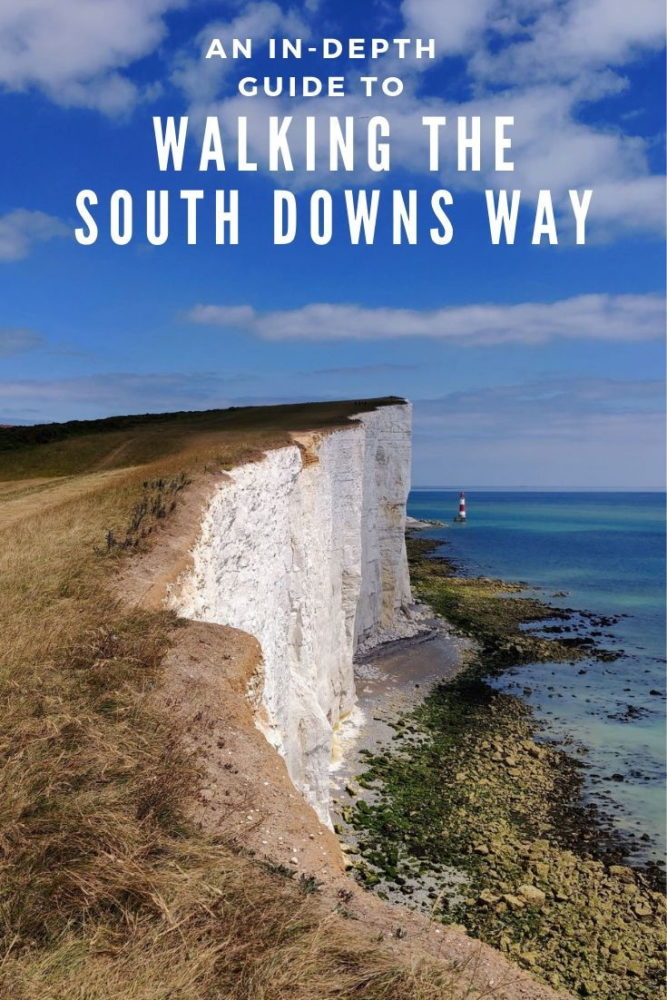
Walking the South Downs Way: An In-Depth Guide
Articles on this site contain affiliate links, meaning I may be compensated if you buy a product or service after clicking them. The full privacy & disclosure policy is here.If there’s one thing the UK knows how to provide, it’s week-long walks. No matter where you are in the country, if you’re looking to hike for a hundred miles or so, you’re spoiled for choice.
My first experience of this was the Hadrian’s Wall Trail, following what’s left of that Roman wall across the north of England. A year later, a friend and I walked the Cotswold Way, a delightful late-summer stroll with a near-endless supply of pretty stone villages and delightful pubs.
Skip forward another year, and to nobody’s surprise, I found myself idly flicking through the National Trails website again. Lauren suggested the South Downs Way, for no particular reason other than it had great views and was in the sunniest part of the country, and that was good enough for me.
Picking a random week just before the start of summer school holidays, we planned a route, booked some train tickets and accommodation, and counted down the days until we could throw on our backpacks and hit the trail.
And so it was that we found ourselves in Winchester one sunny afternoon in early July, standing in front of the oldest working water mill in the country. After a few photos in front of the large signpost that marks one end of the trail, we stomped energetically off along the river and started the South Downs Way.
The sunshine stayed with us for our entire eight days of hiking, a rarity in any English summer. Those energy levels, though? Yeah, they’d dropped substantially by the end.
I’ve broken this post up into two main sections, covering planning and logistics, and the walk itself. If you’re preparing to walk the South Downs Way and want to know how to get to and from the trail, where to stay, distances, costs, and what the food and drink options are like, read the first part.
If you prefer pretty photos, or want a route summary, daily distances, or a day-by-day description of the walk, check out the second section.
Or just read it all!
Planning and Logistics
In terms of difficulty, our (excellent) guidebook suggested the South Downs Way is one of Britain’s easiest National Trails. While that’s probably true, I still wouldn’t rate it as “easy,” especially on longer (15+ mile) days.
The South Downs is a long range of chalk hills, and the trail runs largely along the top of them. If you start in Winchester, as we did and most guides suggest, the first several days are spent almost entirely on a hard chalk path embedded with large chunks of flint. There’s more grass after that, but until the final day, still plenty of rock and rutted dirt to go with it.
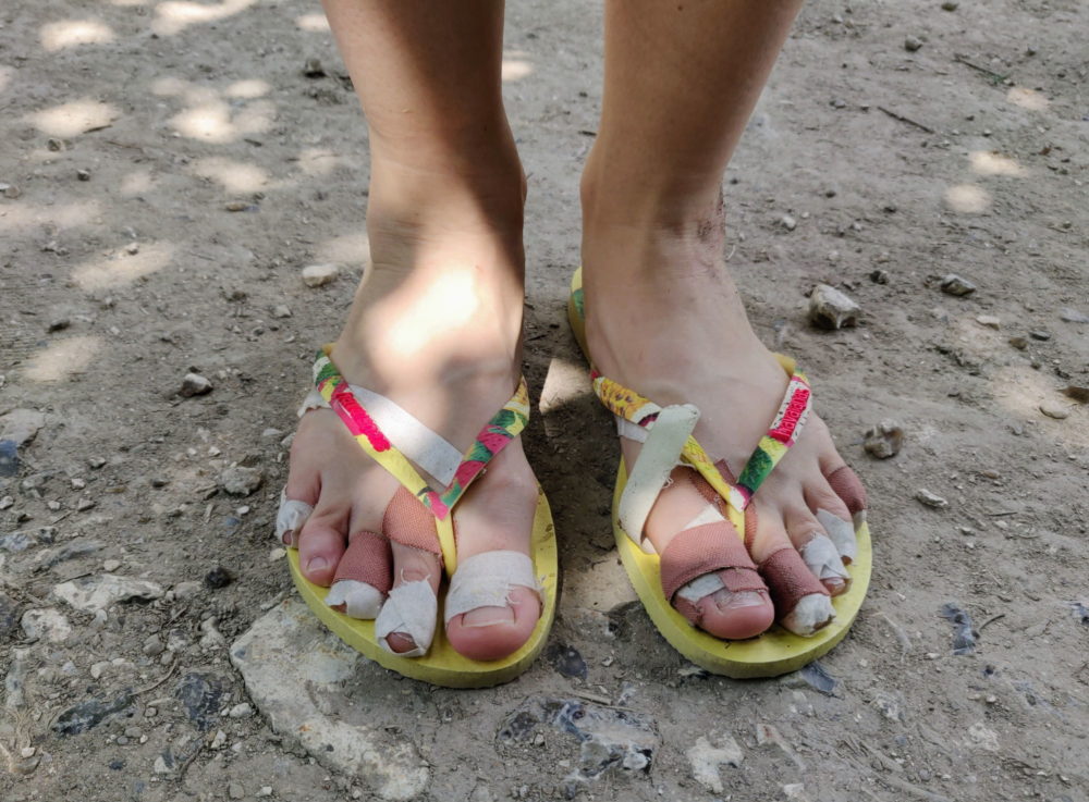
Much like the Caminos de Santiago I’ve walked, long distances on hard paths like that is a recipe for battered feet. I virtually never get blisters these days, and yet had a large, painful one on my little toe for the last part of the walk.
Even with good shoes, Lauren also developed several nasty blisters by the halfway point. There’s not much fun in that. The South Downs Way is not easy on the feet — plan your daily distances with that in mind!
The other challenge with this particular trail is that while the path runs along the top of the hills, the towns and villages don’t. Sometimes the trail will naturally drop down into a valley and go through a village as it does so, but most of the time you’ll be up for a steep off-trail detour to get to accommodation or lunch stops. These detours can easily be a mile or more way, which definitely adds up.
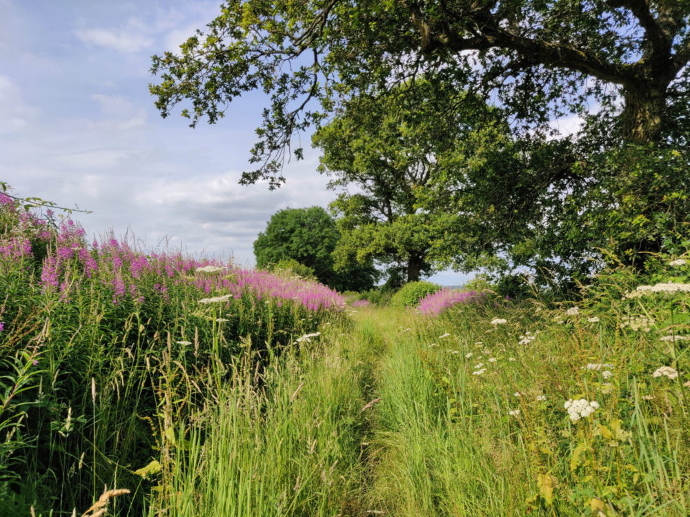
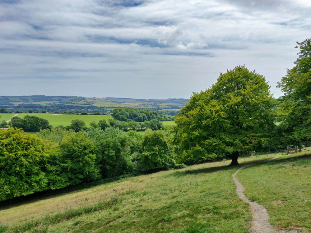
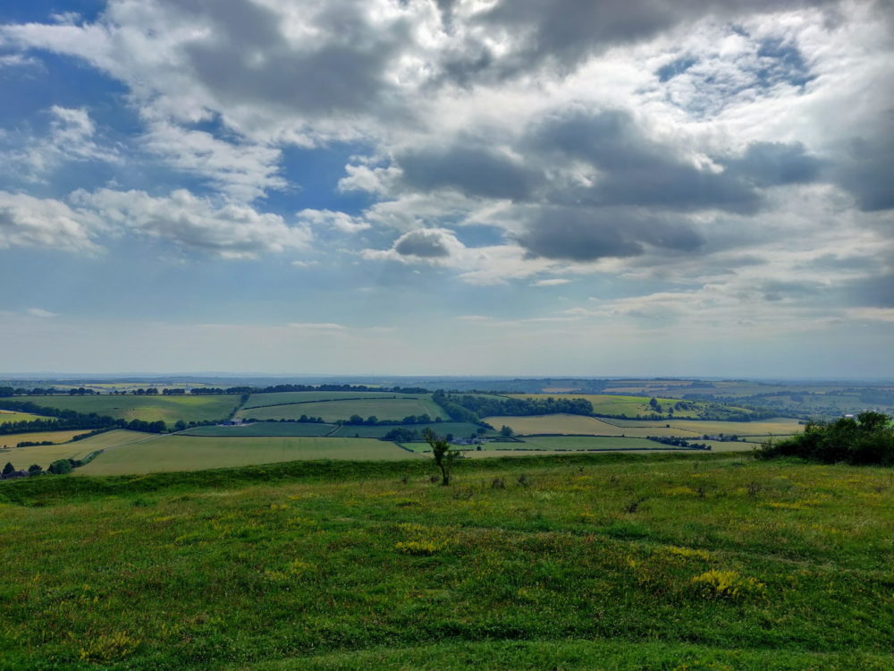
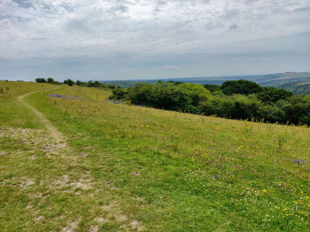
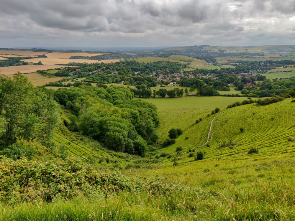
All of that said, the South Downs Way is a spectacular walk. Views are often genuinely stunning, stretching to the ocean in one direction and over attractive valleys and farmland in the other. The trek over the Seven Sisters and Beachy Head is pure postcard material.
The small villages along the way are also a delight, regularly full of gorgeous stone buildings, beautiful old pubs, and medieval churches just begging for you to pop your head through the door. The Cotswold Way gets all of the attention for its pretty villages, but I think those along the South Downs Way are at least as impressive.
Unlike some of the UK’s national trails, there are also plenty of accommodation options to suit all budgets. They may require a detour and aren’t always spaced out exactly where you’d want them, but everything from campsites through bunkhouses and hostels, pubs, BnB’s, and fancy hotels are available.
Much of it is directly bookable online as well, a nice change from the phone calls and emails often needed for Hadrian’s Wall and the Cotswold Way. While there’s a good range of accommodation, though, the options in any particular village will often still be quite limited.
This part of the country is popular with holidaymakers as well, so if you’re walking between late spring and early autumn, don’t expect to just show up and find a bed available.
Wild camping options are very limited as well, especially beside the trail. Unless you’re prepared to take detours, arrive late, leave early, and risk the wrath of a farmer if they find you on their land, it’s not really an option.
As mentioned, we deliberately timed our walk to start before the UK summer school holidays. Booking a couple of months in advance, we had no problem finding a bed for each night. Outside the summer holiday peak, I’d expect you’d usually be fine booking a few weeks before your start date.
Where Does the South Downs Way Start and Finish?
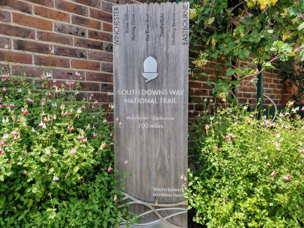
The South Downs Way runs the entire length of the South Downs range of hills, from Winchester in the west to the coast at Eastbourne. Large wooden signposts mark the start and end points, outside the City Mill in Winchester and at the base of Beachy Head on the outskirts of Eastbourne.
You can walk in either direction, although most guidebooks seem to suggest walking west to east. That way, the prevailing wind is at your back rather than blowing in your face for a week.
Also, while Eastbourne itself isn’t the most exciting place to finish, the few hours hiking up and down the Seven Sisters and Beachy Head beforehand are the most spectacular of the entire trail.
In general, I found the scenery and villages kept getting more attractive the further east we went. Knowing the walking was going to be even better today than yesterday made getting out of bed each morning just a little bit easier!
How Long Is It?
The South Downs Way officially runs for 100 miles, or 160 kilometres, but you’ll absolutely walk more than that. The exact distance will depend on where you stay each night and how far off the trail it is, whether you drop down off the ridge for lunch, and how much exploring you do of the larger towns and villages.
My Fitbit told me I’d walked a total of 126 miles (202km) between the signpost at the start and my hotel on the last night. That covered every step I took, including getting to and from the trail for accommodation and lunch breaks, and any other wandering in the evening.
How Well Is It Signposted?
Eighty miles of the South Downs Way was approved as the UK’s first long-distance bridleway in 1972, with the remaining section from Winchester to Buriton added fifteen years later.
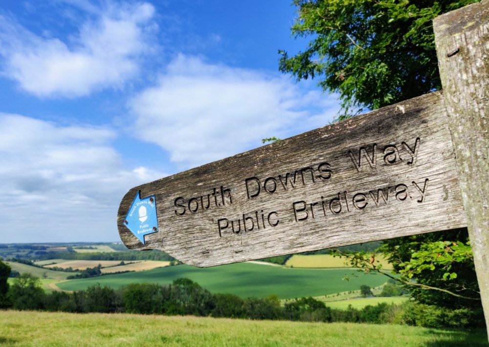
Despite its relative age, however, the waymarking along the South Downs Way is generally very good. It’s a difficult trail to get lost on anyway, since it’s mostly a wide path suitable for horses and cycles as well as hikers, and you’re walking along a ridge much of the way.
Signposts like the one above are very common, especially anywhere there’s a decision to be made about which path to take. If there wasn’t a signpost, there was at least a National Trail acorn marker on a fence post or stile to keep us going in the right direction. As a general rule, if you haven’t seen a marker in the last 15 minutes, you’re probably going the wrong way!
I’d used Trailblazer’s guidebooks for both Hadrian’s Wall and the Cotswold Way, and they’d both been brilliant. The large, hand-drawn walking maps had plenty of useful detail and were easy to follow, and I’d found the food and accommodation listings to be accurate and largely up to date.
Unsurprisingly, I used the same company’s South Downs Way guidebook as well , and it was just as good as the other two.
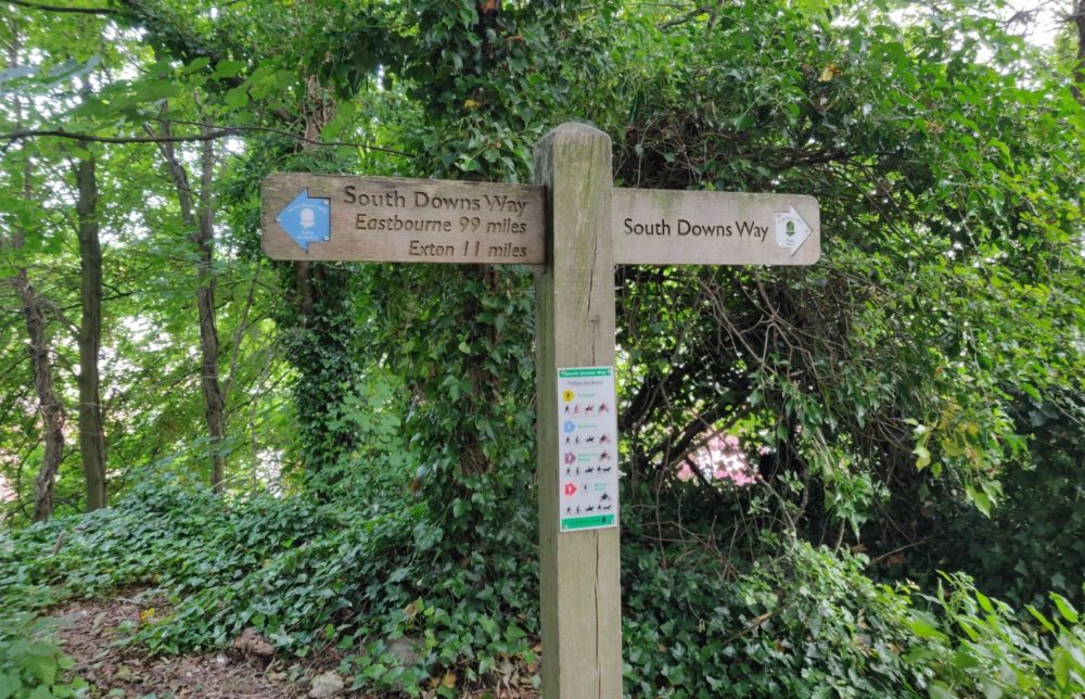
Given all of the above, we found navigation easy. Our only real wrong turn was in a forested section outside Exton with a couple of parallel paths, where we accidentally followed the Monarch’s Way for a mile or so instead. In the end we were only off-route by a couple of hundred yards, but I was glad to have my phone with me to be able to figure that out at the time!
On that note, I used AllTrails to navigate this route, as I do for almost every other hike I undertake. There’s a map available within the app, or you can import the GPX file from the National Trails site. I pay for the Plus version so I can use it offline and import files, but most other features of the app are free.
Where things got more interesting, of course, was when we left the trail to find food or accommodation. The turnoffs were well marked in the guidebook, but from there, you’re generally following a public footpath of some sort and largely on your own. Both AllTrails and Google Maps (along with a UK SIM card) came in useful here.
How Long Does It Take to Walk?
Walking the South Downs Way takes a bit over a week for most people. The exact time depends on your fitness levels and how hard you want to push yourself, as there’s enough accommodation to give plenty of flexibility.
If you’re short on time, very fit, and can handle walking on hard, uneven surfaces for 20+ miles a day, you could be done in five or six long days. You’d be tired and sore, with early starts, late finishes, and no time for lengthy lunch breaks or exploring along the way, but it’s possible. Personally it sounds like torture, but each to their own.
It’s more typical to walk for eight or nine days (7-8 nights), which still provides a good challenge but is much more attainable for most people. We opted for the eight day/seven night version, and in hindsight, would have added the extra day.
That would have let us split up two long days into three shorter ones, and would have meant fewer blisters and a more relaxed middle section. While there was plenty of time for late starts and long lunches towards the start and end of the trail, it would have been nice to have that choice the whole way along.
You definitely don’t have to tackle the entire length all at once, of course. If you’re only in the area for a long weekend, or just don’t have the time or desire to walk 100+ miles, the best bits of the South Downs Way are easily accessible as a day or overnight hike. We met several day walkers along the way, especially as we got closer to Eastbourne at the end.
Getting To and From the Trail
The UK is generally pretty well served by public transport, at least in terms of its existence. It’s not necessarily cheap, and schedules often seem more like ambitions than statements, but it’s usually available if you need it.
The start and end points of the South Downs Way are no exception. If you’re starting from Winchester like we did, the nearest airport is Southampton. If you’re flying into London Heathrow, a coach runs from there to Portsmouth via Winchester.
Trains run regularly between London and Winchester throughout the day. Several other services connect through Reading, making it straightforward to get there from most parts of the country.
Eastbourne also has regular trains to and from London Victoria, and they can be pretty cheap: it’s not unusual to find off-peak advance tickets for under £10. Usefully, this service goes via Gatwick Airport, so you can easily connect with your flight if you’re coming from overseas.
If you’re not planning to walk the whole route, trains and coaches also run to various other points on or near the trail. If you’ve got your own wheels, with a bit of research local bus services will let you turn several sections into one or two-day hikes and return to where you left the car.
We took a mid-morning train via Reading to Winchester, and it was straightforward enough, although not without incident. Delays meant that we missed our first connection and the second one arrived late, but we got there in the end.
From Winchester station, it was a ten-minute walk into the central city, and another few minutes to the start point at the City Mill.
The South Downs Way finishes just outside Eastbourne, and it’s roughly another mile and a half to the city centre and train station. We stayed overnight in Eastbourne and took a late-morning train the next day, but could easily have finished the walk and caught an evening service to London instead.
Bag Transport
We carried everything we needed for the South Downs Way in our backpacks, but you don’t have to. Luggage Transfers offers bag transportation services, where they’ll collect your pack or suitcase from your accommodation each morning and drop it at your destination before you arrive.
A daypack with just water, snacks, and a jacket is much easier to carry long distances than a full pack. Since you’ll usually be booking your accommodation in advance anyway, this approach can work pretty well if it’s something you’re after.
That said, at £27+ per transfer, prices are very expensive for a single bag. By way of comparison, the same service for the Hadrian’s Wall Path costs £10. Per-person costs are more reasonable for multiple bags if you’re travelling in a group, at least.
Weather

The southeast of England is known for being the sunniest part of the country. If you’re walking in summer, you’d be fairly hopeful about having warm, dry conditions at least some of the time.
That said, this is the UK we’re talking about. Conditions are unpredictable at the best of times, and can change quickly at any time of year. The South Downs ridgeline is very exposed in parts, and there’s often no real shelter from wind and rain if it does decide to show up. Pack for bad weather, and be glad if you don’t get any!
We got very lucky. In a summer that was late arriving and wet when it finally did, we had eight days of near-perfect walking weather. Almost every day followed the same pattern, with morning cloud burning off before lunch, followed by blue skies, sunshine, and temperatures typically in the low to mid-20s (C).
It rained overnight a couple of times, but other than a few drops as we set off one morning, we stayed dry the entire time. Any long-distance hike where my jacket never leaves my pack can only be viewed as a success. In the UK, it’s nothing less than a miracle.
Accommodation
Being a holiday destination and within easy reach of London for weekend trips, there’s plenty of accommodation along the South Downs Way. You’ll usually find at least one pub or BnB option even in small villages, and some have many more.
They aren’t cheap, at least in summer, but if you’re travelling as a couple or with a friend, they’re roughly in line with other popular parts of country.
Unlike (for example) the Cotswold Way, those on a budget aren’t left out in the cold. Campsites are quite frequent and well-spaced, and you’ll likely be able to stay in one each night other than in Winchester and Eastbourne themselves.
If you’re not carrying a tent, there are a few backpacker hostels along the route, along with a couple of bunkhouses with inexpensive beds. Given where they are, you probably won’t be able to stay in one every night, but they’ll still help keep the costs down.
Even though I wasn’t staying in them, I visited three of the hostels to take advantage of their cafes (and their toilets) since they were all right beside the trail. Both the YHA Truleigh Hill outside Steyning and appropriately-named YHA South Downs near Southease were modern, clean, and surprisingly stylish. The coffee was good, too. Very important.
I didn’t get to take a look inside the Whetherdown Lodge at the Sustainability Centre outside East Meon, but the food and drink were tasty at the cafe, and the concept is one well worth supporting. Camping, yurt, and other options are also available there.
As mentioned earlier, one advantage of the South Downs Way running through a popular tourist area is the ease of booking accommodation. Unlike some of the other National Trails I’ve walked, we were able to book every night online without needing to resort to phone calls or waiting for people to reply to emails. It just made route planning so much easier.
We ended up with a good mix of traditional bed-and-breakfasts, pub accommodation, and a couple of Airbnb rooms. The quality varied a bit, but in general was better than I might have expected. While a couple of places were on or very close to the trail, most required a detour of a mile or so. That’s just the nature of this walk, really.
None of the places we stayed had laundry service (or at least didn’t mention it), but I was always able to wash clothes in a hand basin and hang them somewhere to dry overnight.
I go into more detail about each place in the day-by-day summary below. For the sake of having an accommodation list in one place, though, here’s everywhere we stayed along the South Downs Way, with a link for more information where possible.
- Day 1: The Brick House B&B, Cheriton
- Day 2: Ye Olde George Inn, East Meon
- Day 3: The White Hart, South Harting
- Day 4: Airbnb, Houghton Bridge
- Day 5: Uppingham B&B, Steyning
- Day 6: Airbnb, Kingston-near-Lewes
- Day 7: Ye Old Smugglers Inne, Alfriston
- Day 8: Albert and Victoria, Eastbourne
Food and Drink
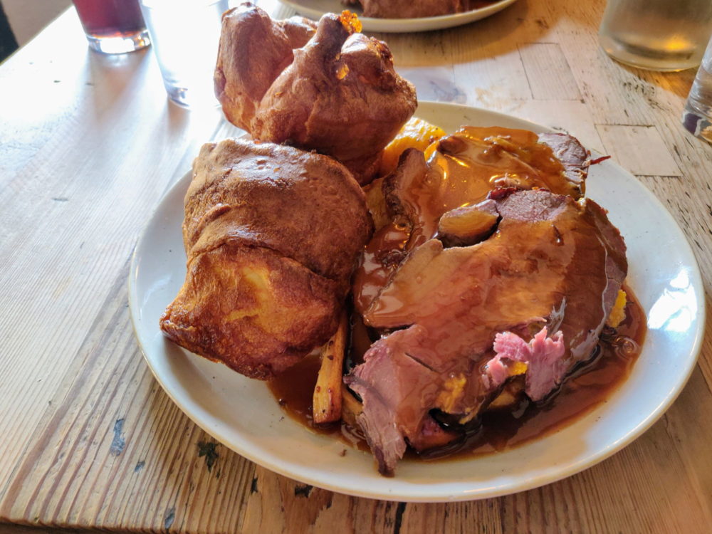
More than any other long distance hike I’ve done, the food and drink were a real highlight of the South Downs Way.
Food on the Caminos I’ve walked has always tended toward lots of calories for not much money. Both the Cotswold Way and Hadrian’s Wall had plenty of good, solid pub grub and huge fried breakfasts, but not much in the way of alternatives outside the cities.
All of those options were available along the South Downs Way as well, but they were far from the only choice. I expected minor variations on the “full English” for breakfast every day, but other than at a couple of places, there were other, better alternatives on offer.
Things like avocado toast and salmon with scrambled eggs, washed down with good strong coffee, were a better way to start the day than several pounds of bacon and beans.
Some of the pubs we stayed at offered a packed lunch option, typically if you ordered it the night before. The Sustainability Centre cafe was also happy to bag up a sandwich and crisps to take away when I asked. These were a godsend on long days when we didn’t want to detour off-trail to find food.
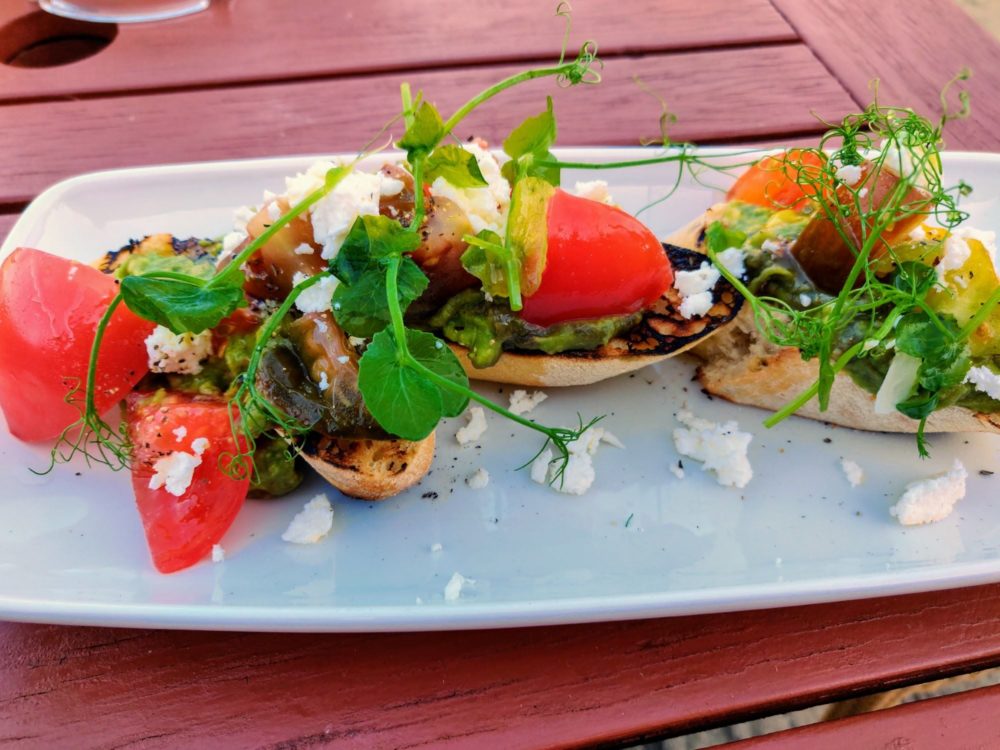
The other lunches, and every dinner, ended up being at a pub. There were a few cafes and restaurants in the larger villages and towns, but given how nice the weather was we much preferred to sit in the beer garden of a country pub instead.
As with breakfasts, the quality of the pub meals was generally higher than I was expecting. While a couple of places served up fairly generic deep-fried pub food, most put some real effort into their menus. Vegetarian options were always available, and often vegan ones as well.
I don’t really drink beer these days, but for those who do, there seemed to be an endless range of real ales available on tap, along with the usual mixture of lagers, cider, and the rest.
Breakfast was always included in the nightly rate in BnBs, and most of the pubs as well. The one place that didn’t just had a breakfast menu to choose from, and added it to the final bill. One of the Airbnb owners offered a light breakfast, and the other left bread, eggs, and spreads to make our own.
Most pubs opened around 11 am, and almost all of were open and serving food by midday. Most of the village pubs stopped serving lunch by 3 pm, then closed for the afternoon until around 6 pm. This affected our walking plans a bit, but was easy enough to manage. We never didn’t get fed!
Other than the first night when the nearest pub wasn’t serving food and we had to walk 20 minutes to a different one, we never had to go far for dinner. All of the pubs we stayed in did food as well, and when we were staying in other types of accommodation, a meal was never more than ten minutes away. After 20+ miles on my feet, I was very pleased about that.
Packing List
Walking the South Downs Way in the middle of summer and not needing to carry camping equipment or food meant I could keep my gear list relatively small.
On these types of walk, I try to keep my bag under about 10% of my body weight. For me, that means everything I need to stay safe and comfortable, including water and snacks, needs to come in under 7-8kg.
As with my other UK long-distance hikes, I carried everything in an Osprey Talon 44 backpack. I’ve reviewed that pack separately in the past, and it remains my go-to option. Other than that, my Hadrian’s Wall packing list covers most of what I took on the South Downs Way, and how well it worked.
The one thing I would mention for now, though, is hiking poles. For the last few years I’ve been slowly converting from “none, ever” to “one, occasionally” to “two, always” when it comes to using them on long walks. The amount of knee pain I get on steep, uneven downhills has dropped massively, and uphill sections are noticeably easier.
I bought a pair of Black Diamond Trail Back trekking poles for the South Downs Way, which were a major upgrade from the single cheap poIe I had before.
There’s a lot of up and down on this trail, and much of it is on steep, rocky paths. Some of those paths would be quite dangerous in the wet without poles, but even in dry conditions, the poles made a huge difference to the amount of energy and pain I had at the end of the day.
Even if you’re an avowed pole-hater like I used to be, I’d suggest giving them serious consideration for this hike!
Costs
Like some of the UK’s other National Trails that go through popular tourist areas, walking the South Downs Way isn’t cheap. Prices for food, drink, and accommodation reflect the fact that many national and international visitors come to this part of England, especially in summer.
Thankfully, there are plenty of campsites for those looking to keep costs down. Spending most nights under canvas, perhaps paired with hostels and bunkhouses now and again, will save you hundreds of pounds if you’re walking solo.
Sites typically cost around £15pp, with the more expensive ones usually having more facilities. Prices at the hostels vary based on how busy they are and size of the room, but as an example, expect to pay somewhere around £25 for a dorm bed at the impressive YHA South Downs.
You can also camp there using your own tent or one of theirs, along with fancier options like camping pods. Various other budget options are also available on or near the South Downs Way, including bunkhouses, camping barns, and several shepherd’s huts.
If you’re self-catering, there were supermarkets and convenience stores in most of the towns and villages we stayed in. Some had limited hours, though, so be sure to check in advance if you’re planning to pick up supplies.
Staying in double or twin rooms in pubs, BnB’s, and Airbnb’s, our accommodation averaged just under £120/night (£60 per person.) Having breakfast included helped reduce the sting a little, but it still wasn’t cheap.
Of course, having a comfortable bed, hot shower, and private room are luxuries you don’t often get on long-distance hikes either!
Expect to pay around £15 for lunch and a drink at a pub, and a bit less if you just grab a sandwich and a soft drink from a cafe. Dinner will typically set you back £20+ as well, so it’s easy to hit £100/day or more each for food and accommodation without even trying.
You’ll be able to save quite a bit on those costs if you carry everything you plan to eat and drink while walking each day instead of buying lunch and snacks, and limit yourself to water in the evenings. I’m absolutely not disciplined enough to do that, but who knows, you might be.
The Walk Itself
As I mentioned earlier, while the South Downs Way is rated as one of the easier UK National Trails, that probably only applies if you’re not doing much more than about 13 miles/21km a day.
The hard, rocky trail gets very tough to walk on after a few hours, especially during the first half of the walk where there’s little respite from it. It’ll be the soles of your feet that start complaining long before anything else does.
That said, the surface gets softer as you get closer to Eastbourne, and the last day was spent largely on grass. By that point, it felt like walking on a fluffy pillow.
On the upside, the South Downs Way has probably the most consistently good views of any of the week-long walks I’ve done in the UK. Climbing up and down from the ridgeline might get old after a while, but you don’t get views without hills, and there’s a hell of a lot of reward for the effort.
Being up on the ridge also means you largely get to avoid busy roads for most of each day. The trail does cross a few A roads here and there, including a couple of dodgy spots where you get to play chicken with oncoming trucks, but in general you’re well away from noisy traffic.
Having such settled weather made the walking more flexible and enjoyable, and with the sun not setting until after 9:00 pm, the only real deadline for getting in was whenever the pub stopped serving food.
On the shorter days, this meant a leisurely post-breakfast start, an unhurried lunch, and still arriving by late afternoon or early evening. On our two 20+ mile days? Well, that’s a different story.
Route Summary
All distances are approximate. They were recorded on my Fitbit, which doesn’t use GPS and usually over-estimates mileage a bit. They cover everything from getting up in the morning to arriving at the night’s accommodation, but not the small amount of wandering around I did afterward.
- Day 1: Winchester to Cheriton, 13.8 km (8.6 miles)
- Day 2: Cheriton to East Meon, 24.2 km (15 miles)
- Day 3: East Meon to South Harting, 23.7 km (14.7 miles)
- Day 4: South Harting to Houghton Bridge, 33.2 km (20.6 miles)
- Day 5: Houghton Bridge to Steyning, 19.3 km (12 miles)
- Day 6: Steyning to Kingston-near-Lewes, 35.9 km (22.3 miles)
- Day 7: Kingston-near-Lewes to Alfriston, 20.8 km (12.9 miles)
- Day 8: Alfirston to Eastbourne, 20.4 km (12.7 miles)
Day by Day
Day 1: Winchester to Cheriton
We’d deliberately planned a short first day so that we could arrive in Winchester in time for lunch, explore for a couple of hours, and still get to our accommodation by early evening.
Those delayed trains put paid to most of the exploring, but we still found time to wander past the Great Hall, admire the Cathedral, go into the City Mill, and firmly declare we’d come back again for a weekend. Winchester is a very attractive little city.
Lunch was at the highly-rated Forte Kitchen cafe and it didn’t disappoint, with good food and smiling staff. We finally tightened our straps and headed off under glorious sunshine around 2:30 p.m,, first alongside the river and then quickly out into the fields and countryside beyond.
Short, mostly flat, and with several nice sections of grassy trail, this first section definitely lulled us into a false sense of security about what the rest of the South Downs Way held in store!
To keep this first day under ten miles, we’d decided to stay at The Brick House B&B in Cheriton, a solid mile and a half off the trail. We split off onto a public footpath in the corner of a field, and followed first an overgrown path and then a small country lane into what turned out to be an attractive little village.
This was the most expensive accommodation we stayed in on the entire walk, but it wasn’t hard to see why: a spacious room with a comfortable bed and powerful shower, in a lovely house with a huge garden. The owner was super-friendly and helpful, and put together a quality breakfast the next morning, complete with home-baked bread.
One thing worth noting if you’re planning to stay in Cheriton on a Monday night like we did: the kitchen at the nearest pub, the Flower Pots Inn, is closed that day. As a result we ended up at the Hilton Arms, roughly a 20-minute walk each way. I wouldn’t rave about either of our meals, but at least the portions were massive.
If you’re happy with a longer first day of about 12 miles, I’d suggest staying at this place in Corhampton instead. You’ll be staying much closer to the trail, with a couple of good pub options nearby.
Total distance: 13.8 km (8.6 miles)
Day 2: Cheriton to East Meon
Between chatting to a cycle-touring Dutch couple over breakfast and grabbing extra slices of that delicious sourdough, we didn’t manage to start walking until nearly 10 a.m. Decadent! There was a good excuse, though: check-in time at the pub we were staying that night wasn’t until 6 p.m., and there was no point in rushing. So we didn’t.
The morning’s walk was largely through woodland and along quiet lanes, and the clouds had disappeared by the time we finished the long, gradual climb up to the top of Beacon Hill. The packs came off at a perfectly-placed patch of long grass, where we admired the views and basked in the sunshine for longer than was perhaps strictly necessary.
Onward and steeply downward, but only as far as the picture-perfect village of Exton. The guidebook had suggested the Shoe Inn as a good place to stop for a bite to eat, and one glance at the beer garden confirmed it.
We stretched lunch out until the pub closed for the afternoon at 3 pm, before heading out for the final six miles. The views got even better, coupled with a long section in the woods along what felt like a dry, rarely-used creek bed. As it turned out, half of that section was actually the Monarch’s Way — we missed a signpost somewhere — which probably explained the overgrown trail. Oops.
Back on track, we took the steeper, shorter path over Old Winchester Hill instead of the longer track that wound round it. The views from the Iron Age fort at the top were more than worth the extra sweat.
The final couple of miles dragged on a bit, with the first hint of the “minced feet” feeling that was to become a regular companion in the coming days. Still, we’d got the timing right, rolling into East Meon and Ye Olde George Inn a few minutes after 6 p.m.
Our twin room above the bar was a bit tired, and the mattress on my bed more springs than anything else. Still, the room was clean, the shower worked well, and it was about 25 steps to get to our table for an impressive dinner.
I even had enough energy left for a walk around the village afterward to check out the 900-year-old church. A short walk, I hasten to add.
Total distance: 24.2km (15 miles)
Day 3: East Meon to South Harting
Dinner the night before was good, but the eggs and avocado toast at breakfast were even better. The strong coffee helped get me out the door before 9 a.m., on a warm, cloudy morning that again burned off and became bright blue skies by lunchtime.
The first stop of the day came at the Sustainability Centre. The trail runs directly past it, and never being ones to walk past a cafe at the best of times, we headed inside for a coffee.
The staff were happy to wrap a couple of sandwiches to take with us as well, a nice touch that allowed an impromptu picnic among the wildflowers at the top of Butser Hill a couple of hours later.
The afternoon’s walking was just as lovely, at least once we’d crossed the noisy mess of the A3 at the bottom of the hill. The Queen Elizabeth Country Park was a particular highlight, full of wooded trails with plenty of welcome shade. I expected many things from the South Downs Way, but needing to shelter from the heat wasn’t one of them.
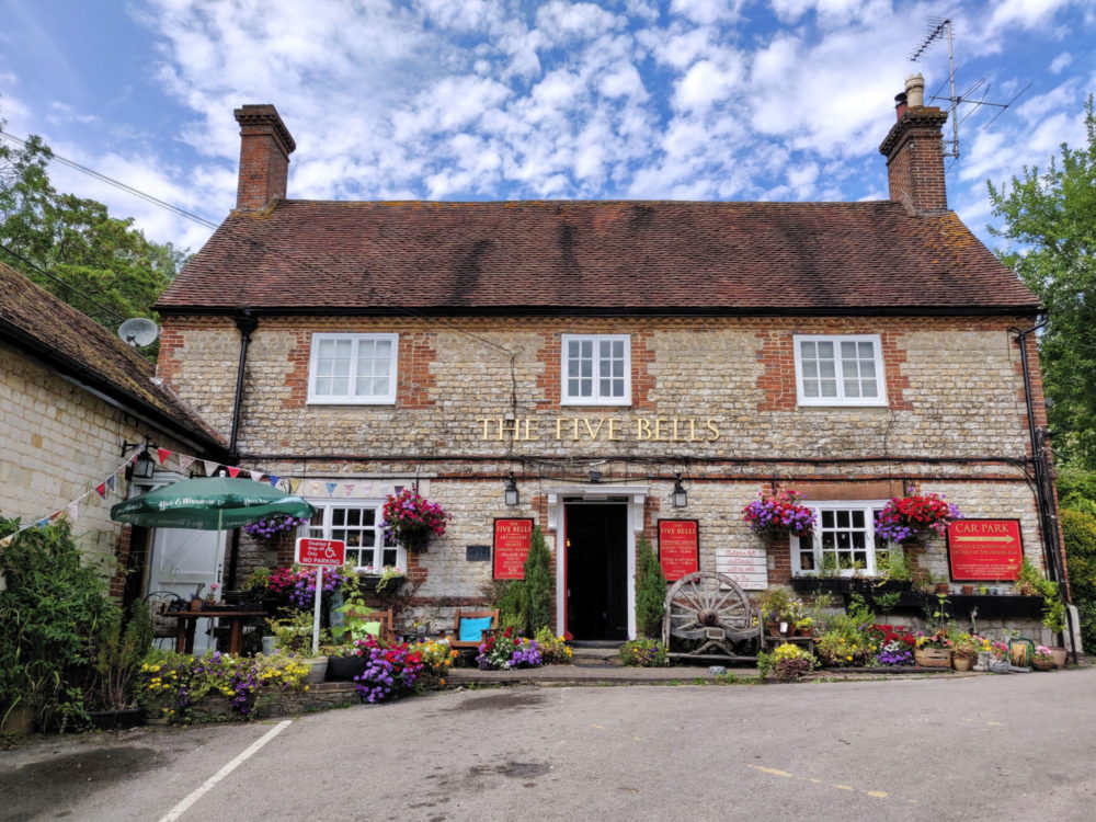
Lauren was taking it slow due to blisters, so she sent me on ahead for a while. I hadn’t planned to detour off the trail before the end of the day, but the call of a cold pint on a hot day is always hard to ignore. It was worth the extra walking: the Five Bells in Buriton was a beautiful old village pub, with outdoor tables that ensured nobody else had to smell me.
Lauren had passed me again thanks to that pub stop, but we met up just before the turnoff to South Harting. It was a slow walk down to the village, and the glorious 16th-century White Hart that was our stop for the night.
The pub itself was all exposed beams and low doorways, but the accommodation out the back was modern and stylish, and the food was once again exceptional. I’d be more than happy to go back and stay there again!
Total distance: 23.7km (14.7 miles)
Day 4: South Harting to Houghton Bridge
The first of two 20+ mile sections on our route, we knew today would be a challenge. With Lauren’s blisters starting to mount up, the bus stop beside the Cocking turnoff at the seven mile mark was looking like a make-or-break point for her before we even set off at 8 a.m.
The pub offered a packed lunch option, and we gladly took it: there were no food options on the trail today, and we sure as hell weren’t going to be adding extra distance by detouring!
Before the tough stuff started, though, the first couple of hours of walking were some of the best so far. The climb out of South Harting started with a lovely section of forest, then opened up into spectacular views as we wandered up toward Beacon Hill. No, we hadn’t done a loop — there are two hills of that name on the South Downs Way. Because of course there are.
Even better than the views, though? The grassy trail that went with them. Just like the day before, we took the (very) steep shortcut over the hill rather than the longer, flatter path around it. Also like the day before, it was totally worth the effort.
We had an early lunch on the side of the trail just before Cocking, and never before has a roast beef sandwich that’s been sitting in a backpack for a few hours tasted so good. Lauren gazed longingly once, twice, three times at the bus shelter as we passed it, and then limped on up the hill. Only 13 miles to go.
The views and woodlands were just as attractive for the rest of the day, but that green, grassy trail quickly became a distant memory. The stony path returned, and with no towns or villages to break things up on this section, our feet were very unhappy by the time we made the final descent into Houghton Bridge.
Hint: if you’re doing the same, don’t take the shortcut that takes you into town from the west, over the bridge. There’s no footpath on that part of the busy B2139, and cars fly along there. It’s really quite dangerous, and not the best way to finish the day.
We were staying in a private room in an Airbnb that night that was the cheapest accommodation of the trip yet noticeably better than some of the other rooms we’d booked.
It had a nice big bedroom and (shared) bathroom, came with a light breakfast in the morning, and was directly opposite the lovely Bridge Inn, a perfect place to enjoy a tasty meal and cold pint in the beer garden. Which soon turned into two cold pints in the beer garden.
Sadly that place is no longer available to book, since I’d have been happy to stay there again. Instead, I’d suggest either a room at the Sportsman Inn or the nearby South Downs Bunkhouse, which has both low-cost bunk beds and B&B rooms available.
Total distance: 33.2 km (20.6 miles)
Day 5: Houghton Bridge to Steyning
A much shorter day today, thankfully, but we were still out the door by 9 a.m. The steep climb out of town got my heart racing, but things stayed pretty level after that, at least by the standards of the South Downs Way.
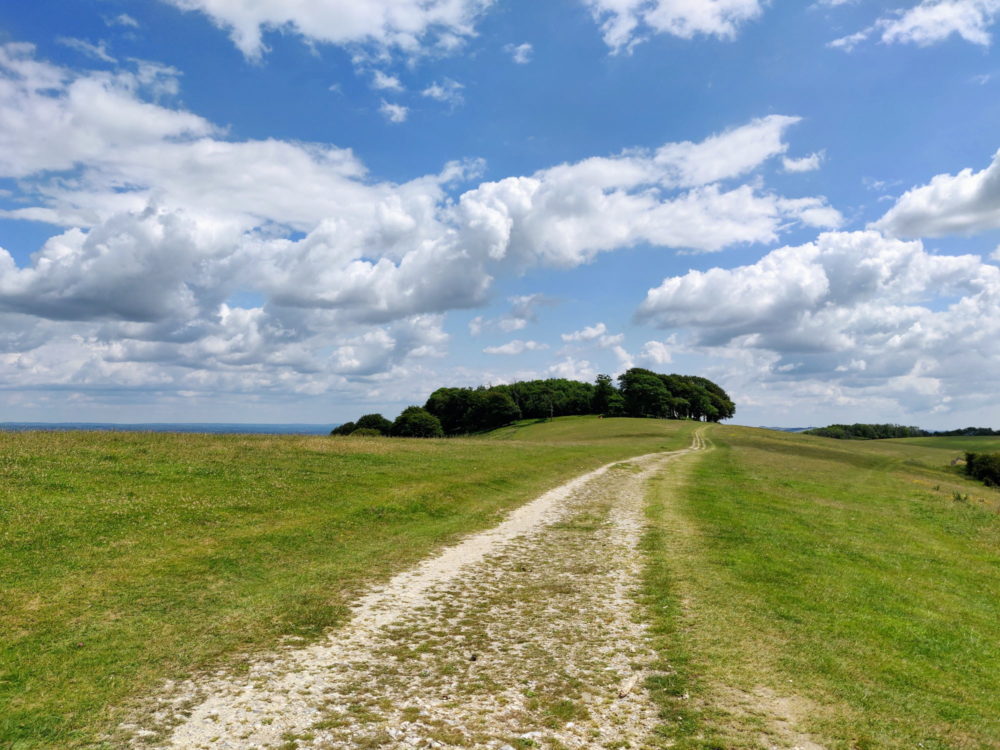
There was the usual mix of great views, warm sunshine, and foot-shredding rocky trail for most of the day, but the highlight was undoubtedly Chanctonbury Ring. This Iron Age hilltop fort topped by a bunch of trees is visible from miles around, and is rumoured to be haunted.
I’m not sure whether the ghosts departed after many of the trees were blown down in a massive storm in 1987, but at least on a sunny midsummer day, there was no sign of the spirit world as we strolled past.
With such nice weather and comparatively easy walking, the miles flew by, and we found ourselves on the steep descent through the trees into Steyning well in time for lunch. The Chequer Inn didn’t really look like much when we stuck our heads in, but the sharing platters that we dawdled over were surprisingly delicious.
Steyning is one of the bigger towns along the South Downs Way, which made it useful for things like resupplying bandaids and blister kits. We stayed at a B&B that’s no longer available, but there are other good options in town including the Castle Inn Hotel and Springwells House.
Dinner was at the White Horse in the town centre, where the food was good, the pub was busy on a Friday evening, and there was even an outdoor table in the sun. Bliss.
Total distance: 19.3 km (12 miles)
Day 6: Steyning to Kingson-near-Lewes
And we thought day four had been a long one!
As we left, our BnB owner commented that the trail got noticeably softer from there, and thankfully she was right. While there was still some of the chalk and flint that had mangled our feet for days, there was plenty of grass and dirt as well. Finally!
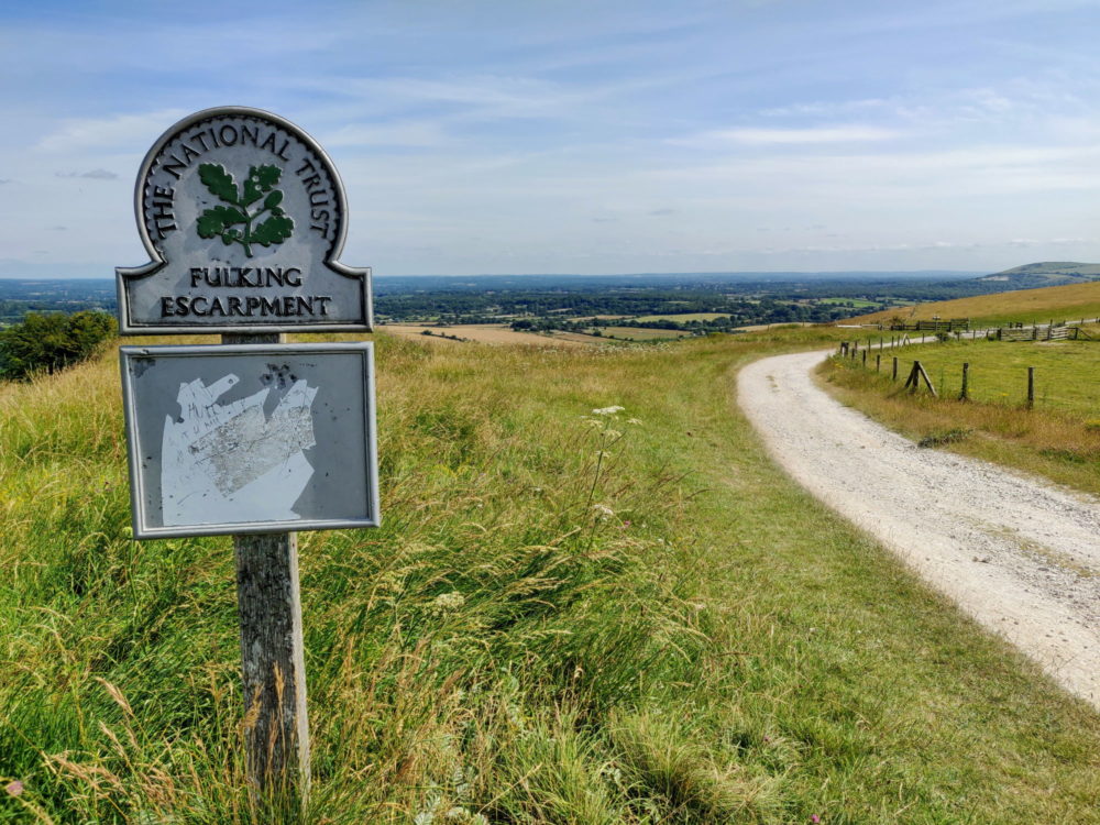
The steep climb up Truleigh Hill easily justified the coffee stop at the YHA cafe near the top, and not long after we saw the best, or at least the most expertly-altered, signpost of the entire walk. I guess if you’re going to call your village Fulking, you kinda have to expect it.
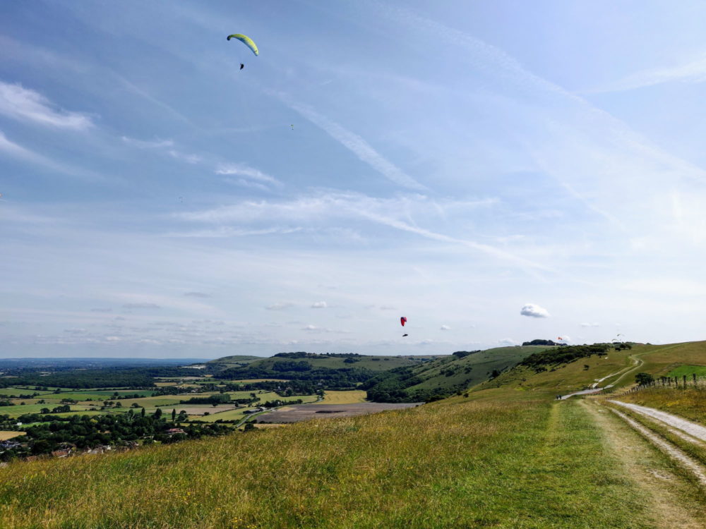
The guidebook had hyped the views over Devil’s Dyke, and rightly so, since they were genuinely impressive. We weren’t the only ones who thought so: this dry river valley is quite a well-known local attraction, and a dozen paragliders looped lazily overhead as we approached.
We stopped beside the trail for a quick snack break, which became even quicker when we looked up to discover a herd of cows had sneaked up to surround us. No, I didn’t know cows could sneak either. They definitely can.
Onward and downward, both geographically and in terms of the quality of our lunch at The Plough in Pyecombe. The staff were friendly and the portions were large, but a gourmet experience it was not.
We’d seen surprisingly few people for almost the entire walk so far, but not today. Along with many other walkers, both day hikers and those tackling the whole thing, we were passed by dozens of mountain bikers doing a one-day charity ride the length of the South Downs Way. I can still hear the ringing of bells now.
We made good progress throughout the afternoon, but with around 12 miles to cover, it still took forever. Morale remained high as we emerged from the trees above Kingston-near-Lewes, our destination for the night, and then quickly plummeted when we realised the circuitous route around the ridgeline to get there would take another hour.
Finally limping into the village in the evening, our wonderful Airbnb host took one look at the state of us and declared that she’d be driving us to the pub for dinner rather than making us walk there. We didn’t argue.
Our self-contained studio was lovely and spacious, with doors that opened out to the garden and a fridge and cooktop for making breakfast in the morning. Let’s just say the hot, powerful shower got quite a workout that night.
I’d happily stay there again, but the booking calendar looks to be completely blocked out. If you can’t get a night there, I’d suggest this studio apartment instead.
Total distance: 35.9 km (22.3 miles)
Day 7: Kingston-near-Lewes to Alfriston
My feet hadn’t survived the previous day unscathed, so at least Lauren and I could both now complain about our blisters. On the upside, we only had a couple of relatively short days left in which to do so.
The morning cloud unleashed a full seven drops of rain on us as we climbed back up to the ridgeline in the morning. My jacket stayed firmly in my bag, the wind blew the rain away, and that was the end of that.
Just like earlier in the walk, any place selling refreshments that’s directly on the trail is something to be treasured, which made stopping at the YHA South Downs near Southease a no-brainer.
They’ve apparently spent three million pounds renovating this old farm house, and it shows. The delicious coffee and cakes in the courtyard cafe ensured a long break and a very slow departure.
From there it was a steep climb (shocking) up Beddingham Hill, a straight march along the top to Firle Beacon, and an equally steep drop down to Alfriston. This pretty village gets a lot of tourists, but I didn’t see many of them. Mainly because I didn’t leave our accommodation for the rest of the day.
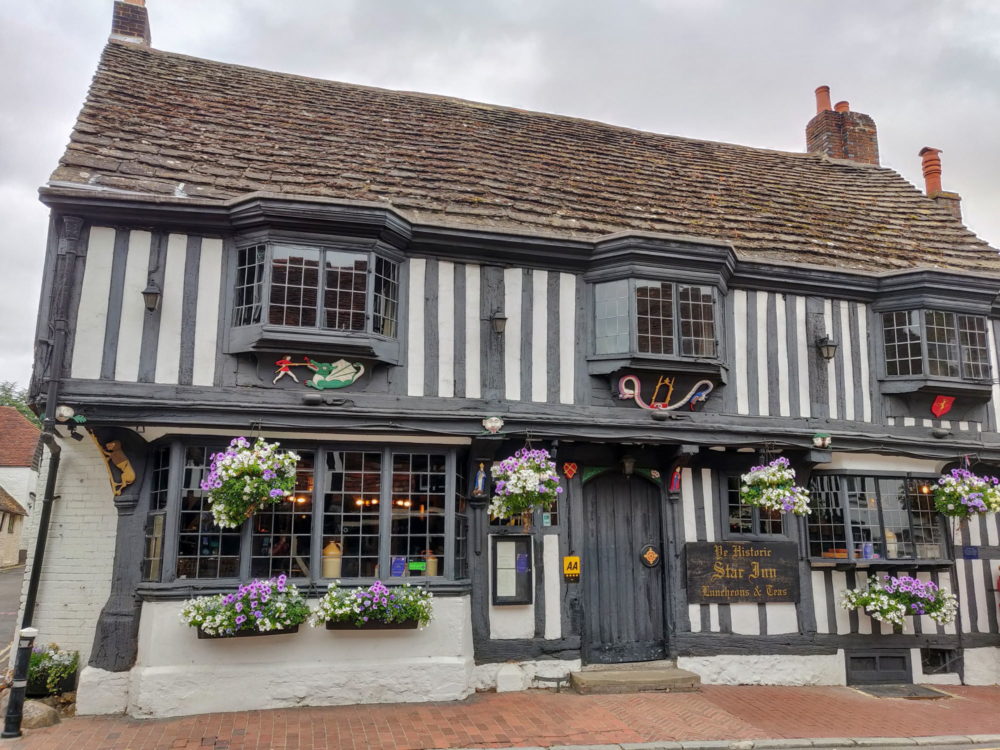
We stayed at the Star Inn, one of the oldest pubs in the country. It apparently dates back to the 14th-century, although it’s clearly had the odd lick of paint since then.
The rooms out the back were fairly small and generic for the amount we paid, and they seem to have at least doubled the nightly rate since we stayed there, so I honestly can’t recommend it now. Stay at Ye Old Smugglers Inne instead.
Still, if you happen to find yourself in town on a Sunday, the roast at the Star Inn was absolutely gigantic. I’ve stayed in apartments smaller than those Yorkshire puddings. We dined mid-afternoon and weren’t sure whether it call it lunch or dinner, but in the end it didn’t matter. Either way, there was no need to eat again that day.
Total distance: 20.8 km (12.9 miles)
Day 8: Alfriston to Eastbourne
The final day dawned cool and cloudy, but there was no rush to get going. Two of my brothers were joining us for this last section, and their train/bus combo from London didn’t get them to Alfriston before 10 a.m. Forgoing breakfast at the Star Inn, I opted for the more interesting-looking options at the Singing Kettle down the road. It was the right choice.
Two familiar shapes appeared in front of me right on the dot of ten o’clock, and we were off. There are two options from Alfriston, the shorter inland path that’s really aimed at cyclists, and the walking path that climbs up and down the coastal cliffs and is renowned as the most scenic part of a very scenic trail. It wasn’t a hard decision.
The clouds stuck around for much of the morning, as we flew through an easy first five miles. The little villages of Litlington and Westdean looked appealing, but with no need to stop so early, we were quickly through them and out to the coast.
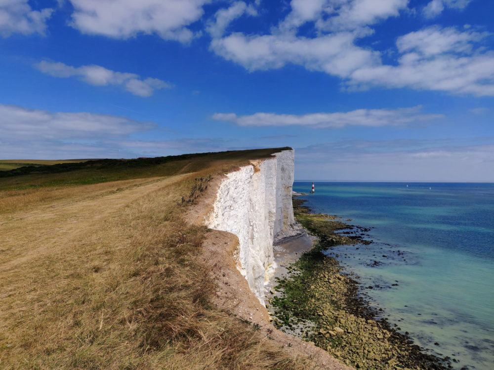
With perfect timing, the sun broke through the clouds as we started to climb the first of the Seven Sisters. Hint: these cliffs can be quite steep, and there are more than seven of them. The ocean views make it all worthwhile.
One of my brothers is living in the US these days, and for some unknown reason, greatly misses English scones and jam. Fortunately, there’s a fancy National Trust cafe right beside the trail at Birling Gap, and judging by the busloads of pensioners arriving at the same time, scones and jam seemed very likely to be on the menu.
I, and especially he, can confirm that they were.
For some strange reason the rest of the Sisters seemed somewhat harder to climb after that, but we eventually made it over the last of them and marched on to the final assault on Beachy Head.
From there, it was all over in a rush: past the pub at the top of the hill, down the steep slope on the other side, and on to the big signpost that marks the end of the South Downs Way.
And then a couple of hundred yards further, to the Pilot Inn and a very long lunch in the sunshine. Mission accomplished!
From the end of the South Downs Way, it was another mile and a half into the centre of Eastbourne. Highlight: Europe’s “number one pier”. If that’s the case, I don’t need to see the other contenders.
We stayed at the Albert and Victoria hotel, which served its purpose just fine. The small room was comfortable, the staff were attentive, breakfast the following day was tasty, and it was a fifteen minute walk to the train station to start our trip back home. I’ll take it!
Total distance (to end-of-trail marker): 20.4 km (12.9 miles)
Alternate/Recommended Route Options
When we were doing our planning, eight days seemed about the right length of time to walk the South Downs Way. That’s an average of 12.5 miles a day, which felt very achievable.
The reality, of course, was quite different. All the detouring on and off trail added an extra twenty miles, and that endless chalk and flint made the first few days very hard on the feet. Those two long days in the middle were tough, but it was hard to split things up any other way with the time we had.
An extra day would definitely have made things easier. There are a few ways to do that, but I suspect the easiest would have seen us arriving earlier in Winchester and doing a longer first day.
This would have allowed us to break things up quite differently, and meant actually walking no more than about 13 miles on any day. If I was to do it again and add in that extra day, my route would look something like this.
- Day 1: Winchester to Corhampton (12 miles)
- Day 2: Corhampton to Buriton (13 miles)
- Day 3: Buriton to Cocking (12 miles)
- Day 4: Cocking to Amberley (13 miles)
- Day 5: Amberley to Steyning (11 miles)
- Day 6: Steyning to Pyecombe (12 miles)
- Day 7: Pyecombe to Kingston-near-Lewes (12 miles)
- Day 8: Kingston to Alfriston (13 miles)
- Day 9: Alfriston to Eastbourne via coastal route (11 miles)
Get regular travel, hiking, and tech updates from me
News, reviews, guides, and more, from here and around the web
Final Thoughts
Despite the blisters, I loved my time on the South Downs Way. It’s a consistently beautiful part of the country, and the trail takes you through much of the best of it.
There’s plenty of accommodation for both budget hikers and those looking for a bit more comfort, at least if you’re prepared to head off-trail for a mile or two. As with many other parts of England, the nicer places aren’t particularly cheap, but the quality was high and they’re still affordable if you’re travelling with a partner or friend.
We had near-perfect weather the entire time, which made a huge difference. Blue skies, sunshine, and warm temperatures make any hike more enjoyable, and we had them every day.
The food was a standout highlight, and with only a couple of exceptions, we loved everything we ate. Many of the country pubs were a downright wonderful place to spend a lazy hour or two, and if those pretty downland villages aren’t on postcards and calendars already, they absolutely deserve to be.
If you’re looking for a roughly week-long walk that showcases some of best pubs, food, and landscapes the southeast of England has to offer, you’ll find it on the South Downs Way. Enjoy!
![Wide beach with several "steps" (rocky cliffs slightly separated from the mainland) alongside. Rocks below the cliffs suggest several rockfalls. Someone has written "[heart] Cornwall" in the sand.](https://whatsdavedoing.com/wp-content/uploads/2025/12/SWCP-Day-17-Pentire-Steps-beach-with-heart-Cornwall-in-the-sand-768x576.jpg)


Thanks for the complete and entertaining blog of your walking adventures on the south Downs. Informative and entertaining.
Thanks for the informative and very helpful day to day description of your adventures. I’m planning to run it over 3 days this summer, and as i’m no longer 21, my planning is crucial. The detail you’ve given helps me tremendously. Hopefully I’ll enjoy my adventure as much as you enjoyed yours. Regards Greg P
What a great review, really enjoyed reading, thanks Dave! I’m planning on walking the Downs in September, east to west, so this has given me much food for thought. Tom
Thanks Tom, glad you liked it!
Thank you. I’m walking the South Downs way. But doing it over several individual days I started in November 24 and finishing august 25. Winchester to Eastbourne. This weekend is cold but hopefully clear and sunny. Time to get my boots on again for my day 3.
Thank you. Sitting here in lockdown planning my SDW walk for June and it’s been very helpful reading your guide. Lovely pics too.
Thanks Mary!
Fantastic, thinking of walking the sdw in july/August with my wife and our dog pasco, added complication regarding accommodation and a dog , sure we,ll be able to sort something , great insight into the walk thank you
Thanks Dave. A few years ago I was due to walk the SDW but had a knee problem . Husband and friends went and I drove around which was not nice. The A27 is hell. This year I managed to do the first half with a friend and could not believe how lovely it was when you rise above the crowds. This piece has helped me as we plan to do the second half this autumn. Thank you.
Hiii, I’m intersted to know if ylu booked your places to stay in advance? I like the idea of just go and see how far I get on that day. Do you reckon is there a goos chance to find something just on the day?
Thanks
I did book in advance, yes. I’d have much preferred to just see how far I got each day (which is what I’ve done when walking Camino routes in Spain and Portugal, for instance) but there’s comparatively little accommodation and the South Downs is very popular with holidaymakers, so there’s a good chance there’d be nowhere to stay if you just showed up late afternoon somewhere and hoped. It might be a different story if you’re walking well off-season, but I personally wouldn’t chance it otherwise.
Thank you ???? I might do a test daybif walking and see how many miles I can do. Then book campsites based on that in South Downs. Does thay sound sensible to you?
I have done only a day long hikes before, mostly big hills/mountains so I can’t be comparing with that. I am also ecologist in profesion, so if I come across intersting meadow I am very likely to get hold up by plants.
Yes, that sounds sensible. Have a great time in the South Downs!
Awesome ???? Thank you