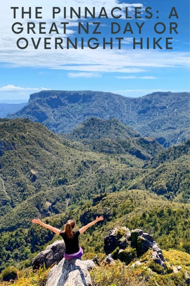
The Pinnacles Walk: A Great Day or Overnight Hike in the Coromandel
Articles on this site contain affiliate links, meaning I may be compensated if you buy a product or service after clicking them. The full privacy & disclosure policy is here.New Zealand isn’t exactly short of spectacular day walks and overnight hikes, and one of the best examples is the Kauaeranga Kauri Trail, starting at the end of the road outside Thames on the western side of the Coromandel Peninsula.
Better known as the Pinnacles Walk (named after the peaks at the end of the track,) it combines beautiful native forest, stunning views out to the coast, and plenty of sweat as you work your way up what was once a packhorse trail used for kauri logging in the early part of the twentieth century.
Steep in parts, the well-constructed path steadily climbs up packed dirt and rough rock steps to nearly 800m at the summit. Make sure your boots have a decent amount of grip, since the rocks can get pretty slippery even when the weather is good: tiny streams keep parts of the track damp even in blazing sunshine. Hiking poles come in useful too, especially on the downhill.
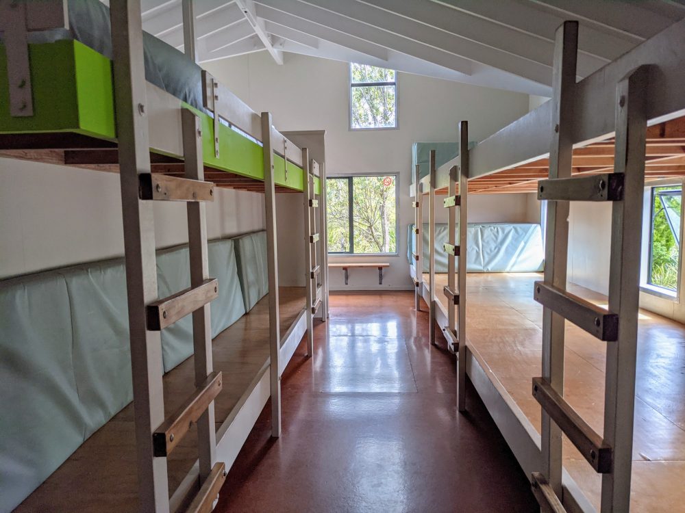
While the climbing can be a bit strenuous, especially in the middle section between the turnoff to the Moss Creek track and the hydro camp junction, it’s short enough to be manageable for anyone with a reasonable degree of fitness. For this reason it’s a popular track with school groups, especially given Pinnacles Hut sleeps a remarkable 80 people across its two large dorm rooms.
If you don’t fancy being kept awake by the rustling and giggling of a few dozen children, the snoring of their teachers, or if you’re as lucky as I was, both at once, it’s worth considering doing this as a day walk instead. It’ll be a pretty long and tough day if you include the Pinnacles summit, with roughly four hours of climbing and three hours of descending, but that may still be better than two hours of broken sleep. Each to their own.
The trail starts from the carpark at the end of Kauaeranga Valley Road, 20km east of Thames. A little over half of the road is sealed, as far as the Department of Conservation visitor centre, with graded gravel after that. It’s worth stopping at the visitor centre to double-check track conditions, use the bathroom, fill your water bottle, and waffle away to the friendly staff for a while.
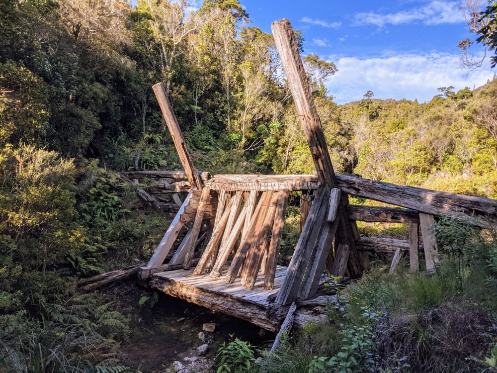
When we walked the track in early December 2020, work was underway to replace the bridge that crosses the Kauaeranga River near the start of the Webb Creek section. As a result, we had the pleasure of a little rock-hopping to get the muscles warmed up. The work was due to be finished a few weeks later, so chances are high that you won’t need to risk wet feet unless you decide to go up or back via the Billygoat Walk: there’s no bridge on that section.
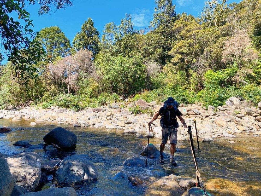
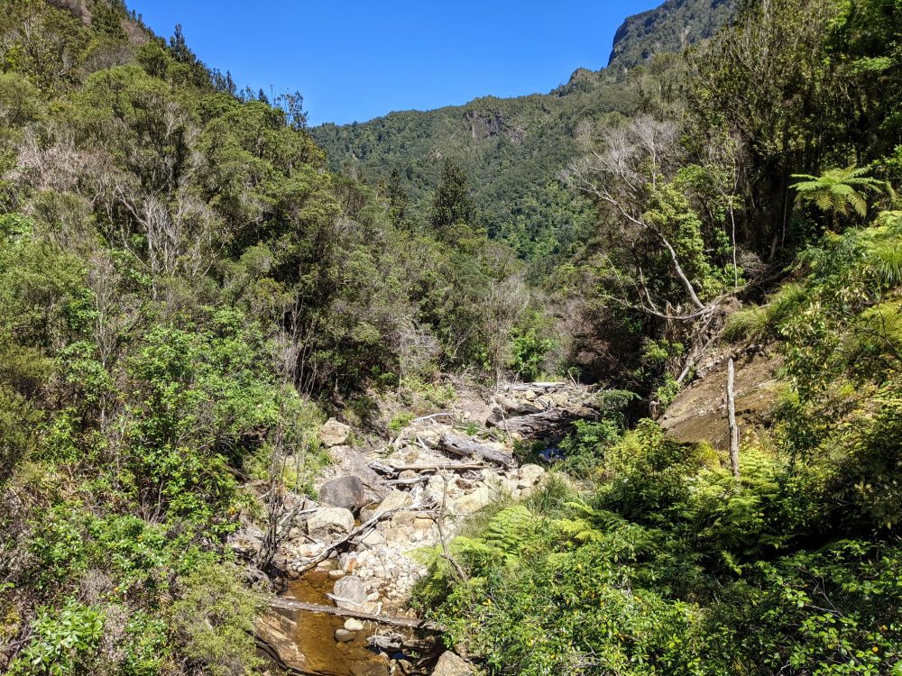
The river safely crossed, the first several minutes of walking were deceptively flat. It’s worth taking the short detour up to Billygoat Landing, which has good views out over the forest to Billygoat Falls. The climbing begins soon after, although it doesn’t get all that steep for a while after that.
As with so many hikes in New Zealand, swing bridges are a regular feature. While there’s one fairly long and sturdy affair, the rest are shorter, flimsier versions rated for one person at a time. You’ll get some great photos as you cross, although keeping the camera steady while the bridge bounces up and down may not be the easiest thing in the world.
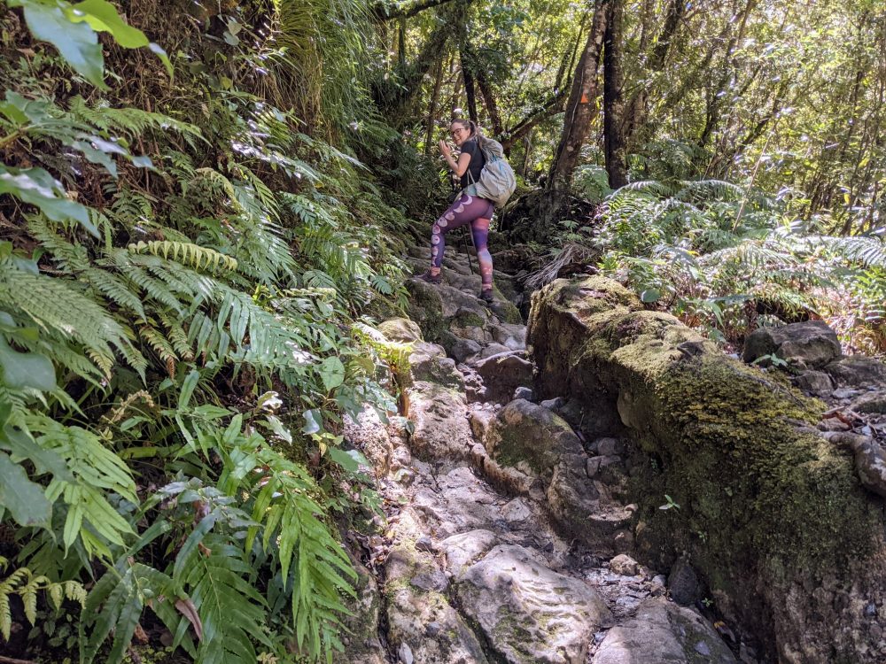
After roughly an hour you’ll pass the turnoff to the Moss Creek trail, which is where the track turns eastward and starts getting steeper. The rocks and cut-out steps are often quite tall and uneven, which those with shorter legs are unlikely to appreciate!
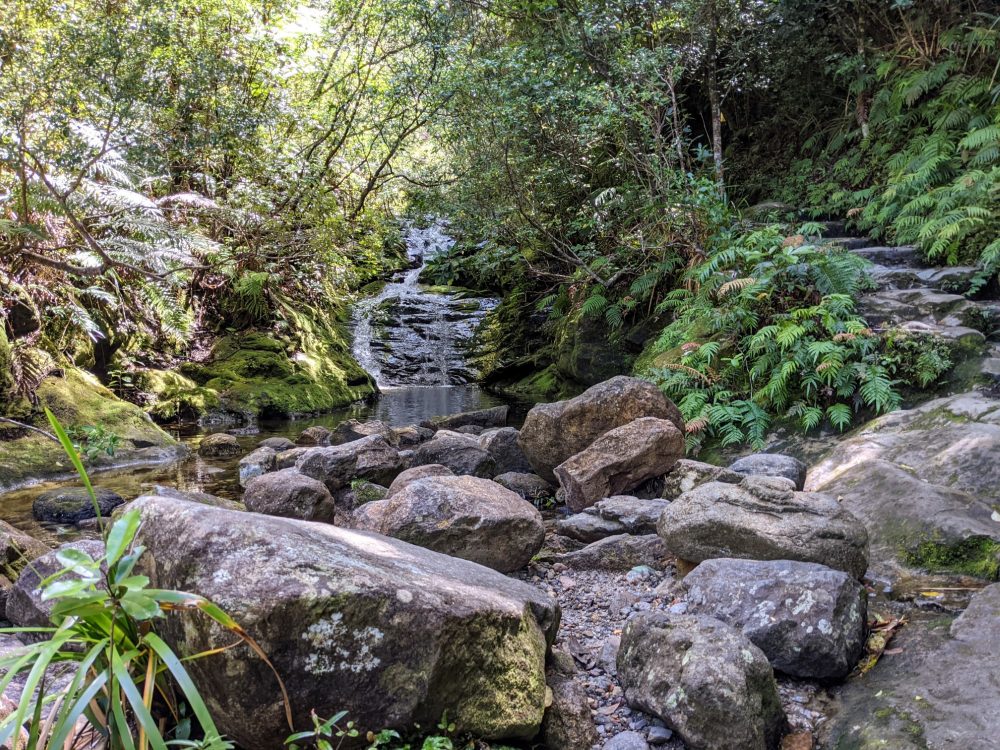
Still, all of those rocks keep the trail largely free of mud, and the lush forest and burbling streams hopefully provides plenty of distraction from your laboured breathing and complaining calves. While there aren’t any benches or tables along the way, small clearings and flat rocks show up regularly enough when it’s time to take a breather.
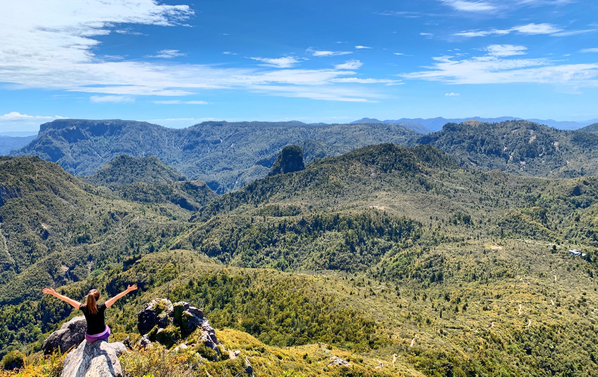
You’ll know most of the steep stuff is over when you hit a larger cleared area that once housed a hydro camp. The remains of an old skidded road lie alongside, and this is also where the Billygoat Walk and Webb Creek sections of track meet. From here, the forest opens up as you follow the Pinnacles Track up the hill and along a relatively flat ridgeline with some great views of the Pinnacles themselves along the way.
This last section seemed to fly by, and it took under 45 minutes from the hydro camp until we found ourselves at the spacious and modern Pinnacles Hut. Nestled in amongst the trees, it housed a pair of very large bunkrooms, a big kitchen and smaller indoor seating/eating area, and a few tables outside on the sunny deck.
There isn’t enough indoor seating for everyone if the hut is full, though, so you may end up spending a lot of time on your bunk on cold or rainy days! We were there in blazing sunshine, however, so I left the indoor seating for the card players in favour of adding to my sunburn.
Several toilets sit a short distance from the hut, and there’s a tank-fed shower that wasn’t working on this particular day due to the recent dry conditions. A few fellow hikers mentioned that the kitchen once had everything from cups and plates to pots, pans, and cutlery, but that’s no longer the case. I’ve no idea whether that’s due to pilfering or pandemic, but either way there were only a few kettles for boiling water when I was there.
Even so, you’ll still get gas cookers, sinks, and running water, plus something I’ve never seen at a DoC hut before: a gas BBQ! I’d seen it mentioned on the DoC site, and packed a couple of pieces of steak just in case it actually existed and was in a working state. I have to say they tasted a lot better than the alternative: dehydrated casserole out of a packet.
After a snack and a rest, we headed back out to climb up to the Pinnacles summit. It’s signposted as a two-hour return trip, but that’s very conservative: we took around 40 minutes to get to the top, ten minutes at the viewing platform, and under half an hour to get back.
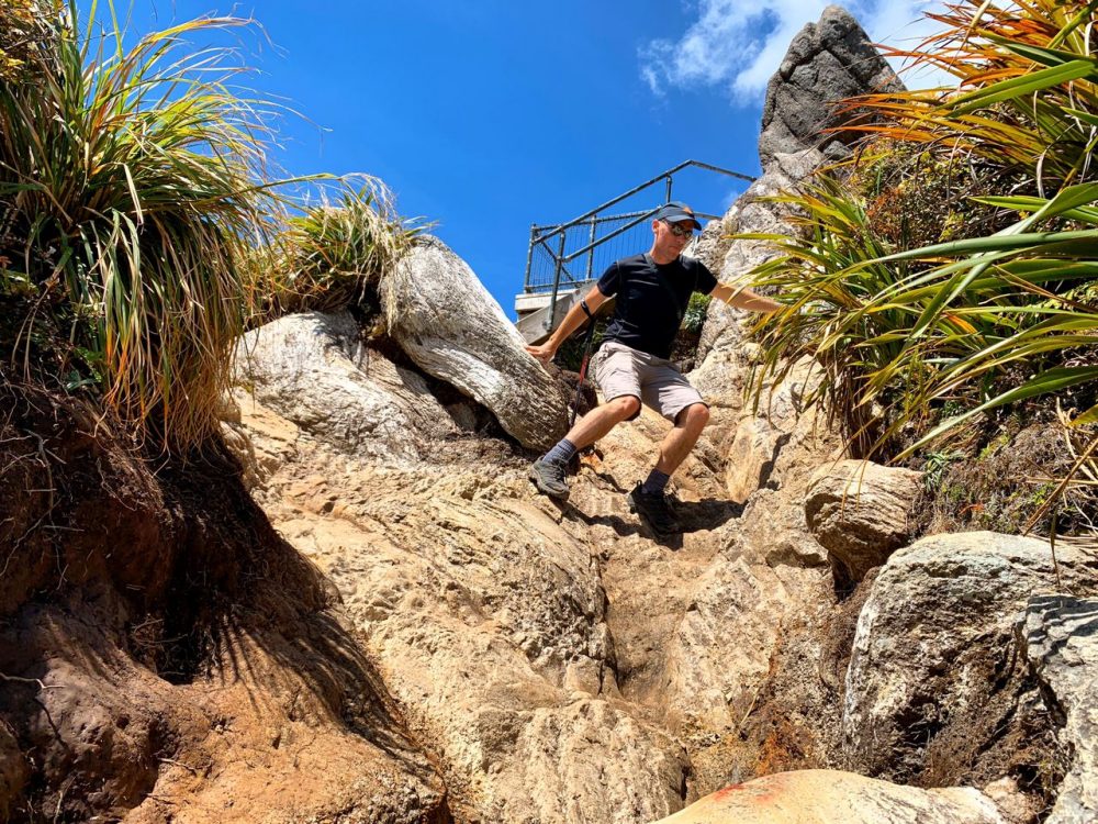
Most of the walk is on a well-formed track that climbs steadily upward on steps or rocky trail. The last part is more difficult, with a couple of ladders and a few short vertical sections that require clambering up and down metal rungs set into the rocks. None of it is a major challenge, at least in dry conditions, but if you’re considering going up there for sunset, make sure you’ve still got enough light to see what you’re doing on the way back down!
This side trip is well worth the effort, as the views over the forest and out to the coast were spectacular both at the top and from several vantage points along the way. Even if you weren’t confident on the ladders and metal rungs, walking the first section of trail is still very worthwhile. We did exactly that a few hours later, heading back up the trail again for twenty minutes to snap a few sunset photos.
Before turning in, we wandered down the side trail that leads past the warden’s hut to Dancing Creek campsite, a basic back-country site with four tent pitches, a tap, and a pit toilet. Alongside it sat the remains of a kauri driving dam that was used to send many thousands of logs downriver a century ago.
It was an interesting insight into the history of this part of the country, and worth the ten minute detour even if you’re not trying to get away from the sound of a few dozen kids shouting at each other.
After a sleepless night where I learned that it is possible for someone to snore while both inhaling and exhaling for several hours in a row, the howling wind and rain spatters on the window suggested that getting moving sooner rather than later wouldn’t be a bad idea. As a result, plans for a leisurely coffee were shelved in favour of a speedy departure, and we were back on the trail before 8am.
We’d planned to take the alternative Billygoat Walk trail, but since it adds anything up to an extra hour and significant rain was in the forecast, we stuck to the main route. Even so, the views were noticeably different heading in the other direction, so we didn’t feel hard done by in the end.
Without the need to stop for photos or recovery breaks, we made good time back down the mountain, and found ourselves back at the river crossing almost exactly two hours after leaving the hut. A quick skip across the rocks, a ten minute stroll back to the carpark, and that was the Pinnacles Walk done and dusted.
We stopped off for a late, tasty breakfast at Cafe Melbourne in Thames, then collected our bags from Lady Bowen Bed and Breakfast, the lovely small hotel in town where we’d spent the previous night. The owners, Stu and Barbara, had cooked up a hearty breakfast to fuel our hike, and were more than happy to look after our bags rather than leaving them in the car overnight.
Overall I really enjoyed this walk. The views were spectacular, the terrain provided some challenge without being too long or difficult, and there was even a bit of history thrown in for good measure.
If you can manage to pick a date where the hut isn’t full of school groups, it’s well worth doing as a straightforward and not especially-difficult overnight hike. If you can’t, or you just don’t want to take the risk, we met several people walking it in a day instead.
That’s how I’d tackle it in the future: hiking it in summer and starting early would ensure there’s plenty of time to get up and down even with the trip to the summit. Sure, it’d be tough, but it’d also ensure more sleep. You’d also not be tied into walking on a particular day because of a hut booking, making it easy to change things around based on the weather if you need to.
Whichever way you do it, you’ll have a blast!
Pinnacles Walk
Location: Coromandel Forest Park, New Zealand
Distance: 12km return to Pinnacles hut, plus 2km return to the summit
Time: 5-6 hours return to the hut, plus roughly an hour return to the summit
Cost: NZ$20/adult if you stay overnight in the DoC hut, otherwise free