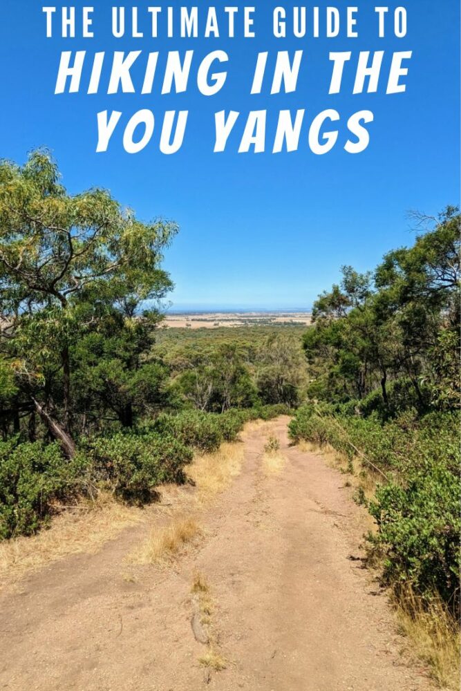
The Ultimate Guide to Hiking in the You Yangs
Articles on this site contain affiliate links, meaning I may be compensated if you buy a product or service after clicking them. The full privacy & disclosure policy is here.The You Yangs, not far from the western outskirts of Melbourne, is one of those delightful places that’s surprisingly close to the city and yet at times can feel like you’re in the middle of nowhere. Full of insect and bird life, not to mention koalas, wallabies, and echidnas, it’s a great way of getting back to nature without a lot of effort.
This regional park is easily accessible as a day trip from both Melbourne and Geelong, and is popular with a variety of horse and mountain bike riders, hikers, climbers, dog walkers, and families just looking for a nice place to have a picnic.
That proximity and range of activities does mean it gets pretty busy on weekends and public holidays, especially during summer. There’s not much chance that you’ll have the well-known hiking routes to yourself during those times, but head for some of the less-popular tracks and you’ll likely see far fewer people.
I’m not much of a mountain biker these days, and don’t own a dog or a horse, but bushwalking is something that I do a lot of. With that in mind, I figured it was time to put together this guide to hiking in the You Yangs, whether you’re looking to spend your whole day there or just a couple of hours.
I hope you find it useful!
Getting There
As long as you have a car, the You Yangs is easily accessible from both Melbourne to the east and Geelong to the west. The drive from central Melbourne is around 60km and takes about an hour, mostly along the M1 freeway until you reach the Little River turnoff.
From there, it’s an easy 15km drive on country roads, through Little River and on to the main entrance on Branch Road in the south of the park. Other entrances and car parks are available to the west, east, and north, and may be more convenient if you’re mountain biking, but most hikers will stick to the main gate.
From Geelong it’s even easier, and you’ll be parked up and ready to walk half an hour after leaving the central city. Take the Princes Highway north and east out of Geelong, keeping left for Forest Road instead of joining the M1. From there, simply stay on Forest Road all the way to Branch Road, and you’re at the park entrance.
Once you’re inside, you’ll need to decide where to leave your vehicle. The largest and most popular carpark is at one end of Turntable Drive, a sealed road that becomes a one-way loop shortly after entering the park. It’s a good starting point for many of the walks.
If you only want to do the Big Rock Walk, leave your car at the visitor centre instead. It’s also on Turntable Drive, just not as far along as the main carpark. You can also park at the Big Rock picnic area and use one of a couple of connecting paths to join up with the main walking tracks to the east.
Public transport isn’t really an option, unfortunately. The closest you can get is Lara station, which takes two buses and up to three hours from central Melbourne, and it’s still a 7km walk from there to the main gate.
Speaking of the gates, they open at 7 a.m. and close at 8 p.m., so make sure you’re out of the park by then.
Gear and Facilities
At least when it’s dry, you really don’t need a lot of gear to do any of the walks in the You Yangs. I’ve walked all of the trails in normal running shoes in the past, and while I wouldn’t have minded a bit of extra grip on a couple of the downhill sections, it never felt dangerous.
Especially in summer, take plenty of water. If you don’t already have an idea of how much you drink when you’re hiking, a useful rule of thumb is about 500ml per hour. You’ll need more on particularly hot days or if you’re mostly going uphill and sweating a lot, and perhaps a bit less in cooler weather.
On longer walks I tend to use a 2L hydration bladder inside a small daypack, since having the hose dangling over my shoulder reminds me to drink in a way that a bottle stowed in my pack does not. On shorter hikes, I just carry a one-litre water bottle instead.
Wearing a hat and high SPF sunscreen is always important in Australia, especially when hiking for hours. Put the sunscreen on before you start walking, and if you’re out for more than a couple of hours, reapply regularly. Some of the trails have a reasonable amount of shade, but others don’t.
There’s good mobile phone coverage in most areas of the park, so if you do manage to twist an ankle or otherwise get into trouble, chances are you’ll be able to call for help.
There are pit (i.e. non-flushing) toilets at Turntable carpark, and water that’s fine for washing your hands but isn’t safe for drinking. If you need to top up your drinking water, there’s a fountain at the visitor centre you can use.
Toilets are also available at the visitor centre, and at most of the picnic areas throughout the park. You won’t find them along any of the trails, however, so be sure to do what you need to before starting to hike!
In terms of trail maps, I use AllTrails for almost all of my hikes these days, and the You Yangs is no exception. I’ve linked to an appropriate map for each track I talk about: just create an account to bookmark the route(s) you think you might walk, then download the app before you head out on the trail.
Flinders Peak Walk
Route: Flinders Peak Walk
Distance: 3.2km return
Duration: 1 hour
Type: Out and back
Start/End: Turntable carpark
Difficulty: Moderate
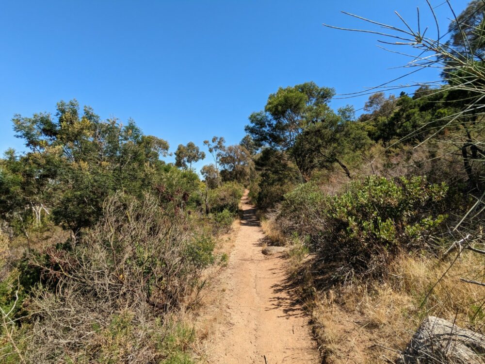
At 340m above sea level, Flinders Peak is definitely more of a hill than a mountain, but it’s still the highest point in the area and can be seen from miles around. Matthew Flinders was the first European to summit it, back in 1802, but he certainly wasn’t the last: the trail that leads to the top is a very popular hike these days.
While it’s barely a mile to the top, the 450 steps are enough to work up a sweat and get the heart racing. They’re not all in a row, however, with a more gradual incline between each set of steps. It’s a well-formed dirt track, and unless it’s particularly wet, there’s no need for anything more than running shoes.
Dogs and children can handle it, even small-ish versions of either, and there are a few benches and viewing areas along the way to catch your breath if needed. Note that dogs need to be on leash throughout the park, including this trail. As with many such restrictions, however, I wouldn’t say it’s strictly adhered to, at least not when I’ve been there.
Starting from the Turntable carpark, you’ll pass a sign for the East Walk almost immediately, and the West Walk soon after. It’s a loop track (discussed below) that circles the flank of the hill, but for the Flinders Peak Walk itself, just continue straight onward and upward.

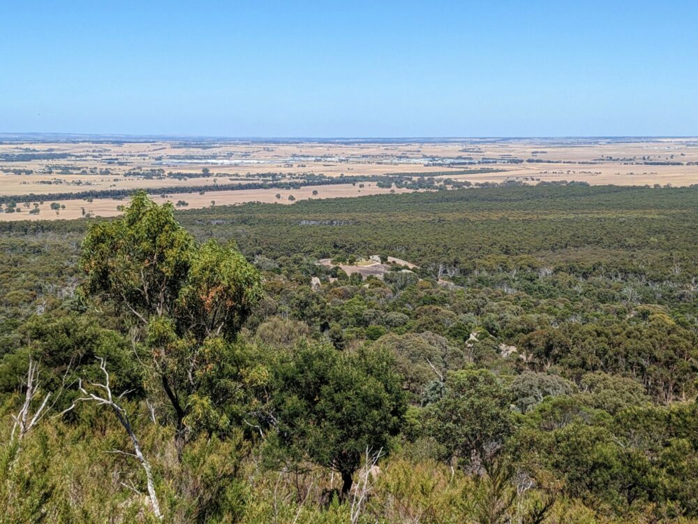
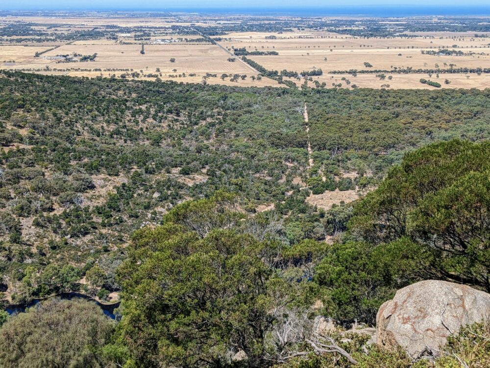
You start getting good views over the surrounding plains quite quickly, and on a clear day, can make out the skyscrapers of the Melbourne CBD over 60km away. Geelong and the coast are also clearly visible.
Towards the top, on your right as you’re heading up, a small viewpoint overlooks the Bunjil geoglyph. This large stone outline of an eagle is designed to be viewed from above, and was created in 2006 for the Melbourne Commonwealth Games. You can also see it from a few places on the East Walk, and the Branding Yard Trail (discussed below) takes you past it at ground level as well.
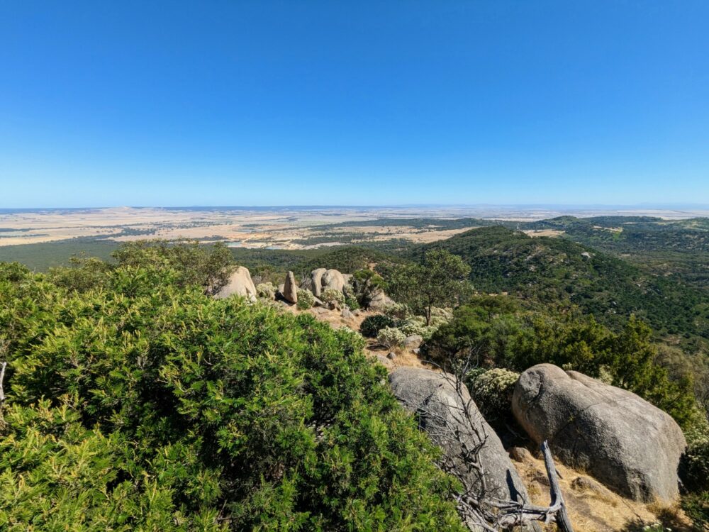
Getting to the top takes about 35 minutes, depending on how often you stop, and it’s worth taking a few minutes to explore the boulder-filled summit once you’re there. A viewing area has been created at the highest point, accessed by a set of stairs, with an old metal plaque dating back to 1913 that shows various points of interest in all directions.
You head back down the same way you came up, either straight back to the carpark, or branching off onto the West or East Walk if you’re not yet done for the day.
Big Rock Walk
Route: Big Rock Walk
Distance: 3km return
Duration: 1 hour
Type: Out and back
Start/End: Visitor Centre carpark/Big Rock Picnic Area
Difficulty: Easy
Alongside Flinders Peak, Big Rock is one of the most obvious landmarks in the park. If you only want to walk around its stony vastness and admire the views, there’s no need for much walking at all: just park at the Big Rock picnic area and stroll the 100m or so to the rock itself.
If you’d like something a little more strenuous that’s still fine to do with even young kids, however, park at the visitor centre and follow the marked signs for the Big Rock Walk. Set aside about an hour, depending on how long you spend on top of the rock itself.
The dirt trail slopes gently up from the rear of the carpark through the trees for 15-20 minutes, catching glimpses of the rock along the way until you reach a fork at its base. It doesn’t particularly matter which way you go, since the track just loops around the rock, but note that you get up on top from the eastern side.
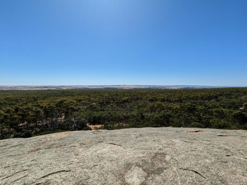
It’s very straightforward, and signposted where necessary. Once you’re up on the rock, there’s plenty of space to spread out even when the park is busy (it’s called Big Rock for a reason), with 360-degree views over much of the rest of the park and surrounding countryside, as well as Geelong and the ocean in the distance.
There are several trees doing their best to grow on a grassy section in the middle of the rock, which really stands out against the grey stone that surrounds it. Casting some welcome shade on sunny days, it’s the perfect place to sit and contemplate life for a while (or just have a drink of water, whichever you prefer).
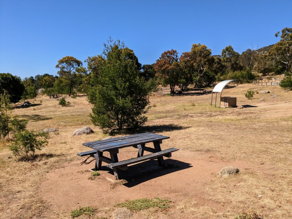
If you need more of a break before tackling the return leg, the large picnic area has a few tables, plus plenty of grass to spread out on if they’re in use. Public BBQs are also dotted around, if you were organised enough to bring bread and sausages with you!
Note: if you’re parked at Turntable carpark and want to check out Big Rock, you don’t need to move the car. Just follow the signposts to walk down Rockwell Road and the Contour Track for about 1.3km and you’ll end up at the rock. Likewise, if you want to extend your Big Rock Track walk to Flinders Peak or the East-West Walk, take the reverse route to Turntable carpark.
East-West Walk
Route: East-West Walk
Distance: 4.5km loop
Duration: about 90 minutes
Type: Loop
Start/End: Turntable carpark
Difficulty: Moderate
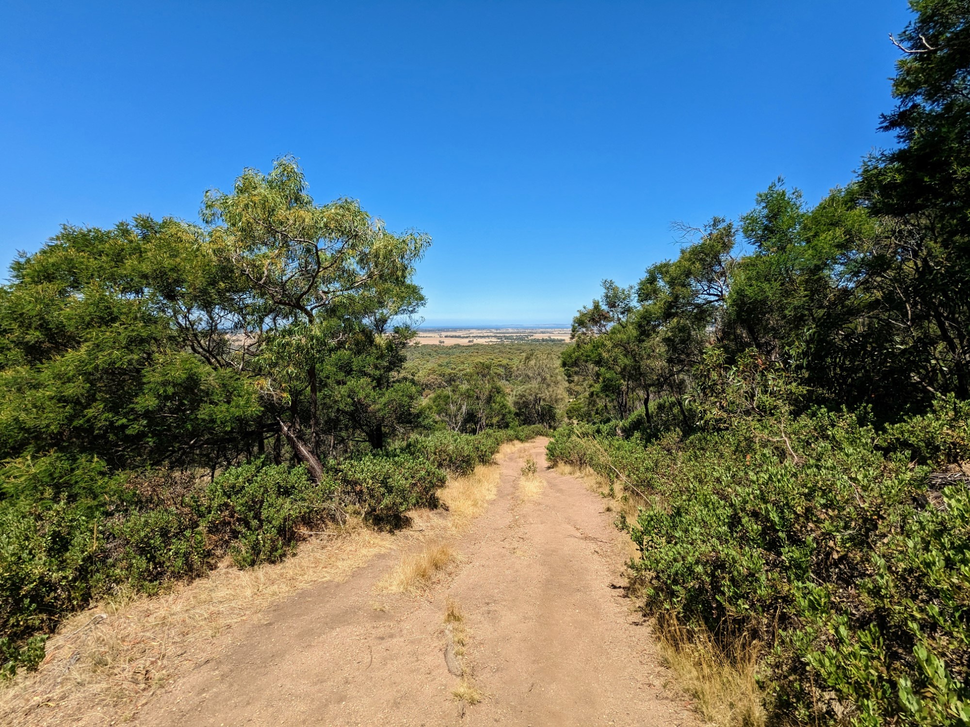
While it’s nowhere near as steep as going straight up Flinders Peak, the East-West Walk that loops around its flanks still provides a reasonable challenge over its near-5km length. It’s probably the hardest walk in the park (not a high bar), and one of most diverse, with ever-changing views as you slowly complete a full 360-degree circuit.
You can choose whether to go clockwise or anti-clockwise (i.e., starting via the West or East paths), and while the distances of both sections are roughly similar, there’s a lot more elevation change on the East Walk. Depending on whether you’re better going up or downhill, that may affect which direction you choose!
The track is largely compacted dirt on the lower levels at either end of the trail, becoming rockier in the higher sections in the middle. Note that there is some scrambling up or down large boulders along the way: it’s not technical, but could be tricky in wet conditions.
If so, it’s one of the few places in the park where hiking shoes with a decent amount of grip might be a better bet than running shoes. The largest boulder (on the East Walk) has a metal handrail to help you get up and down it, but others don’t, and some of the dirt sections are quite slippery when they’re dry as well.
On the western side, Big Rock is clearly visible amongst the trees below, with great views beyond over forest and farmland. A raised metal viewing platform has also been installed relatively close to the start: I don’t think it has the best views on this walk, but is worth snapping a couple of photos from all the same.
You’ll know when you’ve reached the midpoint, as it’s where several other tracks intersect. You’ve got the option of joining the Northern or Saddleback Tracks, taking an alternative route along a management road back to Turntable carpark, or just finishing the other half of your loop. Depending on how fast you walk and what direction you’re walking it, expect this part to take around 45-60 minutes.
The East Walk is the more difficult of the two: alongside that extra elevation change, there’s a bit more scrambling on rocks and some steep-ish sections. Take your time on the trickier bits, however, and you’ll be fine. There are a couple of places that have good views of the Bunjil geoglyph (arguably better than from Flinders Peak, since you’re a little closer to it), so be sure to keep an eye out for that.
Even more than the western side, how long this section takes you will depend on which direction you’re walking and how often you decide to stop. Allow anywhere between about 40 minutes and an hour.
Branding Yard Trail
Route: Branding Yard Trail
Distance: 5km loop
Duration: 90 minutes
Type: Loop
Start/End: (a) intersection of Northern Range Track or Saddleback Track, or
(b) Turntable carpark via a short connecting track
Difficulty: Easy
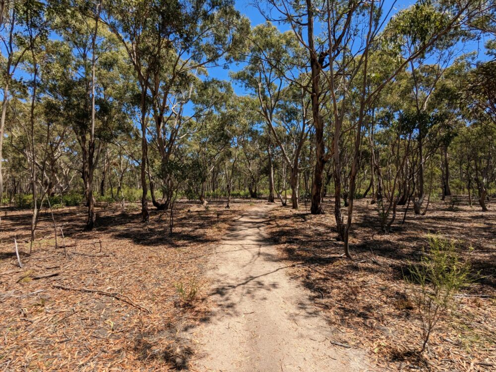
After a relaxing stroll through the forest, without the rocky paths and steep sections that characterise the rest of the You Yangs hiking trails? The Branding Yard Trail is where it’s at.
Even though it’s the longest of the main trails in the park, it’s one of the easiest, and is appropriate for all ages. A gentle loop through a range of different vegetation, it’ll take you past a small cluster of water holes and the Bunjil geoglyph as well.
Because it’s a fairly wide loop, you can get to it in a number of different ways. The easiest options are either to take the short connecting path from the Turntable carpark, or leave your vehicle at the Toynes Road carpark on the eastern edge of the park and walk a short distance down Branding Yard Road (really a 4WD track) to connect with the trail.
Alternatively, you can join from the bottom of the Saddleback Trail (below), or the eastern end of the Northern Range track mentioned above. The only real gradient is the short section of path that connects to the Turntable carpark; everything else is largely flat.
Whichever route you take, you’re in for an attractive walk. It’s relatively straightforward, although the signposting could be a little better at some of the trail crossings. Most of the trail has plenty of shade, so it’s a good option in hot weather, and all of those different intersections means you can do as much or as little as you like.
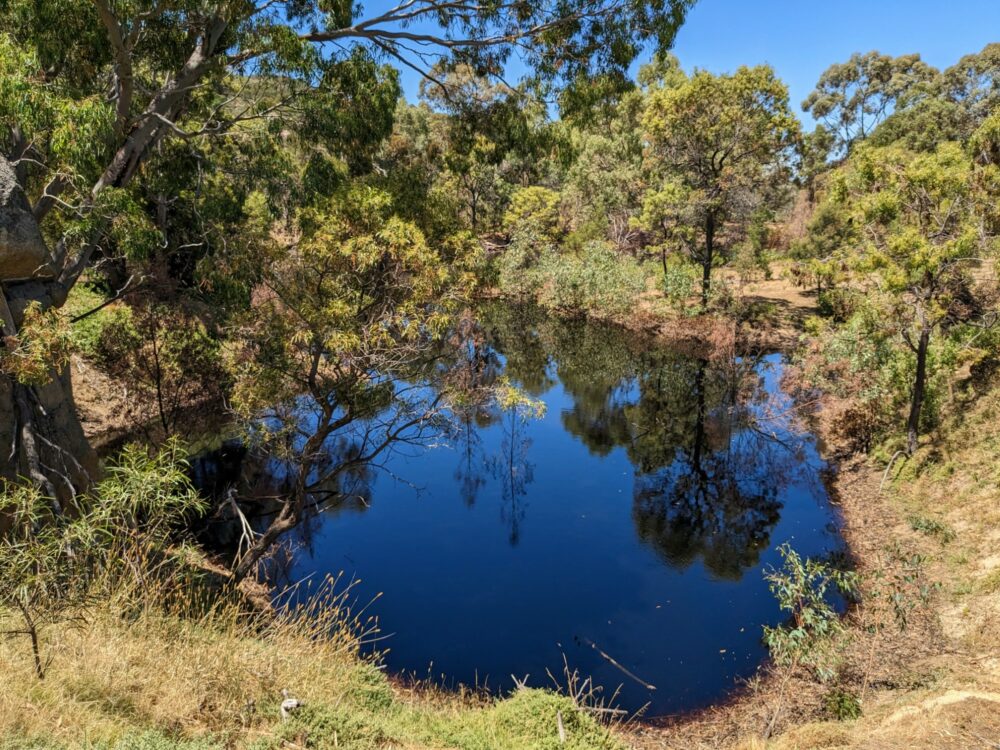
The northern section of the track passes by a pair of small waterholes that are home to everything from ducks to dragonflies, and if you’re heading clockwise, continues past the Bunjil geoglyph. There’s not much to see there, though: designed to be viewed from the hills above, it looks more like a pile of rocks from ground level. The information board is quite interesting, at least.
Saddleback Track
Route: Saddleback Track
Distance: 1km one way
Duration: 15-25 minutes depending on direction
Type: One-way
Start/End: (a) intersection of East-West Walk and Northern Range Track, or
(b) intersection with Branding Yard Trail
Difficulty: Easy to moderate depending on direction
There’s not a lot to say about the Saddleback Track: for most people, it’s more of a connection between other trails than a walk you’ll set out to do by itself. Running from the midpoint of the East-West Walk to the Branding Yard Trail, it’s a steep shortcut between these more-popular tracks.
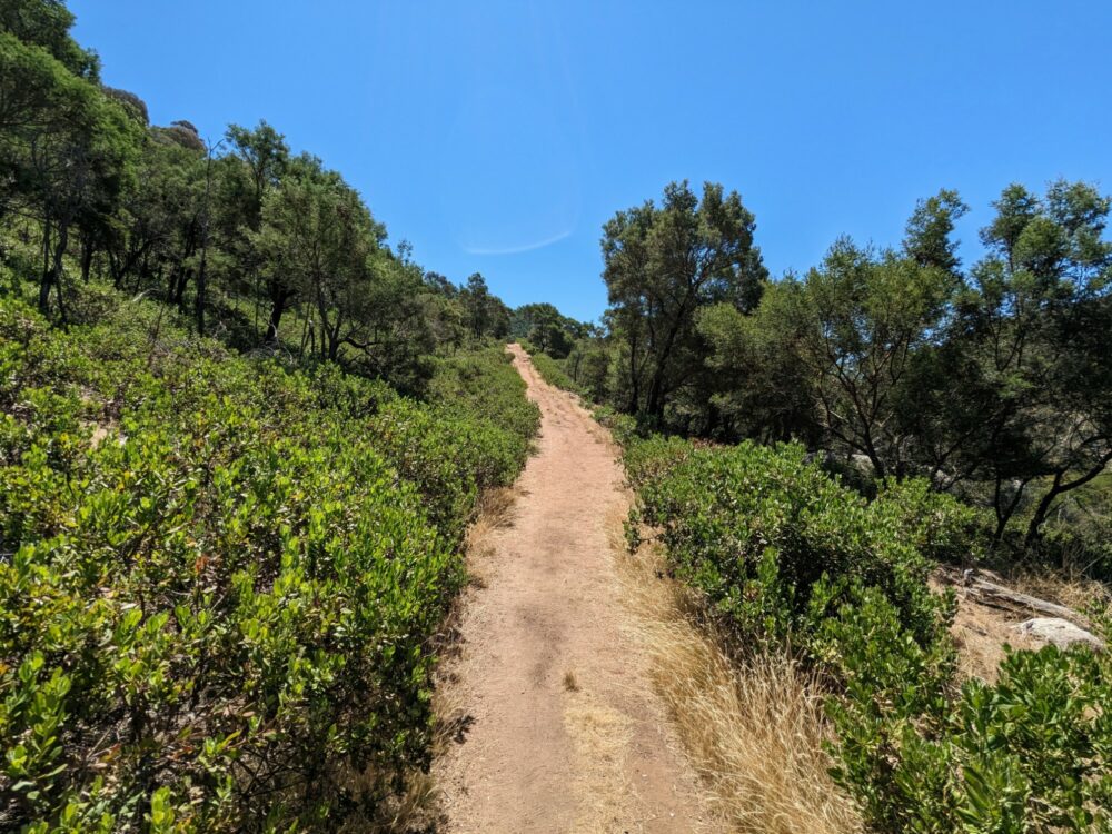
The dirt track climbs sharply from the Branding Yard Trail through the same bush and low trees that make up much of the hillside area in the park. It’s a decent workout and there isn’t a lot of shade, so if you’re walking it in the heat of the day, make sure you’ve got plenty of water (or do it in the downhill direction!).
It’s clearly signposted at both top and bottom, although the sign at the top references the Bunjil geoglyph rather than the Branding Yard Trail to the east.
Note that you can also walk along one of the 4WD park roads (Rockwell Road) to get between the top of the Saddleback Track and the Turntable carpark or Big Rock picnic area. If your car is parked at the latter, it’s a shorter and easier option than using the East-West Walk.
Northern Range Walking Track
Route: Northern Range Walking Track
Distance: 3.5km one way
Duration: 1 hour
Type: One-way
Start/End: (a) intersection of East-West Walk and Saddleback Track, or
(b) Branding Yard Trail near Branding Yard Road
Difficulty: Easy to moderate
If the Saddleback Track is the shortcut between a couple of more popular routes, the Northern Range is the long way round. It’s more challenging than the Branding Yard Trail, probably more on par with the East-West Track, with a few steep sections. In dry conditions the dirt paths don’t have a lot of grip on the descent, so a pair of decent shoes and maybe a hiking pole wouldn’t be a bad option.
For all that, it’s one of my favourite walks in the park, and one of the quieter ones as well. If you’re there at a weekend or other busy time and trying to get away from the crowds, this is likely to be one place to do it.
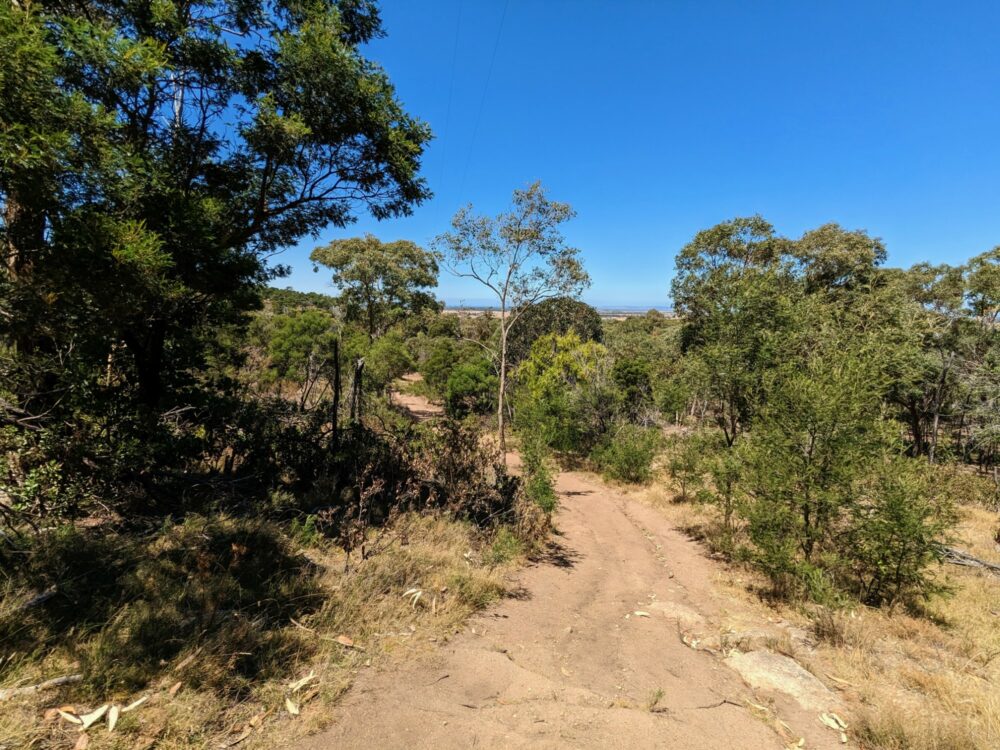
If you start from the East-West Track, the path climbs fairly gently upwards to begin with, looping around the side of a couple of hills rather than going straight over the top. You get some decent views out over the countryside at the highest point of the trail, and plenty of bird and insect life as well, probably helped by the smaller number of visitors.
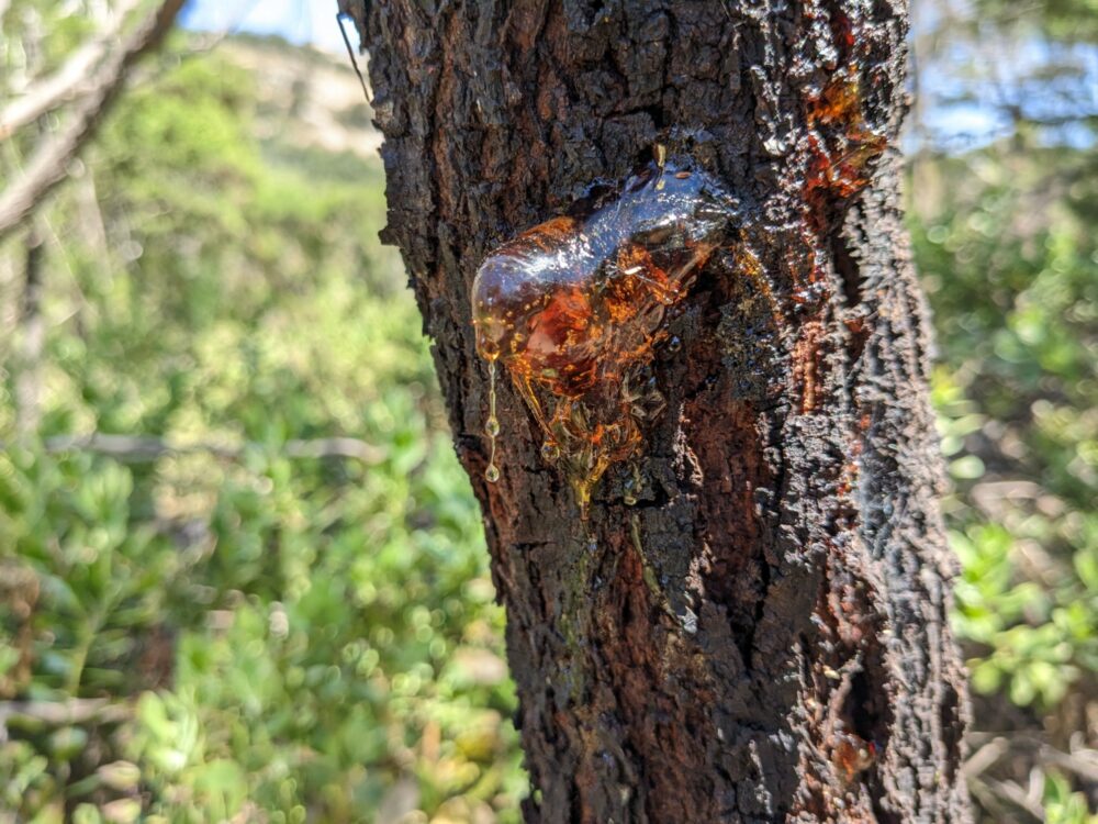
A number of trees in this section have been damaged by fire in the past, and are leaking sap as they heal. It makes for some interesting photo opportunities!
At the other end of the track towards Branding Yard Road, it gets noticeably steeper. Expect a racing heart if you’re walking west, and some slipping and sliding downhill on the dry dirt trail if you’re going east. If you’re struggling for grip on the steep descents, you may find it easier to walk in the grass on the edge of the trail where necessary.
The steep sections don’t last long, though, and the track flattens out again at the start/end point as you cross over Branding Yard Road. From here, you can join the Branding Yard Trail a few metres further on, or walk out of the park to the Toynes Road carpark if you left your vehicle there.
Get regular travel, hiking, and tech updates from me
News, reviews, guides, and more, from here and around the web
Combinations
The You Yangs isn’t a big area, and none of the designated hiking trails in it are particularly long either, topping out at about 5km. Because all of those paths intersect with each other, though, it’s very easy to put together a custom route that lets you walk as far as you like before the park gates close.
Here are a few suggestions of different ways to get that extra distance, but they are by no means the only options. Feel free to grab a copy of the park brochure (pdf) and put together your own version!
About 10km
- Option 1:
- Park at the visitor centre
- Do the Big Rock Walk to the end.
- Take Contour Track and Rockwell Road to Turntable carpark, then climb and descend Flinders Peak.
- Retrace your steps to Big Rock and the visitor centre.
- Option 2:
- Park at Turntable carpark.
- Do the East-West Walk in either direction, which will return you to the carpark, and then take the short connecting track to the Branding Yard Trail.
- Complete a full loop of this trail and return to the carpark via the same connecting track.
- Option 3:
- Park at Turntable carpark.
- Take the West or East Walk to the intersection with the Northern Range track, then follow that until it ends at the Branding Yard Trail.
- Turn right to follow the upper (northern) section of this trail in an anti-clockwise direction, past the Bunjil geoglyph.
- Continue south on the same trail until you reach the connecting track back to the carpark.
About 15km
- Option 1:
- Park at the visitor centre
- Do the Big Rock Walk to the end.
- Take Contour Track and Rockwell Road to Turntable carpark, then climb and descend Flinders Peak.
- Take the East-West Walk in either direction, returning to Turntable carpark, then retrace your steps to Big Rock and the visitor centre.
- Option 2:
- Park at Turntable carpark
- Climb and descend Flinders Peak.
- Take the West Walk as far as the intersection with the Northern Range track and follow that until it ends at the Branding Yard Trail.
- Turn left to follow the lower (southern) section of this trail in a clockwise direction as far as the intersection with the Saddleback Track, then take that back up to where you left the West Walk.
- Take the East Walk back to the carpark.
About 20km
- Option 1:
- Park at the visitor centre
- Do the Big Rock Walk to the end.
- Take Contour Track and Rockwell Road to Turntable carpark, then climb and descend Flinders Peak.
- Do the East-West Walk in either direction, which will return you to the carpark, and then take the short connecting track to the Branding Yard Trail.
- Complete a full loop of this trail and return to the carpark via the same connecting track.
- Retrace your steps to Big Rock and the visitor centre.
- Option 2:
- Park at Toynes Road carpark.
- Walk a short distance down Branding Yard Road until you reach the start of the Northern Range track
- Follow the Northern Range track until it ends at the intersection with the East-West Walk.
- Take either the East or West Walk down to Turntable Carpark, then climb and descend Flinders Peak.
- Take whichever of the East/West Walks you didn’t do before, back up to intersection with the Northern Range and Saddleback Tracks.
- Descend on the Saddleback Track to the Branding Yard Trail, and do the full loop of this trail, returning to where you started it.
- Follow Branding Yard Road east back to your car.
Have you hiked in the You Yangs? Got any favourite trails or tips to share? Drop them in the comments!
All images via author


Thanks for this thorough info Dave, excited to do this walk on Saturday!
Thank you for the guide about combining routes! super helpful.
You’re welcome!