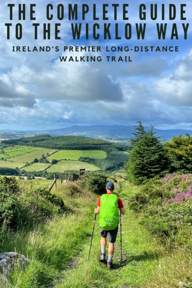
Walking the Wicklow Way, Ireland’s Premier Long-Distance Trail
Articles on this site contain affiliate links, meaning I may be compensated if you buy a product or service after clicking them. The full privacy & disclosure policy is here.It’d been a long time since I’d been to Ireland, and even longer since I’d gone any further than the outskirts of Dublin. I’m not sure why, really: one side of my family comes from this beautiful country, and I’ve always loved the time I’ve spent there.
Despite having walked several Caminos in Spain and Portugal and a number of long-distance walks in the UK, my walks in Ireland in the past hadn’t been much longer than the stroll from one pub to the next in Temple Bar.
A return trip was long overdue, and when Lauren was looking for a week-long walk to do in Europe and stumbled across the Wicklow Way, all of the pieces came together at once.
As we discovered when we went to start researching, though, there’s not a lot of information available online about this walk. While we found and used a helpful little physical guidebook, even that was a few years old and not entirely accurate.
Having now completed the route, I figured that writing a guide to the Wicklow Way myself might be helpful for anyone else struggling to find up-to-date information about this long-distance stroll through the Irish countryside.
This is that guide.
If you’re preparing for the walk and want to know things like how hard it is, where to stay, distances, costs, what the food and drink options are like, and other logistical details, read the first part.
If you prefer pretty photos, or want a route summary, daily distances, or a detailed day-by-day description of the walk, check out the second section.
Or, if you’d rather, just read it all!
Planning and Logistics
Where Does It Start and Finish?
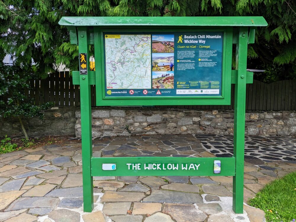
Most people walk the Wicklow Way from north to south, starting from Marlay Park on the outskirts of Dublin. There’s a wooden signboard close to the main park entrance that marks the start point, beside a path that heads south through the trees and up into the foothills of the Wicklow mountains.
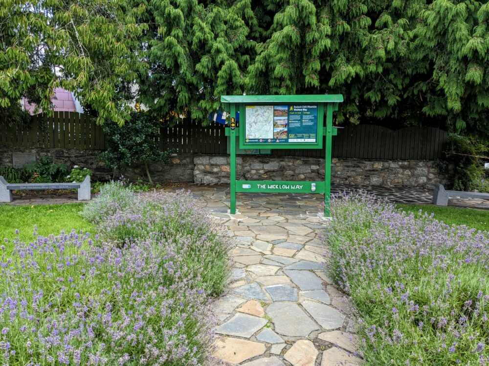
The trail officially ends in the small village of Clonegal in County Carlow, in a small garden beside the main road. There’s a very similar information board there as well, and that’s because you can also start your walk from here instead. Depending on what your plans are once you’re done, that might be a better option for some: finishing in Dublin makes onward transport much easier.
How Long Is It?
The Wicklow Way officially runs for about 130km, although as with any long-distance path like this, you’ll end up walking more. Whether that’s taking alternate routes, going off-trail for accommodation or food, exploring historic sites, or just finding a quiet pub for a pint in the evening, expect quite a bit more time on your feet.
My Fitbit tells me I walked 174km over the course of that week, thanks to an extended wander around Glendalough and some of our accommodation being a few kilometres off-route. It tends to overestimate distances a bit, so I don’t really believe it was quite that much, but it definitely wasn’t 130km either!
How Hard Is It?
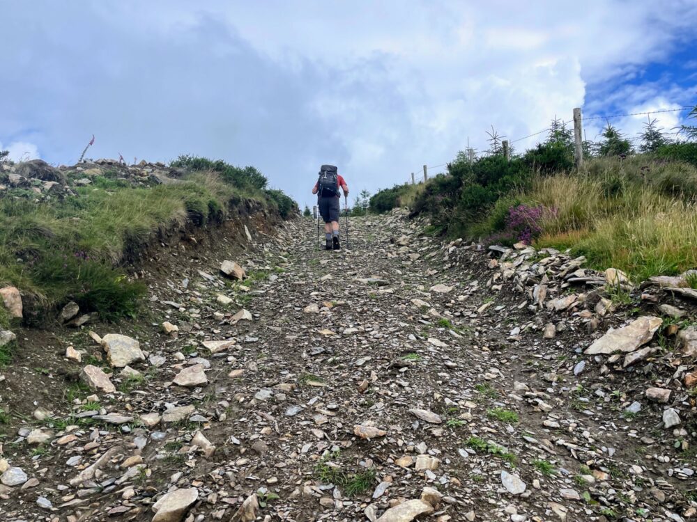
Given that you spend much of the walk in the Wicklow mountains, it’s probably no surprise to hear there’s a fair amount of up and down along the route. The good news is that you never get especially high (a maximum of about 640m), but flat sections are rare for pretty much the entire length.
Some of the climbs and descents are quite steep, but most are more gradual (you can see the elevation chart on this map), and I’d probably describe them as relentless rather than especially difficult. The steepest sections are definitely in the northern half of the walk; the mountains switch to rolling hills after that.
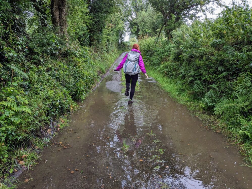
What’s likely to have more of an impact on the difficulty level and enjoyment, though, is the weather. I talk more about it below, but for now, let’s just say that in clear, dry conditions, this isn’t a hard walk for anyone with a reasonable degree of fitness and walking experience. In pouring rain and wind, it can be a different story.
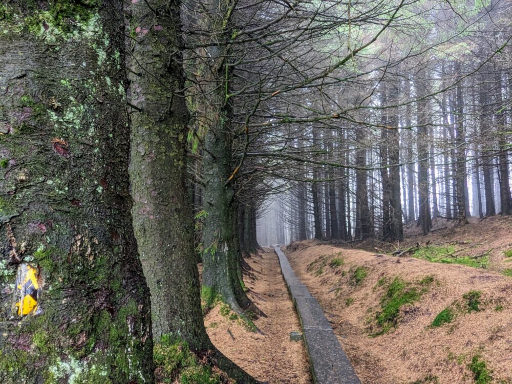
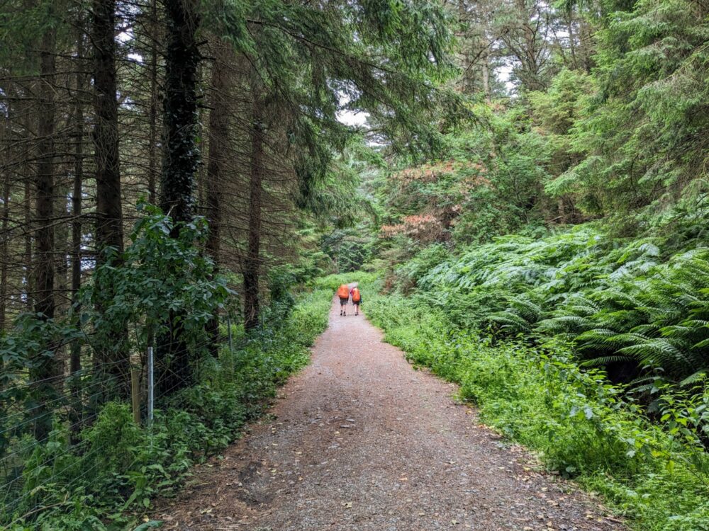
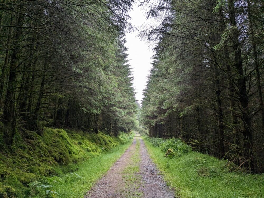
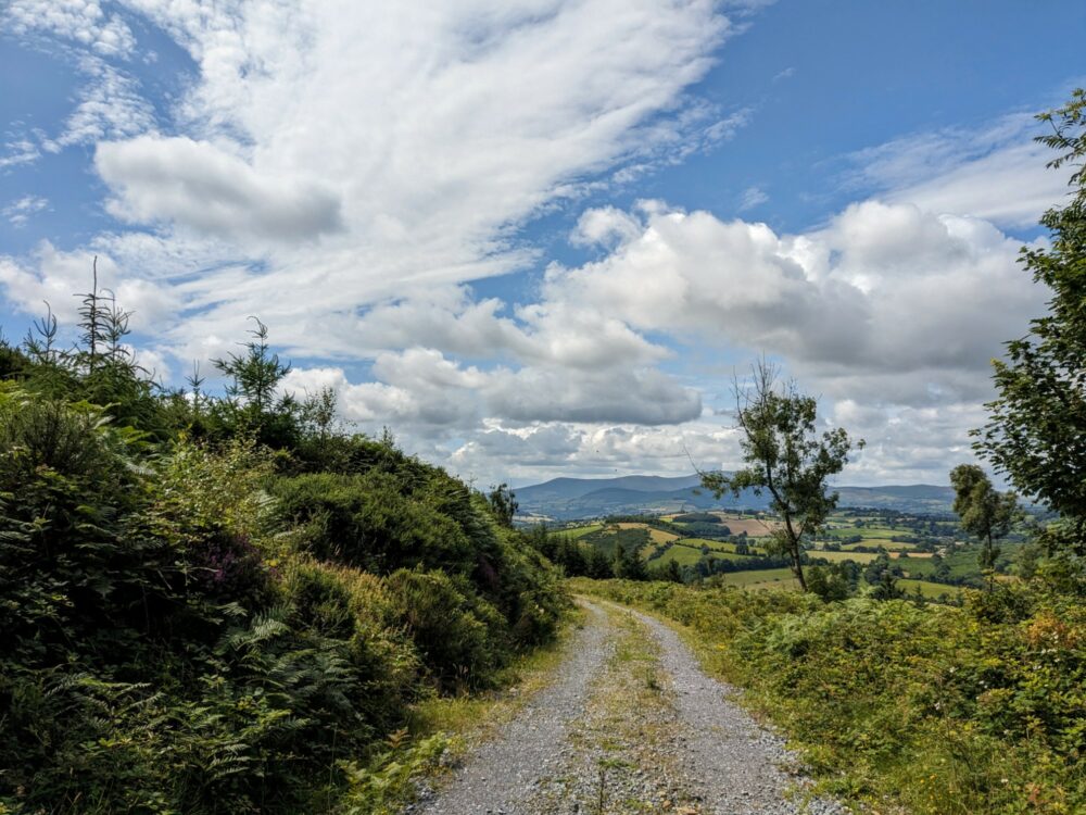
I found the condition of the trail to be pretty good, helped by the fact that a lot of it was on forest tracks. Much of that consisted of light to moderate gravel, along with tarmac during the road walking sections towards the end, and dirt or grass for the rest.
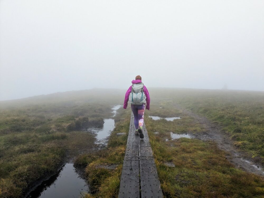
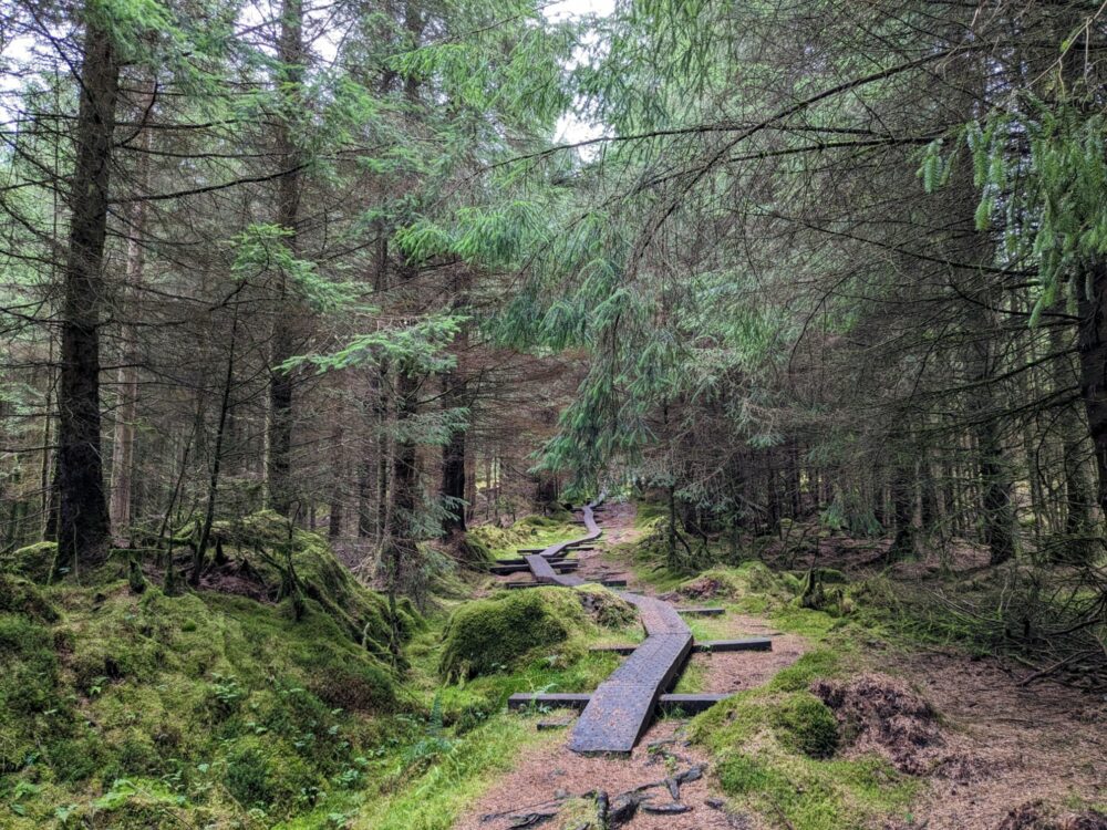
I wouldn’t usually be a big fan of walking on harder surfaces like this, but with the amount of rain we had, it meant a lot less mud than I was expecting. In places where the land was particularly boggy, boardwalks had been installed, which made life much easier.
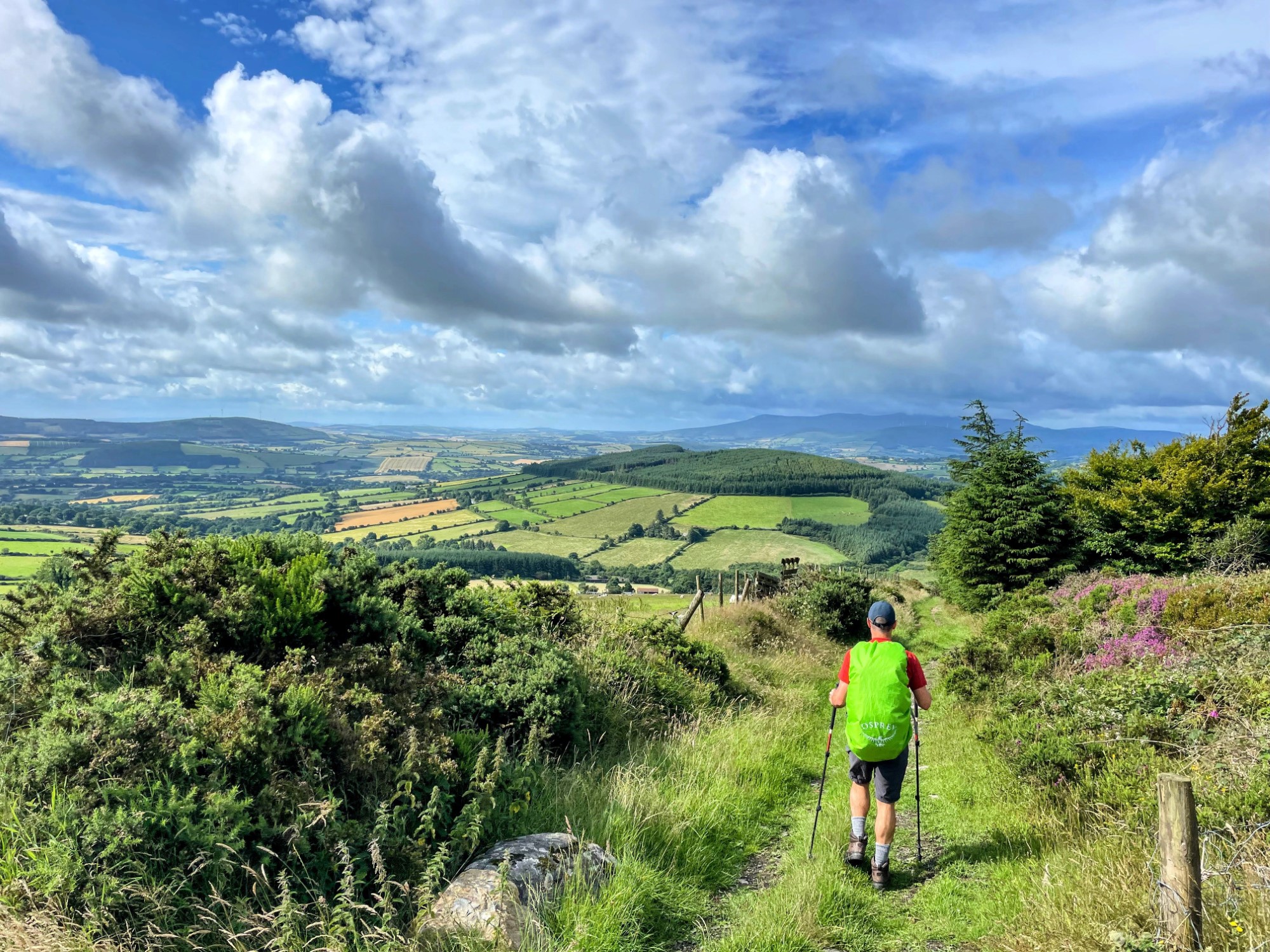
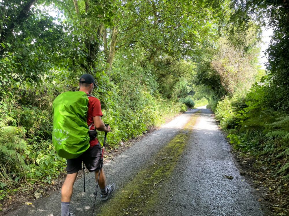
This was definitely a route where my hiking poles came in handy, both for the energy savings when walking uphill, and especially for extra stability on the downhill sections. Some of those sections are quite rocky, and got a bit slippery when it was raining. I use these Black Diamond ones, but any good brand will do.
How Scenic Is It?
We were unlucky, in that some of the worst weather of our walk coincided with some of the most attractive sections of it. That generally meant low cloud and sideways rain, which made it harder to appreciate the scenic views that were apparently all around us!
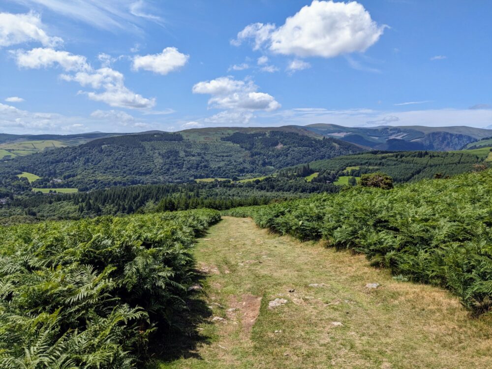
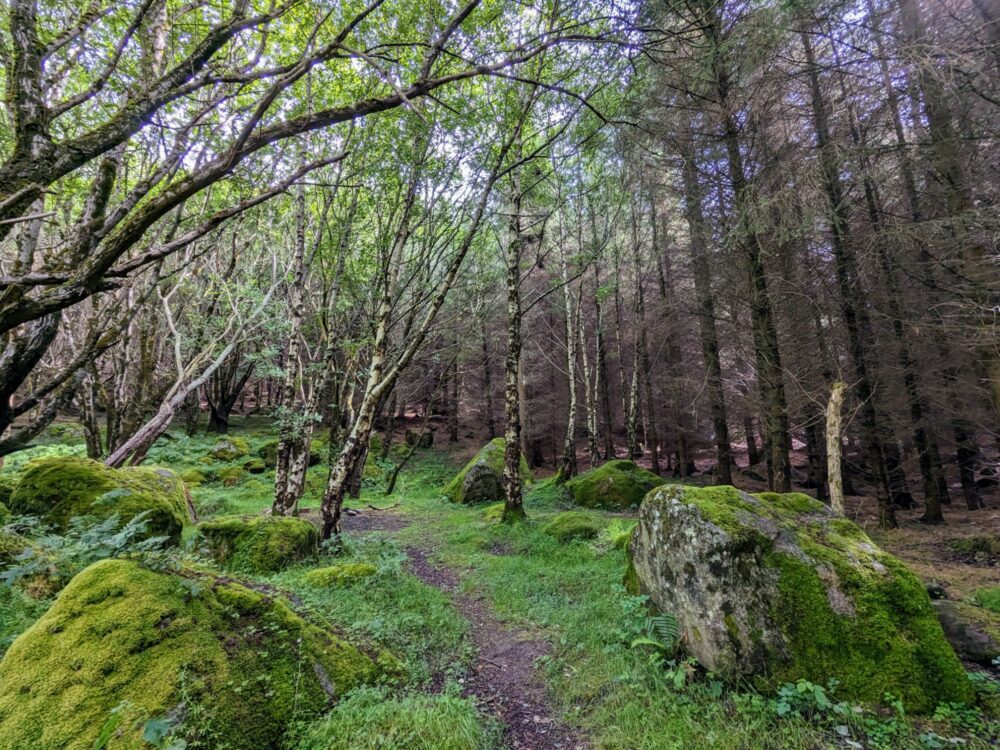
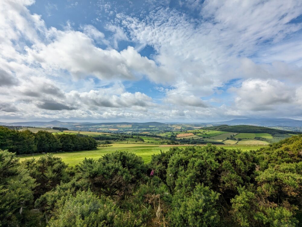
When the clouds parted, though, it was obvious just how lovely much of the Irish countryside is in this region. Impossibly green valleys, placid lakes, tumbling waterfalls, thick forests: it’s a diverse and beautiful part of the world.
That said, as pretty as the countryside is when you get to see it, there’s also a fair amount of walking through plantations where the only real views are of evenly-spaced conifers as far as the eye can see. The route gets criticised for this, and while I think the complaints are overblown, a bit more variety wouldn’t be a bad thing.
Once you’ve left Dublin, it’s countryside interspersed with small towns and villages the whole way to Clonegal. The route almost completely avoids busy roads, with the odd exception as you approach some of the towns.
That’s a nice change from many of the multi-day walks I’ve done elsewhere in Europe and the UK: listening to trucks roaring past on a nearby motorway does tend to ruin the ambience a bit, and there’s none of that here!
How Popular Is It?
The Wicklow Way is apparently one of the most popular long-distance walks in Ireland, and if that’s the case, I can only imagine how few people must walk the rest of them! We only met maybe half a dozen other walkers who were tackling the entire route, although there were quite a few more doing day or overnight sections.
The northern section of the route between Dublin and Glenmalure sees by far the lion’s share of walkers: something like 80% or more of the people who walk some part of the Wicklow Way do it on that section.
I can understand why: that’s definitely the more scenic half, and if I was only going for a day or a long weekend, this would be the part I’d chose as well. I talk more about day-walking options below.
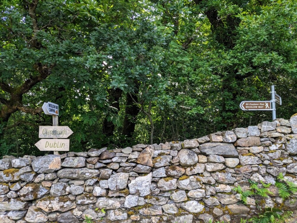
How Well Is It Waymarked?
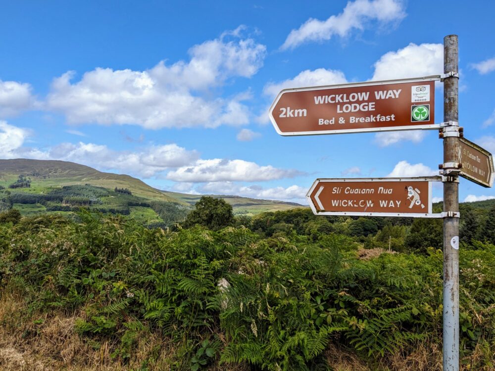
Apparently the waymarking on the Wickow Way used to be pretty bad, with only sporadic signposts that seemed to go missing unusually often. That may well be true, but I’m happy to report that it’s no longer the case: we had few problems staying on the right path.
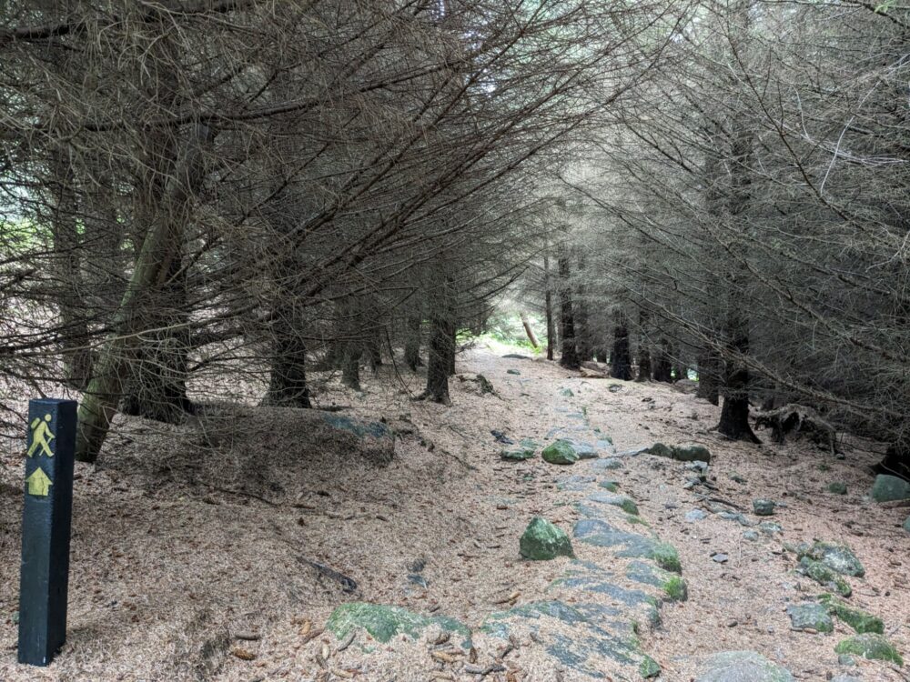
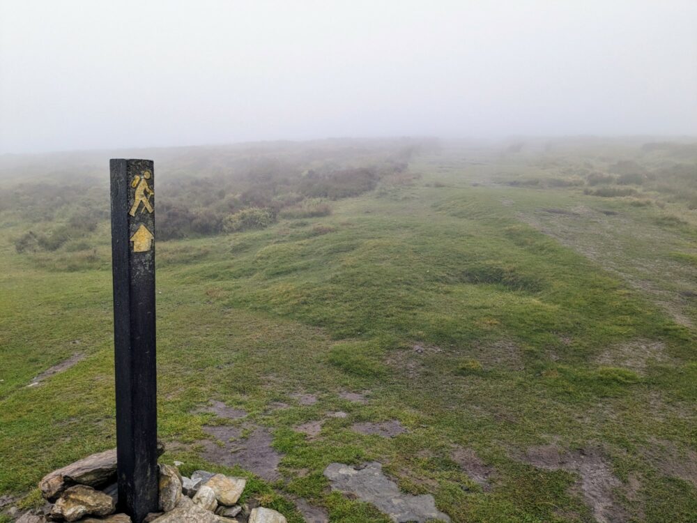
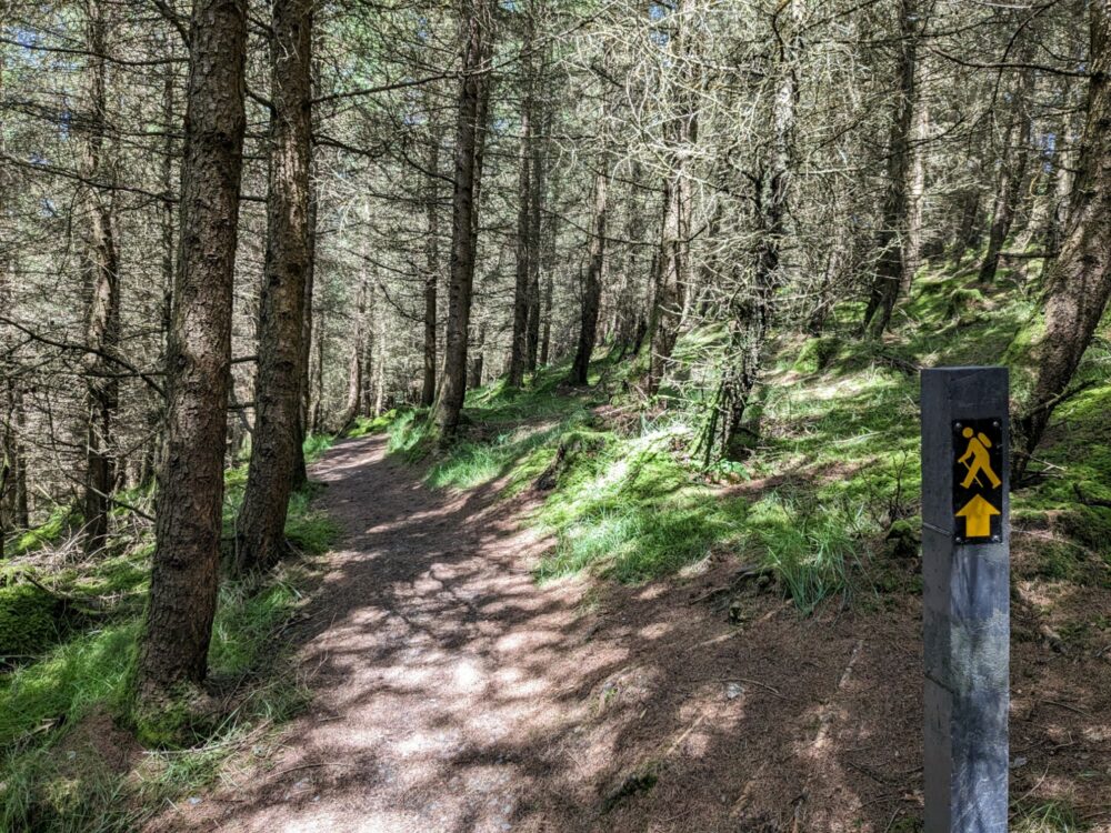
Little markers with a yellow stick figure and arrow on a dark background showed up almost everywhere there was a choice to make, with larger signposts pointing both north and south also quite common.
The path itself has also been improved and made more obvious in many areas, especially those boardwalks I mentioned earlier. It’s a lot harder to get lost on those than on a boggy trail!
One thing I will note is that perhaps more than some other long-distance walks, there are many optional detours and alternative routes available beyond the official track. They’re often worth taking, offering scenic views and nicer trails, but they aren’t always as clearly marked as the main route.
We did manage to miss a couple of markers, usually when there was a turnoff somewhere along a featureless forest road. Fortunately I’d taken the precaution of downloading the AllTrails map to my phone beforehand, so it wasn’t hard to backtrack or find an alternative path to get us back on the route. It’s the app I use on all my long-distance walks these days.
How Long Does It Take to Walk?
Most people take around a week to walk the Wicklow Way, and that’s what we opted for as well. It felt about right, with an average of about 21km of on-route walking each day.
As with many long-distance trails like this, though, the average distance can be deceiving. How far we actually walked on any given day varied quite a bit, based mostly on where we’d been able to find accommodation for the night.
Our shortest day was just 13km, while the longest was well over double that at 32.5km. That’s just the on-trail distance, too: as I mentioned earlier, everything from food and drink options to sightseeing added a few extra kilometres most days.
Assuming you could find accommodation in suitable places, you could easily add an extra day or two into the mix if you wanted to break up that long day we had. Likewise, cutting it back to six days would be pretty manageable if you’re a regular long-distance walker, and not much more difficult either, at least in good weather.
Any less than that makes for some very long days: not impossible, just not necessarily very enjoyable.
Getting To and From the Wicklow Way
Because it’s on the outskirts of Dublin, the northern end of the Wicklow Way is very easy to access. If you’re coming from overseas, there are regular cheap flights to the Irish capital from the UK and Europe, and often the United States as well.
Buses run regularly from the airport to central Dublin. We spent a couple of nights in the city before starting our walk, so we just strolled over to the bus bays outside the arrival hall and took the first service heading towards the O’Connell Bridge.
The Northern End
Our accommodation was near Temple Bar, a short walk from where the bus dropped us off at O’Connell Bridge. When it came time to head to the start point, we just headed back towards the bridge and took the number 16 bus to Marlay Park.
If you arrive early enough in the morning and aren’t looking to spend any time in Dublin, the number 12 route starts at the airport and runs past Marlay Park, so you could go straight through without changing bus if you wanted.
Single bus fares cost €2.60 for most rides around Dublin if you pay in cash, including from the airport. Note that you’ll need Euro coins: the drivers can’t accept notes or give change.
Get off the bus on Grange Road, opposite the main carpark and entrance for Marlay Park. The official start point is close to the entrance, and marked on Google Maps. If you need to stock up on supplies like we did, stay on for an extra stop and get off beside the Lidl supermarket instead: there’s an ATM inside if you need it.
The Southern End
Things are trickier at the southern end of the walk, mostly because Clonegal really is a pretty small village. No buses run to or from here, so unless you’re being picked up or want to call a taxi, there’s a bit of work involved in getting to your next destination.
The nearest places with bus service to and from Dublin are Kildavin (4km) or Bunclody (5km), so you’ll need to get to one of those towns first. They’re both walkable if you’ve got any energy left, otherwise it’s worth seeing if you can hitch a lift. More on that below.
Monday through Friday, the 132 bus starts from Bunclody at 6 a.m. and 7:50 a.m., calling via Kildavin and ending in central Dublin. On Thursday mornings there’s also a 9:23 a.m. service. On Saturdays, only the 7:50 a.m. service operates, while on Sundays there’s an 8:50 a.m. and a 5:50 p.m. service.
Going the other way, the 132 has two evening services from Dublin that stop in Bunclody Sunday through Friday, with again an extra (evening) service on Thursdays. There’s only a single service on Saturdays.
Most of those times aren’t ideal for walkers, since other than on Sundays, they mean you’ll likely need to spend a night in Bunclody at the start or end of your walk to make use of them. On the upside, there’s surprisingly good accommodation there, and it doesn’t even cost a fortune.
The other, perhaps better alternative, is to take the 369 bus to Enniscorthy. You’re going in the wrong direction (south) to start with, but it runs more regularly, and Enniscorthy has regular train and bus services back to Dublin.
Monday through Friday, the 369 runs five times a day from Kildavin and six times a day from Bunclody. It doesn’t operate on Saturdays, but runs four times on Sundays from Bunclody (only once from Kildavin).
All of that’s assuming you want to go to Dublin, of course! We were heading to Wales after our time on the Wicklow Way, via the ferry from Rosslare that’s about 65km south of Clonegal.
The best approach we could come up ahead of time still required 5km of extra road walking and two buses to get us to Rosslare, so we decided to just stick our thumbs out on the side of the road in Clonegal and see what happened.
Sure enough, a lovely guy named Joe stopped a minute later, telling us to jump in when we said we were headed for Bunclody. After we told him we were aiming to get to Rosslare that evening, he decided to take us all the way to Enniscorthy instead, dropping us in the centre of town for the easiest of connections. Legend!
I can’t promise you that Joe will be driving past in his van on the day you finish your walk, but I wouldn’t be shocked if someone else decided to give you a lift. All the usual caveats about hitchhiking safety apply here: I’m not necessarily recommending it, especially if you’re on your own, but the option’s there if you want to take it.
To and From Your Accommodation
There isn’t much accommodation that’s directly on the trail, which means figuring out the best way of getting to and from wherever you’re staying each night. In some cases it’s a relatively short walk, while in others you’ll likely be relying on infrequent bus services, local taxis, or the kindness of the person at your accommodation.
I’ve included the phone number below for the local taxi driver that took us between the nearest trailhead and Eniskerry; on the other days, we either walked to our accommodation or were offered a lift by the person who ran it.
Day Walks on the Wicklow Way
Like I mentioned earlier, the vast majority of people who only walk a section of the Wicklow Way do so on the northern half. That’s partially because it’s closer to Dublin, partially because it’s at least somewhat served by public transport, and mostly because it’s generally prettier walking, on trails instead of roads.
The easiest way to experience a day on the Wicklow Way is to just walk the first section between Dublin and Eniskerry. I describe it in detail below, but in brief, it’s a manageable distance, with enough climbing to get some great views on a clear day, and a pretty forest section at the end.
It’s 22km from Marlay Park to the trailhead beside Knockree Hostel: from there, you can call a taxi to take you into Eniskerry, or walk 5.5km along the road to get there instead. The 44 bus runs from the centre of the village back to Dublin.
You could also leave the trail a little earlier, at the parking lot for Curtlestown Wood. It’s just under 20km from the start point, with a 4.5km walk or taxi along the road to Eniskerry from there. It’s less walking, but you do miss out on that final lovely stroll through Lackan Wood.
A shorter and easier option that’s still accessible by public transport from Dublin is the section between Roundwood and Glendalough. It’s about 13.5km, with some lovely hill walking and views in the latter half. The only real downside is that much of the first half is road walking: quiet roads, sure, but roads nonetheless.
To make this happen, you’ll need to catch the Glendalough bus from St Stephen’s Green or one of a few other stops in Dublin, getting off in Roundwood and walking the roughly 2km to the trailhead at Baltynanima.
At time of writing, the summer timetable sees the bus leaving Dublin at 11 a.m. each day, arriving in Roundwood just over an hour later.
On weekdays, that gives you a bit under five hours to make it to Glendalough in time for the return bus to Dublin at 4:30pm. That’s manageable, but doesn’t give loads of extra time for stops or admiring the view. On weekends, it leaves about an hour later at 5:40pm, making for a more relaxed experience.
If you’ve got your own transport, you’ve obviously got more choice about which sections you walk and when you do it. Even so, unless you can do a car shuffle with a friend or are happy to pay for a taxi to get back to your vehicle, you’ll probably find yourself turning around at some point to head back to wherever you parked: in general, local public transport options are very limited.
Weather
I do a lot of walking in summer and autumn in Europe and the UK, and I’m usually pretty lucky with the weather. It looked like that would be the case for the Wicklow Way as well: for weeks before we started the walk in early July, Ireland had been bathed in sunshine.
That all came to a crashing halt a couple of days before we flew to Dublin, when the temperatures plummeted and the wind and rain returned. As the rest of Europe sweltered in a heatwave, we shivered our way around the capital and hoped that the forecast for the rest of the week was wrong.
The forecast, dear reader, was not wrong.
When it wasn’t raining, it was often gloriously sunny, with warm temperatures and spectacular views. When it was, visibility often dropped to near-zero, strong winds threatened to blow us off mountain paths, and the waterproofing of my hiking gear got the biggest test of its life.
When your leather boots are soaked from the inside because of the sheer volume of water running down your legs, you know it’s not the driest of days.
The one upside of those strong winds is that it meant that while the rain tended to show up out of nowhere, it would often disappear again just as fast. I grew up in New Zealand and lived in the UK for years, so I’m very used to rapidly-changing weather, but even so I’m not sure I’ve experienced anything quite like it!
It rained on five of our seven days on the trail, rarely for more than an hour or two at a time, but often coming and going throughout the day. It meant we missed out on some of the beautiful views promised in the guidebook, and got to spend a lot more time drying clothes with a hairdryer than we’d anticipated, but hey, it’s a week in Ireland.
None of the locals we spoke to seemed particularly surprised by the conditions, even as they all told me just how nice it had been the month before. “If only you’d been here last week”, they’d say, as we quietly dripped onto their carpet. Indeed, if only we had.
More than any other walk I’ve done in this part of the world, I really can’t stress enough how important it is to have a good pair of waterproof boots or walking shoes, and either a proper waterproof jacket and pack cover or a heavy-duty poncho that covers both you and your backpack.
Make sure you’ve tested your gear, and can rely on it to keep you and your pack contents dry even in long periods of heavy rain. Often when the rain showed up, it was when we were somewhere near the top of a mountain, with nowhere to shelter and wait it out.
Hope for great weather, plan for terrible weather, and don’t be surprised if you get both. Probably five minutes apart.
Accommodation
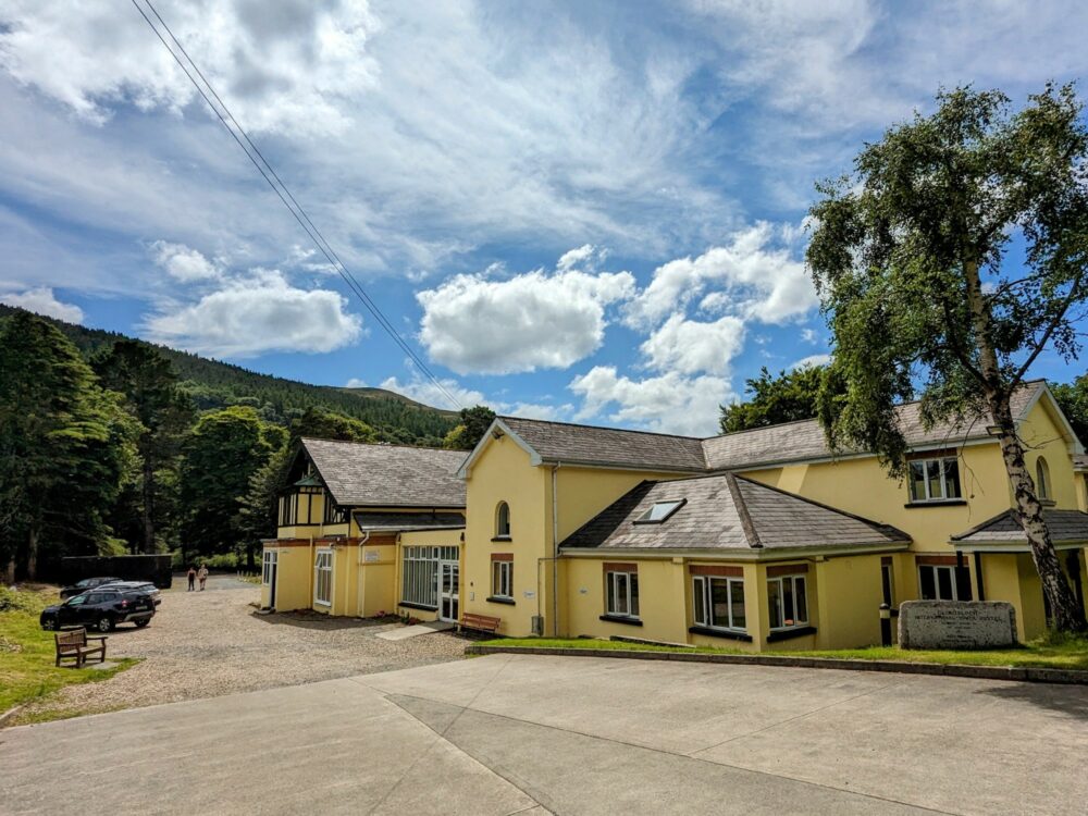
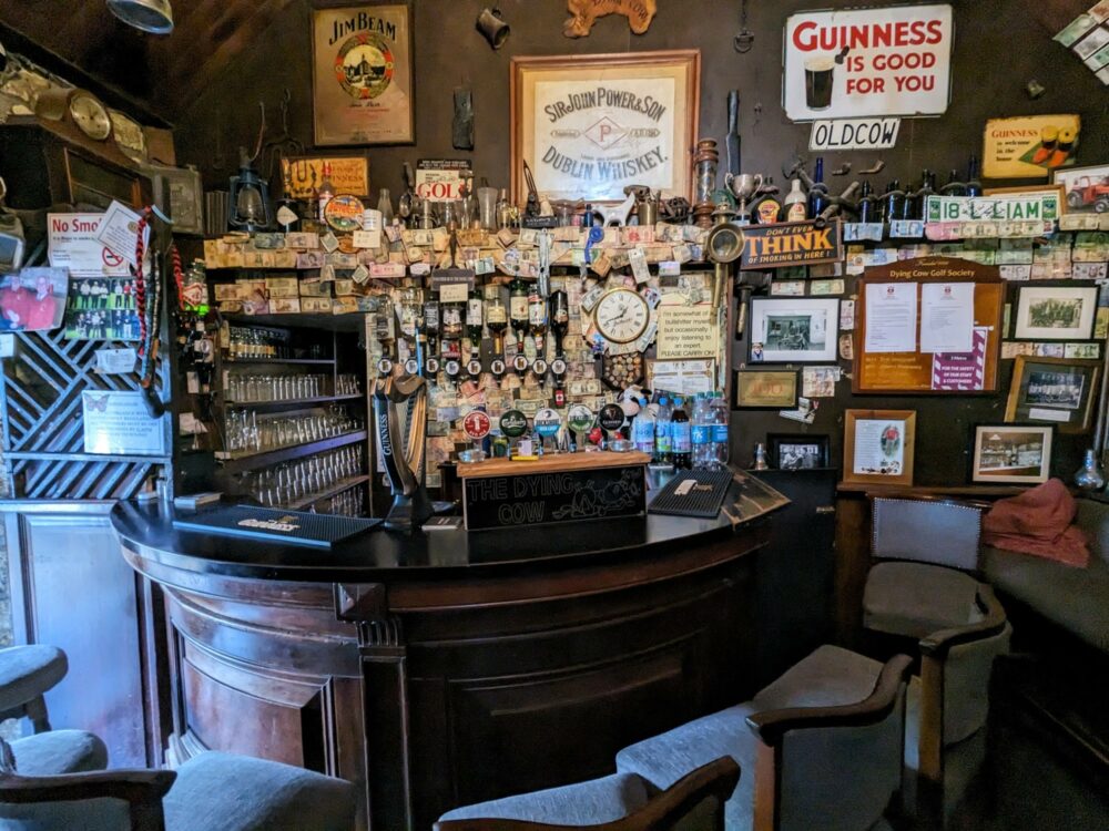
While there’s a reasonable amount of accommodation in the vicinity of the Wicklow Way, little of it is directly on the route. There are a few exceptions, like the hostel in Glendalough shown in the above photo, but most of the time you’re looking at heading 2-5km off-route to find a bed for the night.
At the time, Knockree Hostel near Eniskerry had been converted into accommodation for Ukrainian refugees and wasn’t available to the general public. It’s returned to being a youth hostel now and is right on the trail, so I’d suggest staying there on the first night unless you’re looking for something more upmarket.
We stayed in a mix of different accommodation types over the course of the week, including hostels and pubs, hotels, B&Bs, and homestays. We booked a bit over three months in advance, and were glad we did: July is a busy time of year in this area, and a few places were already full.
I talk about everywhere in more detail in the day-by-day section below, but for the sake of having it all in one place, here are all the places we stayed along the Wicklow Way. In a nice change, all of them were bookable online, making it much faster than usual to piece our itinerary together.
If you’re looking to camp instead, it’s a possibility. There’s only one dedicated campsite anywhere near the Wicklow Way, and even that is over 2km off-route near Roundwood. Wild camping is permitted on Irish Forestry (Coillte) land, however, along with the small 17km section of the Wicklow Mountains National Park that the route runs through.
It’s expected that you’ll leave no trace of your stay when wild camping, and on forestry land, you need a written permit for large groups, campfires, or any stay during the deer hunting season that runs from 1 September to February 28. We came across a group of friends camping on the side of the trail one morning, and saw a few other other people carrying tents at various points.
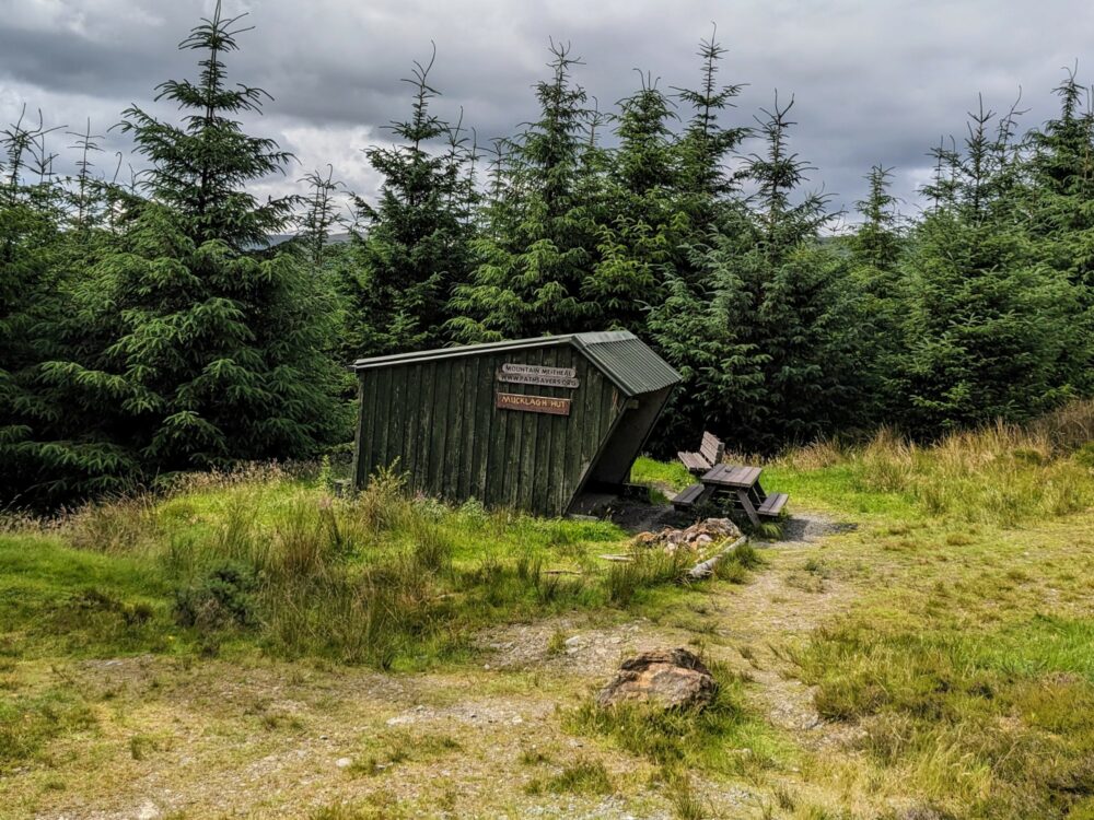
There are three mountain shelters along the route as well, all in the middle sections (days three to five). They’re pretty basic, with a roof and three walls, open to the elements on one side. If it rains, the parts of you at the back of the hut shouldn’t get wet, but no promises about the bits closer to the entrance!
There’s a picnic table and fire pit alongside each hut, but that’s it in terms of amenities. They aren’t bookable, so it’s first-come, first-served. If you plan to use them, I’d suggest arriving with enough daylight left that you can walk on and find somewhere else if they’re full.
I’m glad that we weren’t camping on this walk: the amount of wind and rain would have made for some pretty soggy ground, wet gear, and little sleep. In calmer, drier conditions, though, I could definitely see the appeal.
Baggage Transfer
We both carried mid-sized backpacks (around 45 litres) for the Wicklow Way, but that doesn’t mean you have to.
There’s a luggage transfer service that covers the entire route from Marlay Park to Clonegal, seven days a week between the start of April and end of October. I’ve no affiliation or experience with them, but the online reviews at least are good.
Transfers cost €10 per bag per day, with a minimum of €20. The driver collects your bag from your accommodation each morning and drops at your next stop that afternoon; they say they’ll deliver anywhere along the route within reason.
Apps and Guidebooks
There wasn’t a lot of useful information online about the Wicklow Way when I was researching it (one of the reasons I’m writing this guide, I guess), so I did what I usually do in these situations and bought a guidebook instead.
I’m a sucker for Trailblazer guides but they don’t cover this route, so I went for my backup publisher instead. The Cicerone guidebook turned out to be pretty good, with enough detail to be useful while still being a slim, small book that fit easily in my shorts pocket.
It includes a short history of the route and geography, a bunch of alternate route options and why you would (or wouldn’t) want to consider taking them, plus all the usual elevation charts, maps, and directions you’d expect. I would have liked the maps to have a bit more detail than they did, but I just compared them to my phone app whenever I was in doubt.
The sections are based on a seven-day north to south walk, which is what we did, and we basically followed the recommended daily sections for the first half. Accommodation availability meant that we needed to break things up differently for the latter half, but it didn’t make a lot of difference other than that longer fourth day.
I like to pair a physical guidebook with the AllTrails app on my phone, especially in situations like this where the maps in the book weren’t super-detailed. Having a GPS-based map meant I could figure out when I’d missed a turnoff and get back on track more quickly, something that happened more than once! I had phone service most but not all of the time, so was glad I’d downloaded the map in advance.
Food and Drink

While this isn’t the Camino Frances where there’s a cafe or bar every hour, we had no problems staying fed along the Wicklow Way as long as we did a bit of planning.
That usually meant buying some sandwiches before setting out in the morning, or having a big breakfast and then just snacking on fruit and protein bars during the day, but there was the occasional pub enroute for a hot lunch option as well. Every town and village we stayed had a supermarket or convenience store where we could buy supplies for the next day.
We usually ended up at a pub for dinner, and they were invariably pretty good; not only was a drink very welcome after a long day of walking, but the meals tended to be large and tasty as well. On the one occasion where we were staying at a lodge in the middle of nowhere, the owner provided a delicious three-course meal instead.
While there was no shortage of water falling from the sky, there wasn’t always a lot of it available enroute to fill up bottles and hydration sacks. That was especially true in the more remote mountain sections near the start, not helped by generally having to go off-trail to get to the nearest town or village. Be sure to carry more water than you think you’ll need, especially on hot days.
Costs
Ireland isn’t the cheapest of places to travel in these days, and that’s just as true when you’re walking through it as any other time. That said, Dublin is by far the most expensive place in the country, and we noticed the prices dropping the further we got from it.
In terms of accommodation, we stayed in double or twin rooms of some description the whole time, in everything from hostels to hunting lodges and B&Bs. The most we paid was €70 per person at a B&B in Eniskerry, the least was €43 each in a room in a private home in Roundwood, and we averaged about €54 per person per night.
That included breakfast about half the time, sometimes just a light cereal and fruit option, sometimes a full cooked meal that set us up for much of the day. Where it didn’t, we’d usually eat in a cafe before setting off. A cooked breakfast with a coffee or tea was usually around €12, with lighter options being a little cheaper.
Lunches were generally small (sandwiches, fruit, protein bars) and eaten somewhere on the trail, although we did have a delicious pub lunch at Glenmalure Lodge as we dried out after a particularly wet morning. That cost €19, the price inflated a bit by the two large cups of coffee I needed to warm up!
As usual, it was dinner prices that varied the most, and not only based on the number of pints consumed at the pub. The least we paid was €10 for takeaway fish and chips in Glendalough, where we sat in a park and basked in the evening sun.
The most was €40 at Ballyteige Lodge, although even that felt like good value, since it was a three-course home-cooked meal with plenty of wine. We averaged just over €20 for dinner and drinks.
We only ended up taking one taxi, to and from the trail near Eniskerry. That cost €15 each way.
So, all of that to say, if you’re staying in similar sorts of places to us and having similar sorts of meals, you can probably budget somewhere around €80–100 per person per day for the Wicklow Way and not be too far off. It’ll be a lot cheaper (and a lot less comfortable) if you wild camp,
While pubs, cafes, and restaurants will take cards, you’ll need cash for any taxis. Some accommodation, especially small B&Bs, are cash-only as well, so be sure to have enough to cover your likely expenses. There are ATMs in larger towns, and supermarkets will likely be happy to give you some cash out with a purchase if you need it.
The Walk Itself
All distances mentioned below are approximate, since they were recorded on my Fitbit which has GPS turned off to save battery. They’re fairly close to what’s listed in the guidebook, though, so I suspect they’re not too far off. They include the distance walked between the trail and our accommodation each day, but not any wandering around town for meals or sightseeing.
- Day 1: Marlay Park (Dublin) to Eniskerry, 22km/13.7 miles
- Day 2: Eniskerry to Roundwood, 21.5km/13.4 miles + 3km/2 miles to accommodation
- Day 3: Roundwood to Glendalough, 13.3km/8.3 miles
- Day 4: Glendalough to Ballyteige, 32.5km/20.2 miles
- Day 5: Ballyteige to Tinahely, 20.7km/12.9 miles
- Day 6: Tinahely to Shillelagh, 19km/11.8 miles
- Day 7: Shillelagh to Clonegal, 20.1km/12.5 miles
Day 1: Dublin to Eniskerry
After walking out of our hotel into a cloudy but dry morning, we had a tasty breakfast of mushrooms on toast at nearby Tang cafe, sat around for a while with a second coffee, picked up some enormous sandwiches for later from the Pig and Heifer deli down the road, and eventually stopped procrastinating and headed for the bus stop near O’Connell Bridge.
The number 16 bus rumbled into view right on time, and soon whisked us out of the central city and through Dublin’s southern suburbs. It took about 40 minutes to get to Marlay Park, and after a quick stop at the nearby Lidl to get money out of the ATM and grab some last-minute snacks, we crossed the road and headed to the start line.
Or tried to, at least. Marlay Park plays host to a range of events during the summer, and the setup process for one of them was in full swing. Unfortunately that meant a large area near the carpark was fenced off, and while we could see the sign that marked the start of the trail through the chain-link fence, we couldn’t get to it. No happy selfies for us, then.
There’s no shortage of other paths through the park, of course, so we just followed random ones heading in roughly the right direction until we picked up a Wicklow Way trail marker a little further along. From there it was plain sailing through the rest of what turned out to be quite a large, lovely park, eventually emerging beside the noisy M50 motorway.
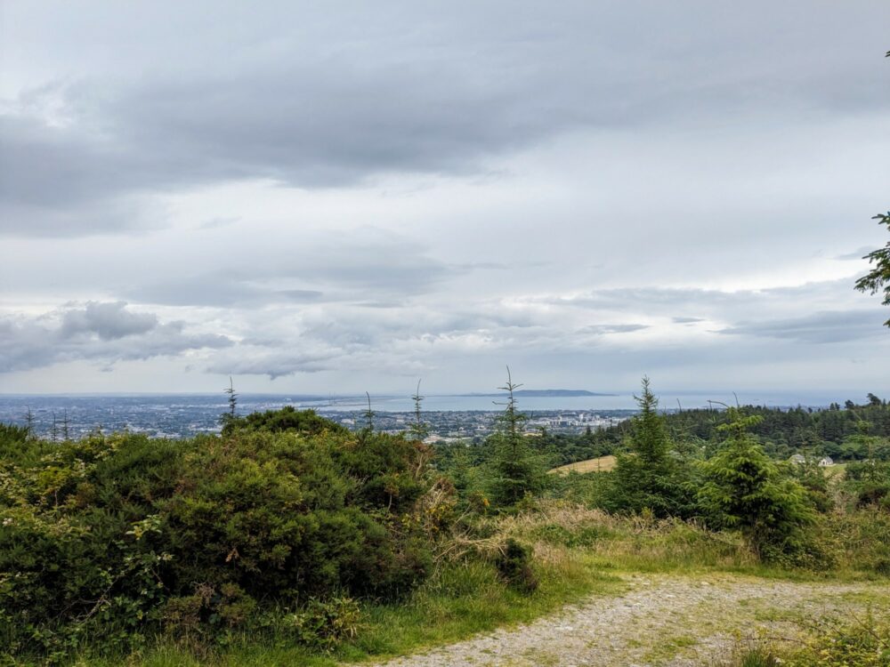
Luckily that was the only motorway we went anywhere near on the entire route, and we soon passed under it and up into the foothills. The sun had been peeking out while we walked through the park, but the clouds returned as we climbed up into the foothills on a gravel track through Kilmashogue Forest.
The higher we climbed, the better the views back towards Dublin became, at least until we got into the cloud layer. After a windswept walk along the ridgeline, we ducked into the forest for a bit of shelter as we ate our sandwiches and discussed whether we were going to take the alternate route via the Dublin Mountains Way that was soon coming up.
The guidebook promised a “fine viewpoint” if we did, but one glance at the ever-thickening cloud suggested that today, said viewpoint would be anything but fine. We stuck to the main path, saved ourselves an extra 4km of walking, and scuttled along the exposed ridgeline as fast as possible until we could drop down to the relative shelter of the forest again.
Pausing only to make sure Lauren hadn’t been eaten by carnivorous ferns on one particularly overgrown section, we dropped out of the woodland for a brief spell of road walking towards Glencullen, before turning down a lane to cross Boranaraltry Bridge and head back into the forest.
From here we had a solid hour or more of gentle but persistent uphill on a wide gravel trail, dodging rain showers as we headed towards the top. The descent down through Curtlestown Wood was noticeably steeper, with rough, rocky steps that were more than a little slippery: not for the last time on this walk, I was glad I’d packed my hiking poles.
I’d called ahead earlier in the day to make sure a taxi pickup would be available (Alpine Cabs in Eniskerry, on 087 299 8836), and rang again as we emerged out of the trees. We could have been picked up here beside the carpark, but to try and even up the daily distances a bit, decided to carry on to the next road crossing a couple of kilometres further south.
Dark and desolate, this final section through Lackan Wood was very different to the rest of the day’s walking, and probably one of my favourite bits. Half an hour later we left the shelter of the forest and popped out beside the Knockree Hostel, just in time for the rain to start again. Because of course.
The cheerful taxi driver showed up a few minutes later, and dropped us off outside Neidin Lodge in Eniskerry. It was the most expensive place we stayed outside Dublin, but this sprawling B&B was absolutely beautiful, with a lovely owner, friendly dogs, a comfortable room, and hot showers that we made immediate use of.
The main part of the village was just a bit further down the hill, and we had dinner at the cozy Eniskerry Inn. Burgers and a couple of drinks finished off what had been an enjoyable, if somewhat damp, first day. There’d be plenty more of those to come!
As I mentioned earlier, the Knockree Hostel was closed when we walked the path, but is open again now. If you’re on a budget, or just don’t want to deal with the taxi or extra walking into Eniskerry, I’d suggest staying there instead. Just note that it’s self-catering, so bring your own food.
Distance: 22km to Knockree Hostel trailhead. Double room at Neidin Lodge: €141
Day 2: Eniskerry to Roundwood
Breakfast was tasty and plentiful at Neidin Lodge, and after a lengthy chat with Marie (the owner) and a quick stop at the village supermarket to pick up what Lauren still describes as the best egg salad and ham sandwich of her life, we were collected by the same taxi driver and dropped back to the trail.
We managed to miss a turnoff on the path through Lackan Wood almost immediately, which ended up as a bit of a happy accident. We realised soon after, but trusty old AllTrails showed an alternate route through the forest to join up with the right path. It only added five minutes, and turned out to be absolutely lovely.
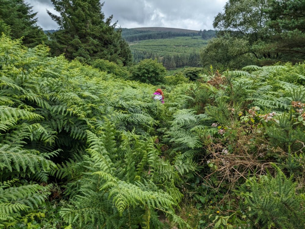
Back on track, we battled through another field of overgrown ferns that threatened to swallow us whole, before crossing a footbridge to sadly leave the valley and the morning sunshine behind as we started to climb through Crone Woods.
The clouds started to gather ominously above us, but stayed just high enough for us to get some good views of the Powerscourt waterfall in the distance as we turned the corner at Ride Rock. The trail kept ascending, the clouds continued descending, and we were soon surrounded by a wall of grey.
Walking through a cloud is rarely dry, and this was no exception as we battled on along the ridgeline. This section near Djource Mountain seemed popular with groups of day walkers: we passed a couple of them, one school group who looked a little shell-shocked by the conditions, and an older guided group who seemed more battle-hardened as they climbed into the fog.
There’s another half-kilometre side trail here, with an obvious marker pointing off to the right towards the summit of the mountain. It’s the highest point on (well, near) the Wicklow Way, with views on a clear day all the way to Snowdonia in North Wales.
Today, however, we barely had views all the way to the end of our arms. The side trail would need to wait.
The walking had been a bit grim for the last hour or two, with gusty winds, heavy showers, and no views. It’s a pity, because (stop me if you’ve heard this before) it’s apparently absolutely lovely on a sunny day.
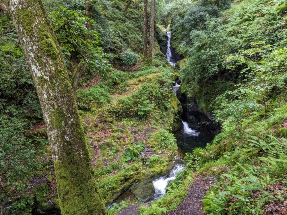
The ground became very wet as we hit the top of White Hill: thankfully a long wooden boardwalk kept our feet out of the bog as we powered on towards a viewpoint high over Lough Tay. You’ll often see this photo used to illustrate the Wicklow Way, but as we arrived, we couldn’t even see the lake below.
Luck, however, was finally on our side as we hunkered down out of the wind to eat our lunch beside a large rock. This boulder marks the memorial to JB Malone, the man largely responsible for bringing the Wicklow Way into existence back in the 1970s and early 80s, and I think he was watching over us that day.
Without warning, the cloud started to lift. Not by much, admittedly, but it was enough to finally be able to see at least some of those views we’d been told so much about.
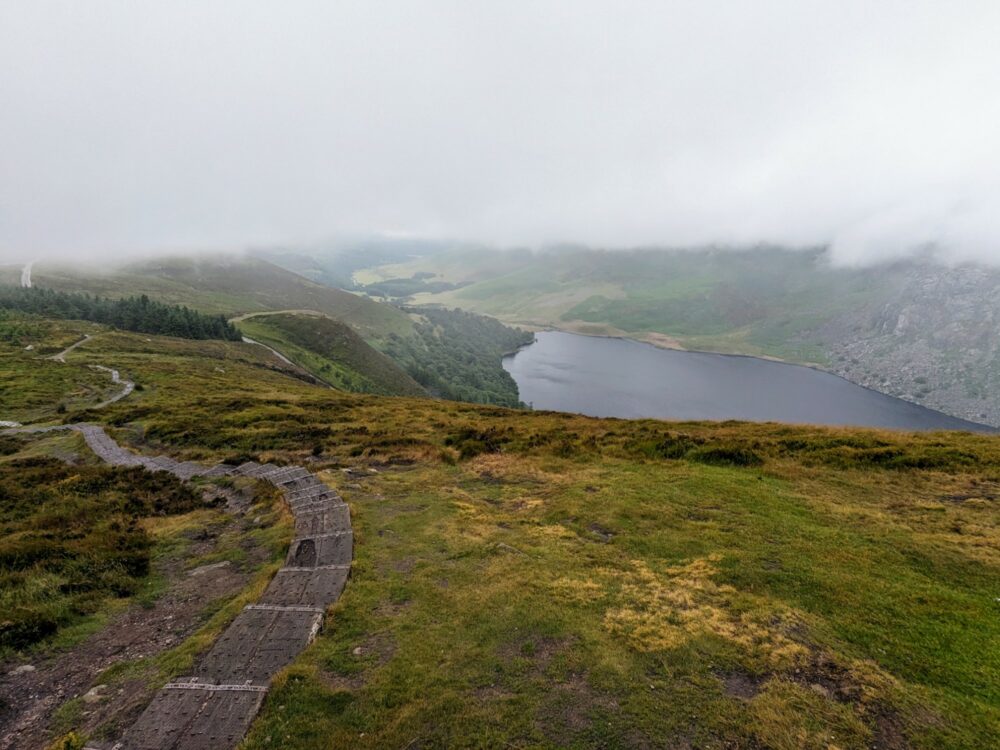
Onward and downward we went, with visibility steadily improving as we dropped back into the valley via an absolutely lovely boardwalked path through Ballinastoe Woods . At the bottom was the option of an alternative route via Lough Dan, but because we were staying in Roundwood that night, it made more sense to stay on the main path.
Or so we thought. Leaving the forest beside the Pier Gates carpark, we were greeted by a private security guard who told us in no uncertain terms that the path was closed due to filming. Who was filming and why we couldn’t pass, he wouldn’t say, but apparently we weren’t going to be going that way today.
Instead, we had the unmitigated delight of 5km of road walking into Roundwood instead. The rain, at least, had passed for now, but it still wasn’t the greatest way to end the day. We flopped down for a pint at the Roundwood Inn an hour later, then headed over to Kavanagh’s Vantry House for an early dinner.
The staff were friendly, the food was average, and the pint was cold. Two out of three ain’t bad, especially by this point in the day. Fed and watered, we hauled our packs off the floor and started the 3km walk back north to our accommodation, a room in an Airbnb outside the village.
As we approached, right on cue, the clouds broke and we were bathed in glorious sunshine, which stuck around for the rest of the day. Typical. Still, it was a lovely peaceful place to spend the night, with a lovely owner (Bernadette) and a friendly dog (Ruby) to keep us company. What more could I ask?
Distance: 21.5km to Roundwood + 3km to accommodation. Double room in private home: €86
Day 3: Roundwood to Glendalough
Bernadette was heading out in the morning and kindly offered us a lift to Roundwood, saving us the 3km walk back down the road. After a huge cooked breakfast at Sugar Kitchen that raised my energy and cholesterol levels in equal measure, we waddled the 2km back to the trailhead at Baltynanima under clear blue skies.
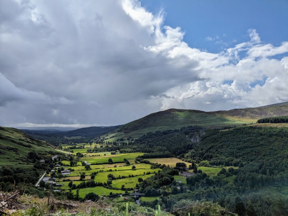
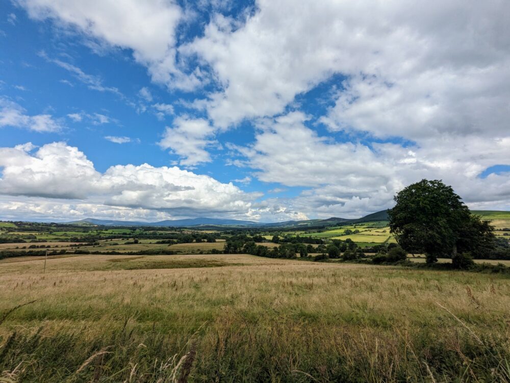
Yes, you read that right. The sun from the previous evening had stuck around, and it would stay out for the entire day. This was easily the best weather we’d had on the walk so far, and what a difference it made to both the views and our mood.
Even an hour or more of road walking couldn’t dampen our spirits; there was little traffic, and scenic views over the surrounding fields and towards the rolling hills that we’d soon be crossing. Sure enough, the path eventually took a hard right up a farm track, over a stile, and up the side of Paddock Hill.
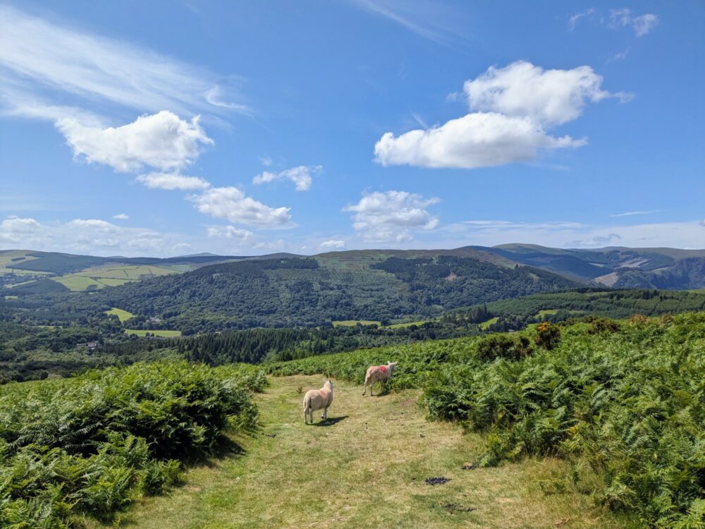
It really was perfect walking conditions, and with a short day in store, we were in no hurry. We dawdled over the heather and bracken-covered slopes, met a few sheep who were also out enjoying the sunshine, and eventually descended down a steep grassy path back into the forest.
This stretch of woodland was quite small, but had a bunch of different paths crossing in every direction. Still, the Wicklow Way markers were frequent and obvious (I suspect people have got lost there before), and it wasn’t hard to stay on track all the way to the bottom where we emerged onto Military Road.
There’s the option of detouring into the village of Laragh for supplies here, but with only a few kilometres of walking left, we didn’t have much need. Instead we stayed on the main trail and climbed another small hill, which teased us with glimpses of our destination before the path dropped back into the pine forest again.
It took about another 45 minutes of gentle and then steep downhill to actually reach Glendalough, which on a sunny Saturday was a busy and noisy contrast to the quiet woodland we’d just left. It’s popular with both local and international visitors, thanks to the ruins of the monastic city that date back as far as the 7th century, as well as the two nearby lakes that give the village its name.
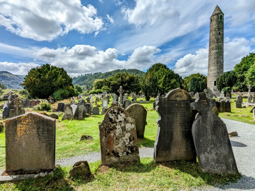
After dropping our packs at the hostel, which fell squarely into the basic-but-fine category, we headed back out to explore the monastic city. There’s no charge to enter, so we joined the throngs wandering around the ruins for half an hour until the call of the sun-filled park alongside become too much to resist.
We grabbed takeaway fish and chips from a nearby food van that tasted far better than they had any right to, then lay in the park and just enjoyed not being on our feet for a while. It didn’t last, though: with more rain forecast for the next day, we figured we should head out to the lakes that evening to see them at their best.
Very much worth the effort, the walk there and back took care of another hour or so, and by that time we were definitely done. With a much longer distance in store the next day, it was time to stop walking, head back to the hostel, and make some serious progress on my book for the rest of the night.
Distance: 13.3km from Roundwood. Double room at Glendalough International Hostel: €100
Day 4: Glendalough to Ballyteige
Given how nice the previous day had been, we were hopeful that the weather today wouldn’t be as bad as forecast. The torrential downpour as we opened the door to the hostel, however, suggested our optimism might have been a little misplaced.
Setting off into heavy rain is rarely the best way to start a 30km+ day, but fortunately it had passed by the time we left town a few minutes later, even if the thick grey clouds overhead didn’t suggest it would stay away for long.
The path we’d followed to the lakes the previous day was part of the Miners’ Way, an alternate route that adds an extra couple of kilometres around and beyond the Upper Lake and past an old mining village.
The expansive views would usually make it the better choice, but given the weather and how far we already had to walk today, we opted for the shorter, more sheltered main route.
Instead, we turned off onto a path up the side of a hill, past a small but pretty waterfall and onward through the trees. After a while we ended up on a forestry road and the views opened up over the nearby hills.
There was still plenty of cloud around, but a strong wind meant that the occasional shower didn’t last long, and we even got glimpses of blue sky here and there as we climbed up. Leaving the gravel road and the trees behind, we crossed onto a boardwalk over a few hundred metres of open, boggy ground.
Perhaps, we thought, we’d dodged a bullet with the weather forecast after all.
And then the heavens opened.
It was genuinely like standing under a waterfall, and with bog all around and no shelter to be found, all we could do was laugh as a river fell from the sky. Torrents of water ran down my legs and into my boots, as everything above my waist stayed dry, and everything below it very much did not.
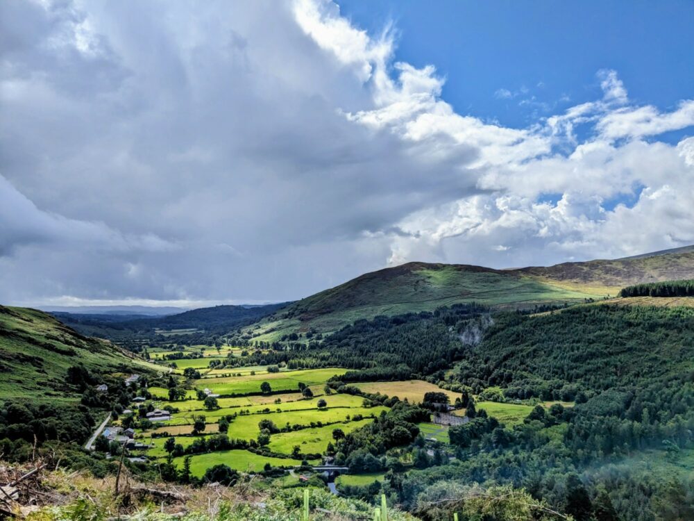
As quickly as it had arrived, the rain disappeared. By the time we got down a set of stone steps ten minutes later, as if to spite us, the skies were blue and the sun had returned. Stopping only to wring several litres of water out of our socks, we continued along a forest track until we got to a viewpoint towards a waterfall and over the lovely Glenmalure valley.
Even more lovely was the sight of the Glenmalure Hotel, which is where we’d already planned to stop for lunch, and was now also where we planned to dry out our sodden clothes. There was plenty of time to do it since we’d arrived a bit early for lunch service, but with steam rising from both my coffee and my boots, we were in absolutely no hurry to leave.
Fuelled by burgers, caffeine, and a change of socks, we eventually dragged ourselves out of the pub and back onto the trail nearly two hours later. We were only about halfway to our accommodation, and sadly those remaining kilometres weren’t going to walk themselves.
Thankfully the sun was still out, and it stayed that way for the rest of the day. Passing the halfway marker for the Wicklow Way soon after we started back out, the 6km climb out of the valley was gradual but persistent, up a gravel track that wound backward and forward across the slopes of Slieve Maan.
With the better weather came (finally) some of those views we’d been promised, however, and combined with some lovely stretches of boardwalked forest path, the distance seemed to pass much more quickly than it had a few hours earlier.
What goes up must come down, and in this case that took the form of a pretty long and steep descent past Mucklagh Hut all the way down to Iron Bridge. Clue’s in the name, it’s a bridge made of iron that crosses the small Ow River. After 30km on our feet today, it seemed aptly named.
The end, however, was almost in sight. We branched off from the route to follow the road for a few hundred metres down to Ballyteige Lodge, a grand old hunting lodge that was our home for the night. It’s the only accommodation in the area, which is why we’d had a longer day than we might have chosen, but it turned out to be a delight.
The cheerful owner, Sean, bought the place decades ago, and had a near-endless collection of stories to share. His skills didn’t stop at storytelling, however: with no restaurants nearby, he cooked up a fantastic three-course meal (complete with wine) that we got to enjoy with a view over the gardens and Mozart playing in the background. Not quite our usual hiking dinner ambience!
As my boots dried out in the warming cupboard, we headed up to bed with a smile on our faces. It had been a long, often wet day of walking, but equally it was full of great views, stunning nature, and excellent food. It was going to take more than a downpour or two (or ten) to put us off!
Distance: 32.5km. Double room at Ballyteige Lodge: €122(+ dinner)
Day 5: Ballyteige to Tinahely
With heavy rain outside, a shortish distance to walk, and a large cooked breakfast on offer, we didn’t exactly race out of the house this morning. The worst of the weather seemed to have passed by around 10 a.m., so we took our chances, bade farewell to Sean and his donkeys, and headed out onto the trail.
Just for something different, there was another long and gradual climb to get things started; it’s really no exaggeration to say that there’d been barely a flat section on the entire walk so far! We stuck mainly to forest tracks and gravel roads for the first half of the day, which stayed dry for the first hour and less so after that.
This was another day where the guidebook suggested great views and we unfortunately didn’t get to see a lot of them. The rain grew steadily more persistent as the afternoon wore on, the heaviest showers managing to perfectly align with a long section of shelter-less road walking from the small settlement of Sheilstown.
Amusing ourselves mostly by splashing through the ever-expanding puddles, we trudged on through the downpour, hoping that the rain would relent by the time we got back into the hills. Surprisingly, it mostly did!
While the clouds stayed low and threatening all day, the worst of the weather was over as we climbed a forest track up onto an open hillside covered in gorse and bracken. The overgrown track was a bit hard to follow here, but AllTrails came to the rescue whenever we started to veer off course.
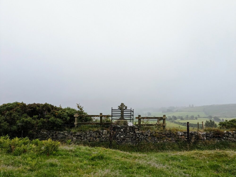
Passing a stone cross that memorialises a doctor who died when his gun when off while crossing the fence alongside, we soon came to a sign pointing left towards Tinahely, our stop for the night. It’s a steep but easy 3km descent, first on grassy track and then local roads that lead directly to the square in the middle of the village.
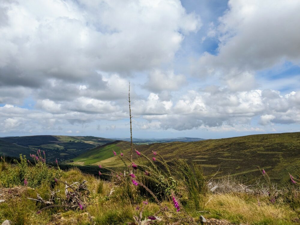
Parts of the trail had been quite scenic despite the inclement weather, but we were already starting to notice the difference between the northern and southern sections of the Wicklow Way. The switch from mountains to rolling hills made for smaller climbs and easier descents, but the views were less expansive and more of the walking was on tarmac.
Our accommodation was on one side of the square, and we spent the afternoon drying our boots and clothes before heading out for dinner. With two pubs within 100 metres, we didn’t have to go far.
O’Conner’s got the nod, and it turned out to be a good choice: it was a cozy, local sort of place that had good food, cold pints, and friendly staff. We were getting ready to leave when the rain came back, loud enough on the roof to drown out the jukebox! Oh well, time for another pint, I guess.
Distance: 20.7km. Double room at Madelines Accommodation: €105
Day 6: Tinahely to Shillelagh
After all the rain the night before, I wasn’t sure what to expect when I threw back the curtains the following morning, but bright sunshine definitely wasn’t it. We went for a large and tasty breakfast at D’lish cafe as soon as it opened, then headed quickly out of town to make the most of the good weather while it lasted.
Because Tinahely isn’t directly on the Wicklow Way, we had a couple of choices about how to return to the trail. We could have just retraced our steps from the day before, but that seemed a bit predictable, so instead we followed an alternate route called the Tinahely Loop that meandered its way around the other side of Muskeagh Hill instead.
The first kilometre or so was along the road, before an arrow pointed straight up the side of the hill to the right. I was surprised how steep the next 3km were, first on a grassy trail and then on increasingly-rough gravel and stone as we got closer to the top of the hill.
The views, though, became increasingly impressive, and finally having the clear skies to appreciate them was all the excuse I needed to stop regularly to catch my breath.
Finally reaching the top of Muskeagh Hill, we met a couple of local women who were out for a walk. We got to chatting, and soon realised that one of them was married to someone who grew up in the same little town in New Zealand that I grew up in. Not quite what I was expecting on a hillside in rural Ireland, but it’s a small old world sometimes.
More predictably, however, a large black cloud loomed ominously on the horizon. We bid farewell to our new friends and headed quickly down into the forest, hoping that any rain that was going to fall would do so while we had some shelter.
Of course, that’s not what happened. It waited until we rejoined the main trail on the road at the base of the hill, getting heavy enough after a while that we stopped under an enormous oak tree to contemplate our life choices.
The two women from earlier drove past at this point, kindly offering us a ride to the next village. It was a generous suggestion, but because we’re masochists completionists, we decided to wait things out a bit longer.
For once, that was the right decision. The clouds passed, the sunshine returned, and we had blue skies for the rest of the day. Finally!
The vastly-improved weather helped take my mind off the fact that almost all of the remaining 10km or so of the day’s walk would be on paved roads. They were mostly minor country roads, at least, so we didn’t have to dodge much in the way of traffic.
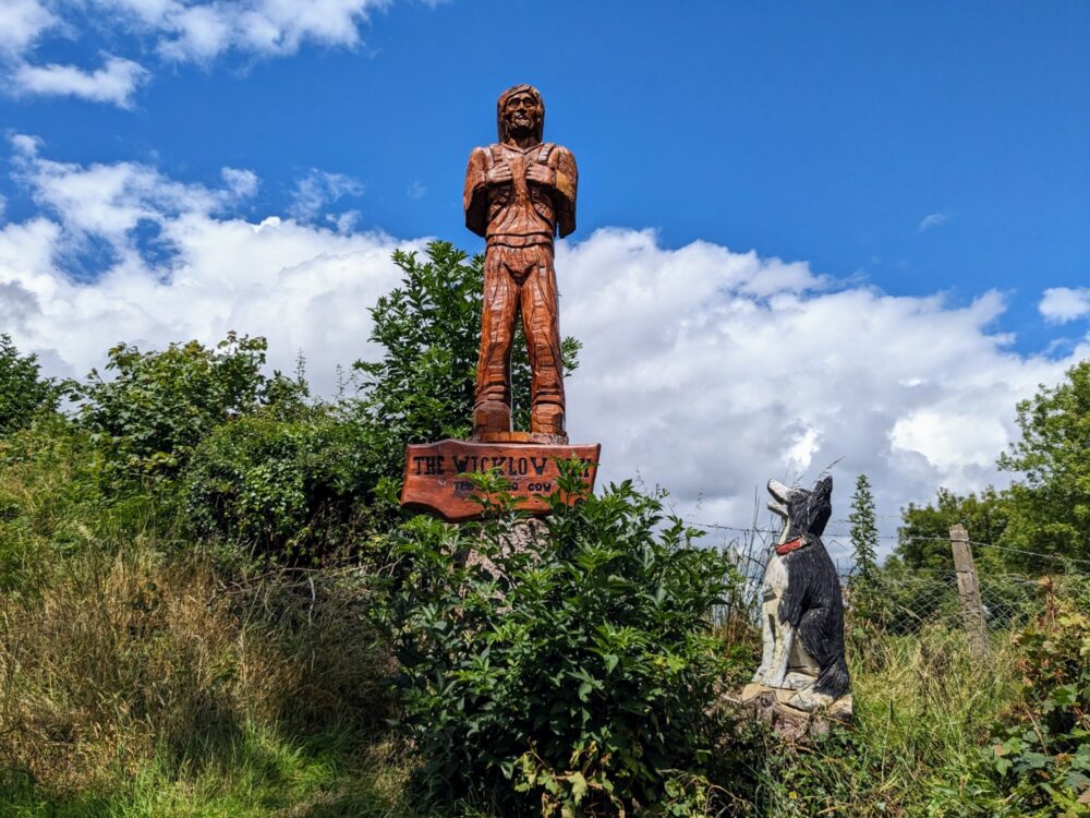
Continuing on past the hamlet of Mullinacuff, we strolled along in the sunshine as far as the Stranakelly Crossroads and the famous Dying Cow, one of the few pubs directly on the route. You’d do well to not spot the pub as you’re walking up to it, but just in case, there’s a large wooden Wicklow Way sculpture directly opposite.
The name apparently comes from a time when the police raided the pub and accused the owner of serving drinks after hours. She defended herself by saying she was merely giving refreshments to neighbours who had come around to help her with a dying cow! The truth of the story is debateable at best, but it’s a great name for a pub either way.
The pub is absolutely tiny inside, but with weather like this, we were much happier at the outside tables instead. After a drawn-out pint in the sunshine (the pub doesn’t do food, more’s the pity), we eventually stopped procrastinating and started off up the steep road over Cronelea Hill.
The views over the surrounding countryside were pretty the whole way, and chased by horseflies for much of the distance, we made quick work of the final 6km to a junction with a busy road at Boley Bridge.
We were staying the night at the Central House pub in Shillelagh 3km down the road, and Sean, our host for the night, had told us to call for a pickup rather than risk the fast-moving traffic. We weren’t about to refuse an offer like that, and he turned up a few minutes later, depositing us outside the pub shortly after.
The pub itself was closed that day, sadly, but the rooms were nice, and there was a cozy common room where I got to engage in one of my favourite pastimes: waffling for ages to fellow walkers!
With the pub closed, there weren’t many dinner options in Shillelagh that night, so we just picked up supplies from the small supermarket and ate them in the park instead, alongside a large sculpture of the traditional fighting stick that gives the town its name. It wasn’t the most glamorous of meals, but it was nice to be able to sit outside and enjoy it for a change.
I really enjoyed today: the combination of a shorter distance, scenic views, sunny weather, and new people to bore with my hiking stories is always a winner as far as I’m concerned!
Distance: 19km. Double room at Central House: €102
Day 7: Shillelagh to Clonegal
Our final day on the Wicklow Way dawned warm and sunny, and stayed that way throughout. After making breakfast of the toast-and-cereal variety at the hotel, and sandwiches of the bread-and-tuna variety for lunch, Sean dropped us back at the Boley Bridge track junction and bade us farewell.
He’d been a great host, and nothing had seemed too much trouble. If your route plans see you spending the night in Shillelagh, I’d highly recommend staying with him.
My memory had told me that there were no more climbs in store on this walk, but my legs were soon telling me something different. There’s nothing like a 5km uphill to get the morning started, right?
Honestly though, we loved it. The path seemed to veer all over the place on its way up Stookeen hill, giving us great views in every direction on the way up and especially along the ridgeline near the summit.
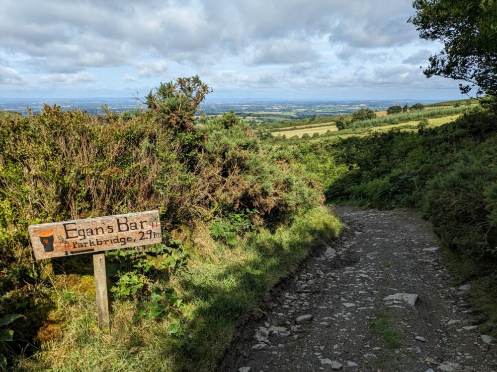
A small sign pointed left soon after, sending us down a steep grassy trail and road that saw us losing almost all of the height we’d just spent the last hour working so hard to gain. There’s a shortcut option at the bottom that saves a bit over 4km, running close to Egan’s Bar in the little settlement of Parkbridge.
The pub was tempting, as was the shorter distance, but we stuck to the main route and were glad we did. Taking the shortcut would have meant we missed out on one of the day’s nicer bits of trail, and weren’t in that much of a hurry anyway.
Instead, we followed small country lanes for a few kilometres, passing farmhouses and hamlets before stopping in the grass on the side of the road for those tuna sandwiches I’d been looking forward to all morning.
There wasn’t long to go now, but never fear, there was still time for one more climb. It was a worthwhile one, though, on a forest track up, along, and over Urelands Hill. The walk through the forested slopes on the way to the top was a nice change from the country lanes we’d spent the last hour on, and the views from the top were expansive and, as it turned out, the last ones we’d have on the Wicklow Way.
The path soon dropped back down to the road, which we simply followed all the way into Clonegal. It took an hour to get there, though, crossing from Country Wicklow into Country Carlow just before we hit the outskirts of town.
The end, as is so often the case on long-distance walks, was sudden and anti-climactic. One minute we were walking along a lane into Clonegal, the next we were standing beside a signboard in a small park beside the main road, taking photos of each other and watching cars drive idly by.
And that, as they say, was that. After a few minutes of sitting on a bench, we shouldered packs once more and started heading along the footpath towards the turnoff for Bunclody, thumbs stuck out in the hope that a random driver would take pity on us and save us the 5km walk.
As I mentioned up top, it only took a couple of minutes for Joe to pull over and offer us a lift all the way to Enniscorthy. He really was a saviour.
Getting to Enniscorthy much earlier than expected gave us more choice about our onward connection; in the end we bought a ticket for a train leaving in 90 minutes, which gave us enough time to grab a sandwich and coffee from a cafe back in the main part of town before heading back to the station.
The train line (and the buses) run regularly back to Dublin, but we were headed for Rosslare, ready to catch a ferry to Wales the next morning and start our next adventure!
Get regular travel, hiking, and tech updates from me
News, reviews, guides, and more, from here and around the web
Final Thoughts
So overall, how would I rate the Wicklow Way?
Well, it’s a bit tricky. We were unlucky with the weather, meaning that many of the beautiful mountain views that we’d seen in the guidebooks were completely hidden by clouds and fog, and we got a lot wetter than we’d anticipated for a walk in the middle of July.
Whenever the clouds did clear, though, it really was obvious just how lovely this part of Ireland can be. The sun-soaked section of trail on day three between Roundwood and Glendalough was a real highlight, and even the final couple of days as we headed towards Clonegal held plenty of great views.
People grumble about the amount of road walking in the later sections of the route, along with the amount of time spent in monotonous conifer plantations, but those complaints felt overblown to me. Sure, both things exist, but I’ve had much more in the way of tarmac and pine trees on long walks elsewhere in the world.
While it’s super-easy to get to and from the Dublin end of the trail, the Wicklow Way would definitely benefit from better public transport at the southern end. Even a bus that ran every hour or two between Clonegal and Enniscorthy would make a big difference, connecting walkers to Dublin, Rosslare, and elsewhere throughout the day.
With the exception of our meal at Ballyteige Lodge, food tended towards the tasty and filling rather than the gourmet. Given that that’s exactly what I want when I’m doing long walks, however, you’ll get no complaints from me on that front. As is so often the case in Ireland, the pubs were cozy and cheerful everywhere we went.
It’s a shame there’s so little accommodation directly on the route, and that most of what’s within a reasonable distance of it isn’t especially cheap. Still, it’s no worse in terms of cost than similar walks I’ve done in the UK (the Cotswold Way, South Downs Way, and Norfolk Coast Path were even more expensive), and if the prices really are prohibitive for you, there’s more wild camping available on the Wicklow Way than most other long-distance walks I’ve done.
Long story short while it’d benefit from a few logistical improvements, I’d say it’s still a good introduction to long-distance hill walking if you haven’t done a lot of it before, especially if you get better weather than we did!
It’s long enough and mountainous enough to present a decent challenge in the early sections without being particularly dangerous, and it doesn’t require you to tackle huge distances each day if you walk it in a week like we did.
As I often say at the end of guides like this, the big question for me at the end of any long walk is: having walked it once, would I do it again? The answer is more nuanced with the Wicklow Way than some of the others I’ve done, but I think that all things considered, I still would.
I’d just be praying for much better weather next time!
Did you find this guide to the Wicklow Way useful? Did I leave anything out that you’d like to know more about? Let me know in the comments!


That was a fantastic and well written article. Thank you so much for sharing it with the wider world. Myself and my girlfriend are hoping to do the Wicklow Way at the end of July. Hopefully the weather gods will smile on us!
Goodness me, an absolute cracker of a guide. Thanks for documenting it all.
Thanks Phil!
Thanks for the well written guide, Dave. By chance, do you have the elevation gain/loss per day? There’s so much conflicting information out there I’d love to get the “real” numbers from someone who has actually walked the walk. Thanks!!!
Hi Cindy,
Unfortunately I don’t – at the time I only had a Fitbit for tracking the walk, which didn’t measure elevation. The guidebook I mention has elevation charts for each section, but they don’t include the total ascent/descent per day. Sorry!