6 of the Best Day Walks in the South Downs
Articles on this site contain affiliate links, meaning I may be compensated if you buy a product or service after clicking them. The full privacy & disclosure policy is here.The newest of Britain’s national parks, the sprawling South Downs National Park covers over 600 square miles of England’s southeast. There’s a lot to see and do and especially if you’re a hiker, a lot of ground to cover.
While the 100 chalk-filled miles of the South Downs Way gets most of the attention when it comes to walking trails, there are also literally hundreds of day hikes spread out across the length and breadth of the park.
Whether you’re looking for an easy stroll for an hour, a half-day riverside ramble, a day-long clifftop hike, or pretty much anything else that takes your fancy, you’ll likely find it somewhere in the South Downs.
My hiking boots and I have spent a good chunk of time exploring both the South Downs Way and several shorter trails, so I figured it might be useful to put together a list of several of my favorite day walks. Ranging beween three and 11 miles, they’re all accessible by public transport (at least to some extent) and all but one finish where they started.
None of them require high degrees of fitness or any particular gear beyond a good pair of walking shoes and protection from the elements. Many have great views along the way, and it’s never too far to a pub if you’re in need of refreshment.
For each walk I’ve included a summary that includes the distance, parking and public transport options, and whether it’s a loop or one-way. At the end there’s a link to a website or PDF brochure with detailed directions along with any alternative route suggestions, and I use AllTrails for on-the-ground navigation. Enjoy!
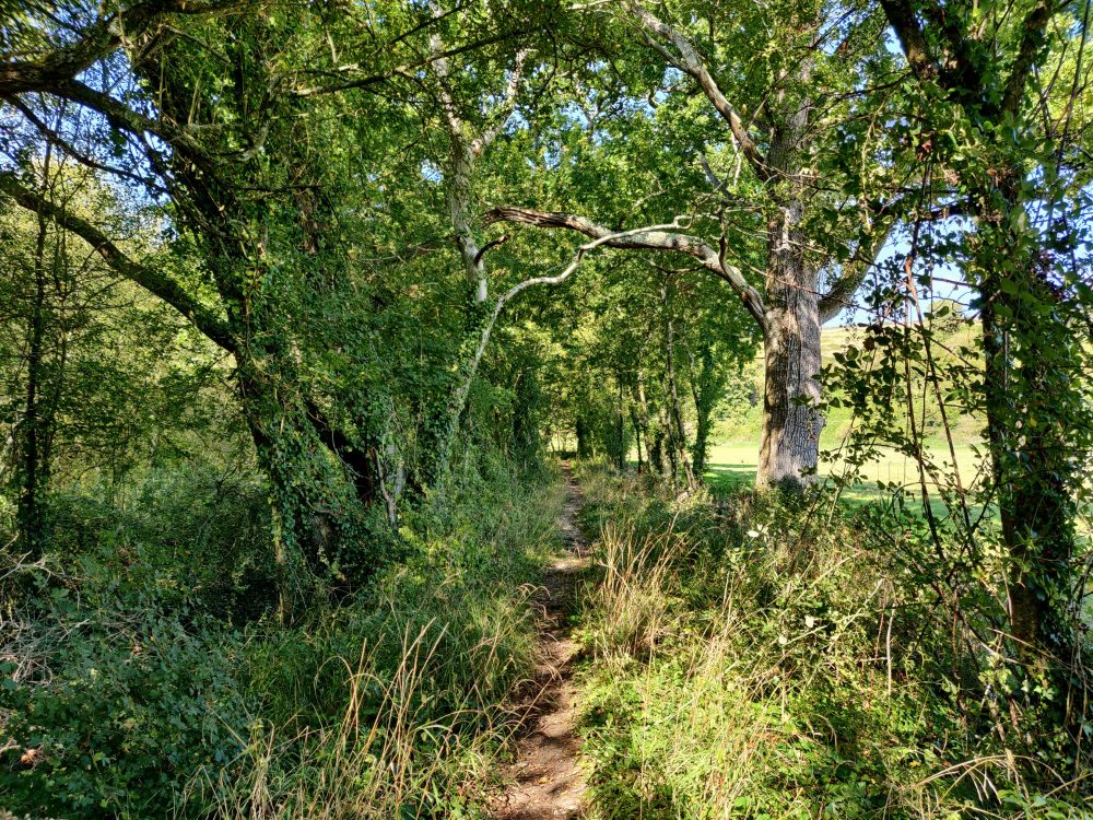
Black Down Circular
Where: Black Down, near Haslemere and Fernhurst
Length: 3 miles (5km), with shorter and longer options
Type: Loop
Parking: Yes, free in National Trust carparks (GU27 3BJ)
Public Transport: Yes, if you’re happy to walk the extra ~2 miles each way to/from Haslemere station
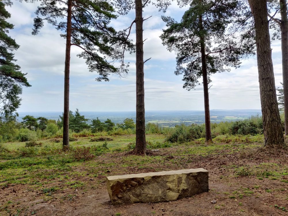
Looking for a short walk with great views? The highest point in the South Downs National Park, Black Down is the place for sweeping vistas over the Sussex Weald and South Downs. While the undoubted highlight is the Temple of the Winds viewpoint, there are plenty of other spots that’ll also have you reaching for your camera.
This circular trail starts and ends in the (free) National Trust carparks on Tenneyson’s Lane, a few minute’s drive from Haslemere. You can also walk there on roads and footpaths from the train station, which adds about 30-40 minutes each way. I was staying a couple of miles away, so used public footpaths and bridleways to get to the start point.
The first mile or so of the trail is largely flat, on well-formed paths that are suitable for almost anyone including those with pushchairs. The track gets somewhat rougher and muddier after that, with a steepish descent to Crotchet Farm and subsequent climb back towards the carpark.
If you’d rather not deal with that, a clearly-marked alternative path loops back to the starting point, running parallel to the track you started on. It’s again mostly flat and well-formed, so is a good choice after heavy rain as well. This will cut the distance down to around two miles.
The trail is a good mix of woodland and heath, with strategically-placed seats and benches that give great views to go with your sandwiches. On the day I walked it in early autumn, there hadn’t been any rain for a while and all of the trails were firm and mud-free. It was easy enough to go exploring off-trail as well, with a variety of tracks criss-crossing the marked path.
The Writer’s Way
Where: Chawton, Alton, and surrounds
Length: 11-13 miles (18-21km)
Type: Loop (11 miles) or one-way (13 miles)
Parking: Yes, free in Chawton village carparks (follow the P signs)
Public Transport: Yes, train to Alton then bus #64 to Chawton
The longest of the walks on this list, the Writer’s Way draws on the rich literary history of this part of the country to connect several towns and villages near one of the park’s northern boundaries.
The trail starts in Chawton, an attractive village where Jane Austen lived for the last eight years of her life and wrote all of her novels. If you’ve got the time, it’s worth spending an hour or two visiting her house (now a museum) before or after your walk. There’s a pub over the road if you’re in need of refreshments.
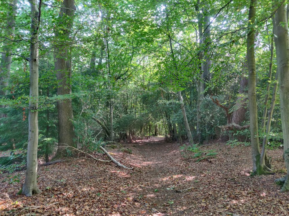
After a short stretch of woodland the trail emerges in Alton, skirting the main downtown area. This is the least exciting part of the route, mostly on paved footpaths until you climb up and over a decent hill and head back out of town.
Once you’ve cleared the suburbs and walked under an overpass, the track leaves the paved stuff and heads down Watery Lane, a long, sunken, tree-lined stretch of rocky streambed that’s straightforward in dry conditions. During or after heavy rain, you’re better off walking beside the golf course that runs alongside (and above) the lane if you don’t like wet feet!
The rest of the path to Selborne is an attractive mix of woodland trail and country lanes, and the various pubs and cafes in the village make a logical place to break for lunch. You can also visit the house of Rev. Gilbert White, whose observations on the flora and fauna of the area in the 1700s led to him being described as one of the fathers of modern ecology.
Onwards and upwards, the path run over the flanks of Selborne Hill and through fields with some great views over the surrounding countryside, before eventually breaking right towards Farringdon.
If you’re doing the loop track, you’ve got a couple of options: a footpath that starts just after you leave Upper Farringdon, or St Swithun’s Way that you pick up shortly after crossing the A32 and passing Lower Farringdon. I took the latter, but both tracks lead pretty directly back to Chawton.
The latter parts of the Writer’s Way in particular make for an attractive and enjoyable walk, but that first hour or so through the outskirts of Alton isn’t much to get excited about. As an alternative, you could do an out-and-back walk from Chawton to Selbourne via St Swithun’s Way. It’d be about eight miles in total, walking through woodland and countryside with minimal road or pavement outside the villages.
East Meon Circular
Where: East Meon and surrounds
Length: 5 miles (8.5km)
Type: Loop
Parking: Yes, free in East Meon village carpark (GU32 1PF)
Public Transport: #67 bus has limited service to/from Winchester, with no service on Sundays or public holidays
I first visited the lovely village of East Meon while walking the South Downs Way, and this shortish day walk takes in some of the best bits of the surrounding area. There’s one steep climb and an even steeper descent soon after, but it’s otherwise mostly flat.
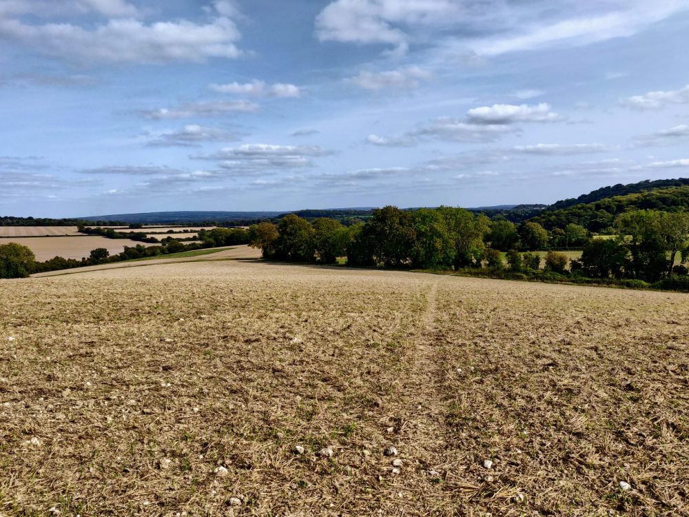
Starting at the carpark, you head through the village and yard of the wonderful 12th-century church before starting to climb. After the initial ascent through the trees behind the church, the path then runs through farmland for around half a mile. The surrounding countryside is scenic enough, but the good parts really start once you leave the fields and head up the unmarked Halnaker Lane onto a woodland trail.
This easy dirt path becomes the South Downs Way, and stays relatively flat for a mile and a half. After crossing a road, however, it’s time to give the lungs a workout: the track becomes rocky and narrower, and climbs steeply for half a mile until it flattens off and opens out to a long ridgeline.
After you’ve caught your breath, keep an eye out for a wooden gate on the left and a faint path heading off across the fields: it’d be easy to miss, since the main South Downs Way trail continues straight ahead.
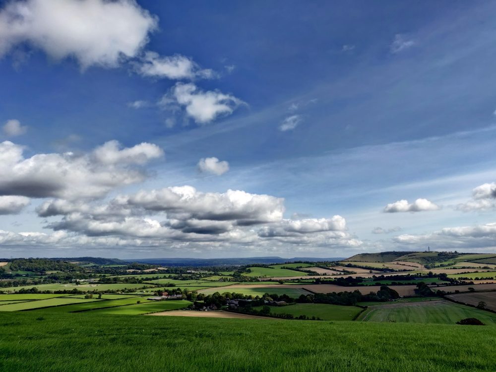
With sweeping views out over the South Downs National Park and back toward East Meon, the lush hillside here is the perfect spot to stop for a drink and a packed lunch. After you’re done, follow the clear trail across the top of the field, through the gate, and down the steep path to the bottom.
From there, it’s only 10-15 minutes through fields and a small patch of woodland back to East Meon, where there are a few good pub and cafe options if you need them.
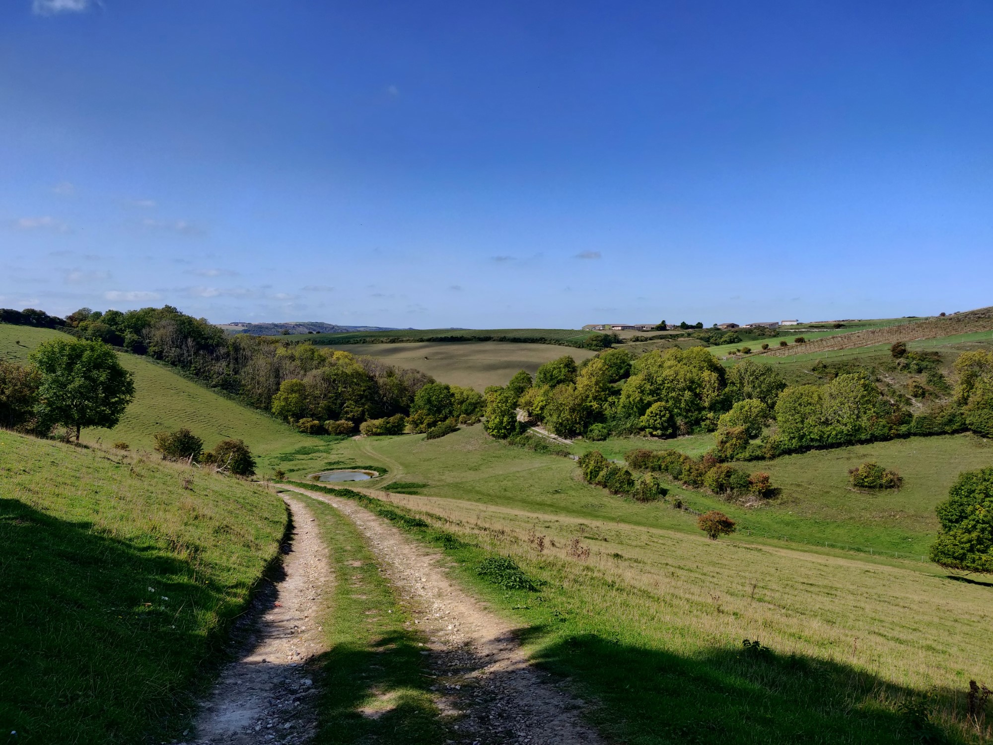
Amberley and River Arun Circular
Where: Amberley and surrounds
Length: 8.5 miles (13.5km)
Type: Loop
Parking: Yes, free at Amberley station (BN19 9LR)
Public Transport: Yes, train to Amberley
Not a big fan of hills? This loop track should be right up your alley, since other than a couple of short (albeit steep) climbs, it’s largely flat the rest of the way. You’re richly rewarded with great views of the surrounding countryside when you do have to climb, not to mention the impressive remains of Amberley Castle.
Those aren’t the only highlights, though: there’s some lovely riverside walking, a bit of quality time through the woods, and even a decent section of overgrown, rarely-used trail that makes you feel you’re a lot further from civilisation than you really are. All this in what, for most people, is about a three-hour walk.
Starting from Amberley train station (situated a little confusingly in nearby Houghton Bridge), head through the village past the riverside cafes and pubs. These are the perfect spots for a post-walk pint, but for now, cross the bridge (take care, since there’s no footpath and plenty of traffic) and drop down to the riverside path at the far end.
The track then wanders along beside the river Arun for about a mile, crossing it once at a bridge near the start, before striking out across the fields towards the attractive little village of Amberley. There are several pubs and cafes if you’re in need of refreshment: this is the only place for food and drink before you get back to Houghton at the end.
Get regular travel, hiking, and tech updates from me
News, reviews, guides, and more, from here and around the web
The first of the two ascents starts at the end of the village, where you briefly join the South Downs Way as you climb steeply up a stony path to the top of the rise. There are great views here while you wander along farm tracks for half a mile before dropping just as steeply down to a lovely spot beside a waterhole that’s ideal for a lunch break.
The second climb is shorter than the first, and takes you up to a path along a ridgeline with even better views than before. Dipping in and out of the woods, the path becomes a wider chalk track for around half a mile before it turns into the trees and heads down a steep, narrow, stepped path. Watch your footing here if it’s wet.
Soon after you’ll hit a narrow trail that, at least in September when I walked it, was pretty overgrown. It wasn’t hard to make out the path, but for 10-15 minutes there was a lot of stepping over logs and debris and carefully avoiding stinging nettles. Long pants are useful here!
The track eventually widens out again, at which point there isn’t far to go: a few more fields, a bit more time amongst the trees, and a final last jaunt back along the river to take you back to your starting point and those riverside pubs that now look even more appealing!
Liphook and Milland Circular
Where: Liphook, Milland, and surrounds
Length: 7.25 miles (11.5km)
Type: Loop
Parking: Yes, pay and display at Liphook station (GU30 7DN)
Public Transport: Yes, train to Liphook
Looking for a stereotypically pleasant walk in the English countryside? You could do a lot worse than this loop track that offers plenty of woodland, quiet country lanes, and handily-located pubs with large beer gardens. Always an important consideration.
The route starts at Liphook station and quickly heads out of the village past the Links Tavern. This is a good place for a pint at the end of the walk, but for now is where the trail thankfully turns off the busy road and onto a bridleway through the woods.
The tree-lined path runs alongside the golf course for a while, crossing a rail bridge and a road before eventually leaving the fairways behind. The next section of trail was quite overgrown when I walked it, although it’s possible I wasn’t on the right path: the instructions in the brochure were a bit hard to follow on the ground. Not that it really matters, since you’ll end up in the right place regardless: the next landmark, Milland House, is easy to find.
From there the path runs through fields and forests for around half a mile, largely avoiding the road until close to Milland, roughly the halfway point of the walk. The small park at the start of town has a few benches that make for a good spot for lunch, but the Rising Sun pub at the next crossroads is an even better one.
Follow Fernhurst Road back out of the village, passing a pond on the left and then turning down Wardley Lane. This quiet sealed laneway runs for nearly a mile with fields and farmhouses on both sides, before ending at a dirt trail that climbs steeply (albeit briefly) through the woods over a hill and down the other side past Hatch House.
The path then joins up with the Serpent Trail, a 65-mile path that takes in some of the best areas of heathland in the country. You’ll only stay on it for around half a mile, however, before turning off onto a byway that quickly leads to the main road and back to Liphook.
Alfriston to Eastbourne
Where: Alfriston, Seven Sisters, Beachy Head, Eastbourne
Length: 10.5 miles (17km)
Type: One-way, with loop alternatives
Parking: Yes, pay and display parking in Alfriston
Public transport: Yes, train to Glynde then #125 bus to Alfriston (3x per day, Mon-Sat). Regular trains from Eastbourne at the end, or the #125 bus back to Alfriston.
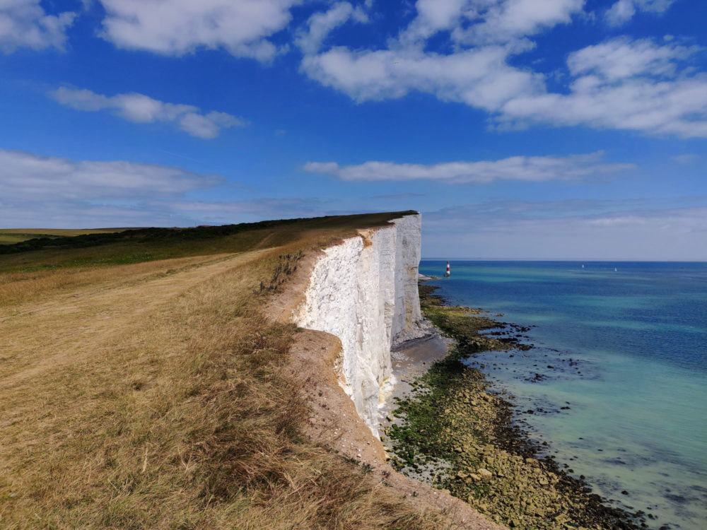
One of the most beautiful parts of the South Downs, I walked this stunning route on my final day of the South Downs Way. The waves twinkled and the white cliffs positively glowed in the sunshine, doing a great job of distracting me from the blisters I’d picked up over the previous 90 miles!
Assuming your feet are in better shape than mine were, the only real difficulty will be the relentless up and down over the cliffs of the Seven Sisters to Beachy Head. Fortunately there’s a National Trust cafe part way along at Birling Gap, which can fortify you with tea, scones, or whatever other stereotypically English delights take your fancy.
Before any of that, though, you’ve got five miles or so of fairly easy walking towards the ocean from Alfriston. Starting off in fields beside the river, you follow the signs for the South Downs Way coastal path, passing through the villages of Litlington and Westdean/Exceat along the way. Cafes and pubs are available in both if you need them.
The Seven Sisters visitor centre in Exceat is worth a look, and also sells snacks and drinks. From there, you’re in the Seven Sisters Country Park itself, and the views open up along the rolling cliffs and out over the ocean. Especially on a sunny day, it’s truly spectacular.
The Birling Gap cafe is a popular spot, since there’s a large carpark and bus tours also tend to stop there. There’s plenty of seating both inside and out, though, so you should be able to find somewhere to sit and dunk your biscuits into your teacup if you’re so inclined.
It feels like you’re close to the end by this point, but never fear, there are still several solid climbs and descents remaining! After about 20 minutes you’ll pass the Beachy Head lighthouse at the base of the cliffs, and that’s when you know you’re nearly there.
There’s a pub at the top of Beachy Head itself, but you’re better off waiting just a little longer for that cleansing ale. Finish the walk by walking down the final hill, passing the marker for the end of the South Downs Way, and enjoying a pint and a meal at the Pilot Inn instead.
You’re now in the suburbs of Eastbourne, with buses and taxis to take you to the centre and train station. If you’re heading back to Alfriston to collect your car, either walk (25 minutes) or take the 3 or 4 bus from near the Pilot Inn to Gildredge Road, then the 125 bus back to Alfriston.
Alternatives: If you wanted to turn this one-way walk into a longer loop trail, you can return via the 7.5-mile inland route from Alfriston and Eastbourne via Jervington. Most people would do it over two days, but if you’re sufficiently fit and motivated, you could walk the full 18 miles in a day.
Since public transport options are (much) better in Eastbourne, I’d suggest starting and ending there if you’re walking the loop. This also means that those splitting the trail over two days will spend the night in Alfriston, which is a lovely village in its own right. I stayed at Ye Old Smugglers Inne, and can recommend it.
This page has basic information about both sections of the route at the bottom. Since they’re both an official part of the South Downs Way and waymarked as such in both directions, it’s hard to get too lost.
If you’re looking for something shorter that still includes great views and plenty of cliffside walking, this brochure lays out a 7.1-mile loop from Eastbourne that goes via Beachy Head and Birling Gap.
Got any other favourite day walks in the South Downs? I’d love to hear about them for next time I’m there!


This post has definitely inspired me to explore more of the South Downs – the variety of walks you’ve highlighted is fantastic, as is the variety of pubs and cafes along the way!