My Complete Guide to Spending a Day on Rottnest Island
Articles on this site contain affiliate links, meaning I may be compensated if you buy a product or service after clicking them. The full privacy & disclosure policy is here.Rottnest Island is far from a secret; this little island off the coast of Perth has been a popular holiday destination for locals for decades. Visitors from around Australia and the rest of the world have woken up to Rotto’s charms in recent years as well, and that’s hardly a surprise.
With its stunning beaches, bays, and walking tracks, fascinating history, and of course the resident quokka population, all wrapped up in a compact little island that’s easy to get around, it’s tailor-made for day trippers. That’s how I’ve visited whenever I’ve gone, basing myself in Perth and heading there and back on the ferry for an action-packed day.
And action-packed days they’ve definitely been: there’s a lot to see and do there, and as I learned, not enough time to see everything and go everywhere before the last ferry heads back to the mainland.
That’s why it’s worth putting a bit of effort into figuring out what you want to do in advance, and how you’re going to do it, so you hit the ground running as soon as you arrive and make the most of your time.
I didn’t do that the first time, and I regretted it. As I learned on subsequent trips, a little planning goes a long way! That’s why I wrote this article, to be honest: it’s the guide I wish I’d read before I went to Rottnest Island myself.
I’ve covered everything I can think of, from which ferries to take to a detailed look at how to get around the island by bike, bus, or feet, the best beaches, snorkelling, trails, and sights, and of course where to get the perfect quokka selfies! Just a quick note for international readers before we start: all prices are in Australian dollars.
Let’s get into it.
Getting There
Given that it sits out in the Indian Ocean, 19km west of Fremantle and 33km from downtown Perth, Rottnest Island is surprisingly easy to get to. Three different companies run ferries out there, from a few different locations as below:
- Perth CBD ➡️ Fremantle ➡️ Rottnest Island
- Fremantle ➡️ Rottnest Island
- Hillary’s Boat Harbour ➡️ Rottnest Island
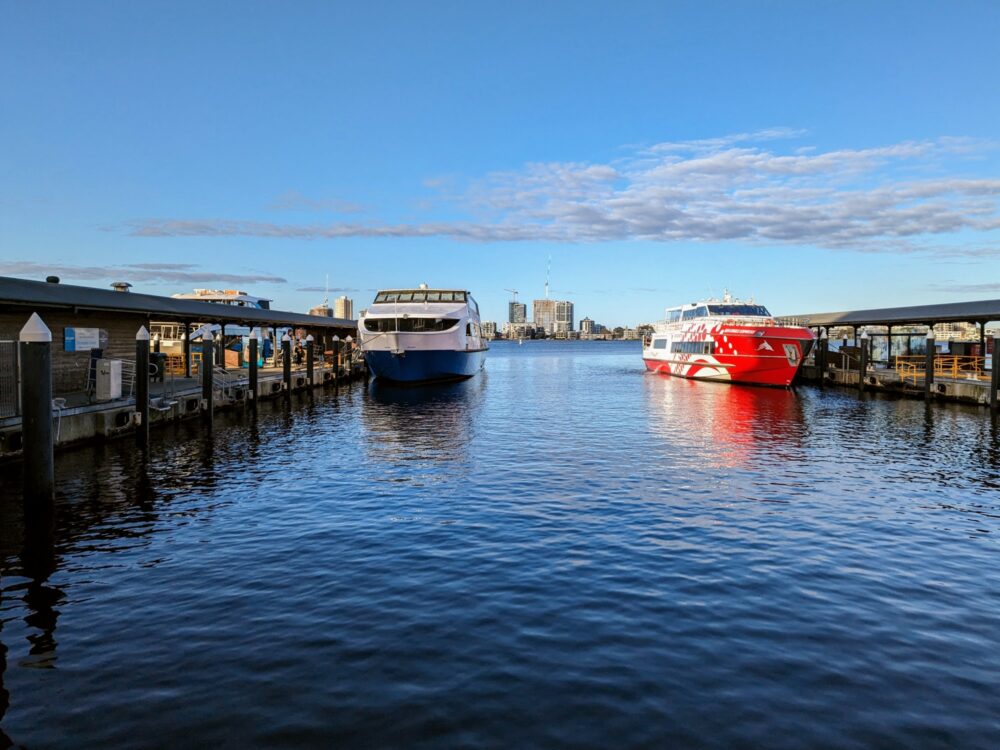
If you’re staying in or near the CBD like we were, a service from Barrack Street Jetty is the best option. Two companies, Rottnest Express and Sealink, run ferries from there in the morning and return in the late afternoon. Prices and timetables are similar but not the same, so check both companies before you commit. They both have a free shuttle option from various CBD hotels.
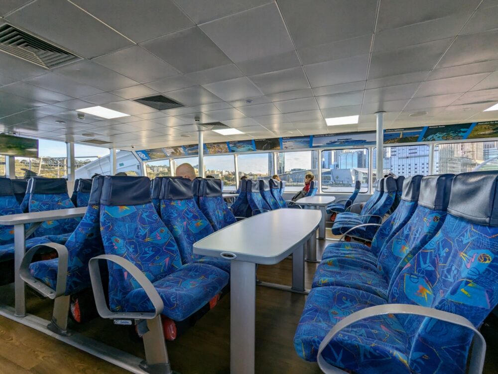
In either case, the boat leaves from the Elizabeth Quay precinct in Perth, basically operating as a river cruise complete with commentary as it runs up the Swan River. It takes about 75 minutes to get to Fremantle, where there’s a brief stop to pick up more passengers before heading out to Rottnest.
As well as the boats that leave from Perth, several other services run solely from Fremantle (B Shed Jetty) to Rottnest and back throughout the day. If you’re not staying in Fremantle, there’s a train and bus station a five-minute walk from B Shed that will take you to and from the CBD or anywhere else on the suburban transport network.
You pay less for a ticket from Fremantle than the CBD, so if you don’t need the river cruise or the times don’t suit, just head to Fremantle and pick up the ferry there instead.
As well as that B Shed jetty on the south bank of the river, Rottnest Express also runs a service from North Port on the northern bank. Sometimes the same boat calls in at B Shed as well, sometimes it heads straight over to Rottnest, although note that this service is currently paused until mid-September 2024.
Finally, the Rottnest Fast Ferries service runs from Hillary’s Boat Harbour in the north of the city to Rottnest and back. It’s slightly cheaper than the others, and your ticket includes a free shuttle from various spots in the CBD and inner suburbs. Chances are the services from Fremantle or the CBD will still be more convenient unless you’re living/staying in the north of Perth, but it’s still worth a look.
Prices and Timetables
Ferry prices and schedules vary throughout the year, so double-check exactly when the boats run before making any decisions, especially if you’re visiting outside the peak summer season. Given the size of the island and the fact that the return boats stop by the time it gets dark, though, I’d suggest getting there as early as possible, by mid-morning if you can.
As a rough guide, booking in advance, expect to pay somewhere in the region of $80-100 per adult for a return ticket from Perth, or $50-60 for a return ticket from Fremantle. Like airline tickets, prices do go up as the number of available seats drops, so it’s worth grabbing tickets at least a week ahead of time if you know you want to travel on a specific day.
On top of the ferry ticket, there’s also a Rottnest admission fee. It currently stands at $20 per adult for a day trip, or $27 if you’re on the island for longer. Assuming you’re travelling over by ferry, it’ll be included in the total when you buy your ticket.
If you thought those ticket prices weren’t quite high enough, there are a few options for the Perth to Rottnest service designed to help you pay even more. Rottnest Express has a “VIP” ferry that serves refreshments, cheese, and wine, and doesn’t stop in Fremantle, and even a seaplane alternative if you’d like to pay ~$200 per person each way. I have not done either of those things, and strongly suspect I never will.
More usefully, the ferry companies also offer options like hiring a bike or taking your own bike or surfboard over. The details vary slightly between companies: here’s what was on offer as of mid-2024.
| Rottnest Express | Sealink | Rottnest Fast Ferries |
|---|---|---|
| Adult bike: $36 | Adult bike: $35 | Adult bike: $29 (day return) |
| Adult bike with cargo trailer: $50 | Breakfast box: $12 | Snorkel set: $20 |
| Snorkel set: $23 | Transport of own bike: $20/$25 | Transport of own bike: $18 |
| Transport of own bike: $20 | Transport of own surfboard: $15 | Transport of own surfboard: $15 |
| Transport of own surfboard: $11 | ||
| Transport of both: $26 |
You don’t have to hire through the ferry company, however. If you like the convenience of arranging and paying for everything all in one place, you can, but note that Pedal and Flipper Hire on the island will rent a bike or snorkel set to you for less money, and they have better bikes and more options. The choice is yours.
You’re required to choose your return ferry time when you book, which basically means you can be certain of a space on that sailing. The ferry operators will usually let you take a different service on the same day if there’s room, but there’s no guarantee, especially at busy times.
Because of that, I’d suggest booking the latest ferry you think you might take: if you finish early, just ask whether you can get on an earlier boat. If not, well, there’s a pub on Rottnest!
💰Once you’ve figured out what day and times you want to travel, it’s worth doing a quick price check for the same tickets on GetYourGuide. You won’t save money when booking a week or more in advance, but because the ferry companies ramp their prices up the sailing date gets closer, I’ve found tickets here to be cheaper for last-minute trips.
Getting Around the Island
Walking
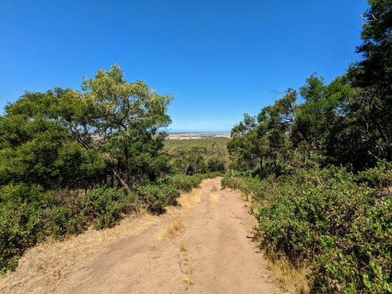
At 11km long and 4.5km wide, you could theoretically walk a loop of Rottnest Island in one very long day, but I strongly suspect you won’t want to.
That leaves you with a few choices about how to get around. If all you really want to do is see a few quokkas, have a bite to eat, laze on the beach for a while, and then head back to the mainland, you’re fine: all of those things are available within an easy stroll of where the ferry docks.
The Basin, arguably the prettiest and most well-known beach on the island, is a 15-minute walk away. None of the food and drink places in the main settlement are more than a few minutes from the jetty, while heading west for ten minutes takes you to a great little viewpoint that looks out over the salt lakes and township.
If you want to explore more of the island, though (and believe me, you absolutely should), you’ll need some sort of transport. There are no private cars, so most people either pedal around on a standard or electric bike, or take the Island Explorer hop-on hop-off bus. I’ve done both on different trips, and enjoyed both experiences for different reasons. A range of tours are available as well, if you’re short on time and/or energy.
Cycling
On my first trips over to the island, I hired a bike from local company Pedal & Flipper Hire when I arrived and headed off to explore. Cycling around like this meant that I didn’t have to worry about the bus timetable or whether it’d be full when it arrived: I could go wherever I liked, whenever I liked, and spend as much time I wanted there.
It’s the most popular way to get around, and if you’re mostly looking to just beach-hop your way around a few bays, I can highly recommend it. Because the island is surprisingly hilly in parts, I’d suggest cycling in an anti-clockwise direction if you’re planning to do a loop: it makes for largely gentle downhill riding with the occasional steep climb, rather than a relentless uphill slog the other way!
That said, on a non-electric bike on a hot day, you’ll work up a pretty solid sweat in either direction. If you’re fit, motivated, and don’t stop for too long anywhere, you can cover the whole island in a day: it takes around four hours to ride around it without breaks. Even so, let’s just say that I saw a lot more bikes close to the settlement than further afield!
In reality, I’d suggest not trying to get around the whole island unless you’ve got an e-bike. There are plenty of lovely beaches on the eastern half of the island, and limiting yourself to a shorter distance just means more time to enjoy all that white sand and sparkling ocean.
At off-peak times, you can usually just rock up to the store and hire a bike when you get there. On summer weekends and school holidays, though, you’re better off booking in advance to speed up the process and guarantee you’ll get one.
The other thing to note is that there can be quite a long wait. Staff are generally pretty efficient, but when hundreds of people arrive at once and want to immediately collect a bike, it can still take 20 minutes or more at peak times. If you’re one of the last off the boat and the line is painfully long, you’re probably better off going to grab a coffee and coming back afterwards instead of standing around grumpily waiting.
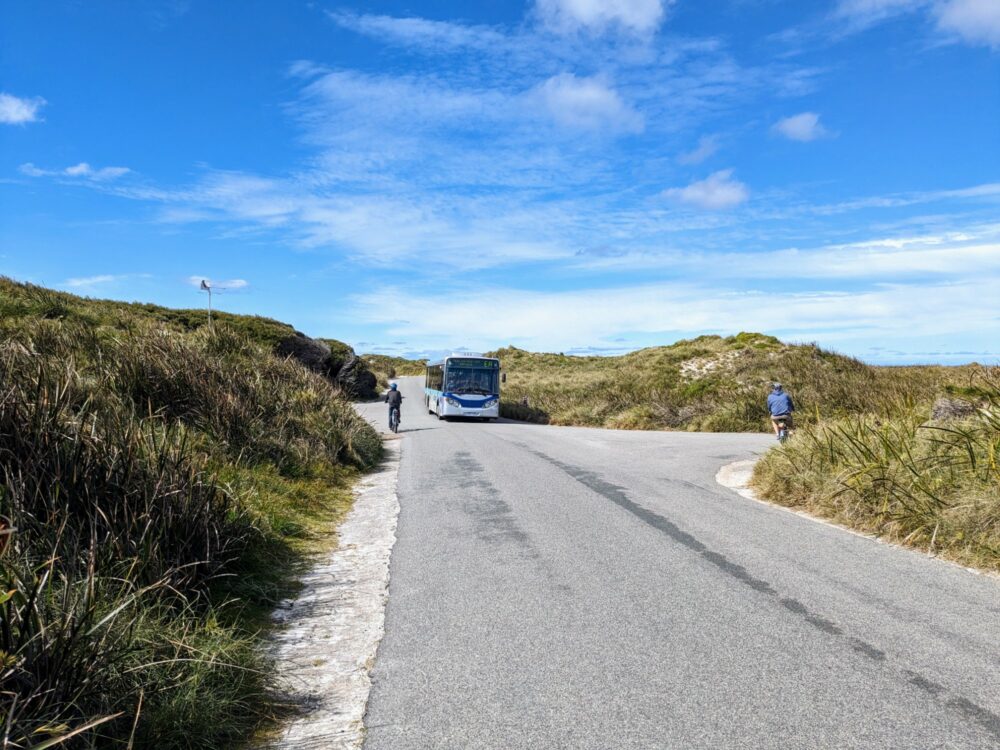
Hop-On, Hop-Off Bus
On my most recent trip to Rottnest, we opted to take the Island Explorer hop-on, hop-off bus around instead. Not only was it slightly cheaper than renting a bike, but it meant that on what was a pretty warm spring day, we could explore the whole island without being absolutely exhausted by the end of it all.
The other advantage of taking the bus was that it made it easier to enjoy the walking tracks. There are five different trails marked around the island, nearly all of which link up with the bus route at various points, so you can get off at one stop and get back on at another.
We did this a few times, and it was a great decision, letting us see some of the most beautiful beaches and other parts of the island without having to backtrack to where we’d left the bikes afterwards. It also meant that if we’d just missed a scheduled bus, we could make the most of the time by walking to the next stop instead of standing around waiting.
The bus leaves from the signposted area in the main village and does a one-way loop around the island, with 19 different stops along the way. You can get on or off anywhere you like, and the ticket (which costs $30 per adult) is valid all day.
The schedule varies a bit depending on the time of year, with starting and ending times aligned with the ferries. You can generally expect a bus to show up every 20-30 minutes from early morning to mid-afternoon. Tickets are available online in advance, or from the kiosk alongside the first/last stop on the day.
Buses can fill up at peak times, which could leave you having to wait for the next one to show up. That’s more of an issue at the popular spots marked on the brochure/map: if there’s a long line of people waiting there, it might be worth walking back to the previous stop and getting on there instead.
Other Options
While bike and hop-on, hop-off bus are the main two ways of exploring the island, they’re not the only options.
Despite Segways having fallen out of fashion with pretty much everyone except mall cops in America, those self-balancing two-wheeled “personal transport devices” are alive and kicking on Rottnest Island. Tours leave from Thomson Bay and run for an hour around the settlement, or further afield for 90 minutes. Try not to hit the quokkas. Or fall into the ocean. Or both.
Organised bus tours are also available, with a couple of different options. The “Bayseeker” tour follows the same route as the hop-on, hop-off service, but you’re on one bus the whole time, getting out at specific locations and having a guide provide commentary along the way. It leaves twice a day at 11:15am and 1:45pm, and takes a bit under two hours.
The “Grand Island” tour also goes around the island, and adds a trip on the historic railway and exploring the island’s old WW2 fortifications and tunnels. Lunch is included in this roughly four-hour tour, which leaves at 11:30am and costs $99.
Speaking of the railway, it’s a relic from the war, built to transport ammunition from the barracks to the guns set up on Oliver’s Hill. Some of the tracks were removed after the war, but they’ve been restored and preserved as a tourist attraction in recent years, with a train leaving the main settlement every hour between 10:30am and 2:30pm. Tickets cost $10, which you can buy in advance or on the day.
Of less interest to most day trippers is the accommodation shuttle service that runs between the three populated parts of the island: Thomson Bay, Kingstown, and Geordie Bay, all on the northeast coast.
Likewise there’s an on-demand electric golf cart service that runs around and between those three areas; useful if you have limited mobility, but probably not otherwise.
Finally, there’s a guided e-bike tour available as well, running Friday through Sunday. This four-hour tour starts at 11:30am, and you’ll circle the island with a guide, stopping for a swim at West End before heading back. The tour costs $100 each, minimum two people.
When You Arrive
The ferry docks at the pier on the east of the island, beside the main settlement at Thomson Bay. From there it’s a minute’s walk to the Visitor Centre and toilets, with all of the shops, cafes, and restaurants nearby.
If you’re renting a bike from the ferry company, they’ll be handing them out at the jetty, so just join the line and show your ticket to the staff member. If you’re renting one from Pedal & Flipper Hire instead, just follow the signs (or Google Maps) to pick up your bike from them instead. The store is off to your left as you leave the jetty, a couple of minute’s walk away.
Just like everywhere else in Australia, wearing a helmet is mandatory on public roads: it’s included in the hire price, as is a lock that you’re asked to use whenever you’re parking the bike somewhere.
The Visitor Centre is the place to go for information about the island, with friendly staff who can answer pretty much any question you might have. We called in there to have a chat, grab some brochures, and use the toilets before we set off.
If you’re planning to take the hop-on, hop-off bus, the ticket kiosk is just beside the bus bays. It’s not hard to find, behind the Visitor Centre on Digby Drive: chances are you’ll see a bus or two parked up there anyway.
If you’re in need of refreshment, the main settlement is definitely the place to get it: options are limited to non-existent elsewhere. It’s a captive market, so I wouldn’t say that any of the restaurants or cafes offer amazing value or exceptional food, but I had a decent coffee and sausage roll at the bakery near the bus stop.
In general, though, I’d recommend bringing your own food from the mainland if you can: not only will it likely be cheaper and tastier, it also gives you the option of eating it while you’re out exploring the island rather than having to come back to the village to buy it.
Make sure you’ve got plenty of water with you before heading out around the island. There are a few water refill stations, but they’re all near the settlements in the east. Once you get further west, you’re on your own.
What to Do
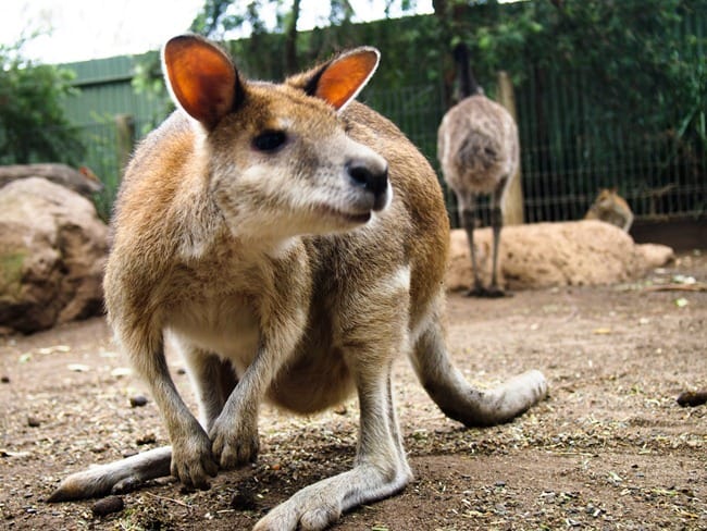
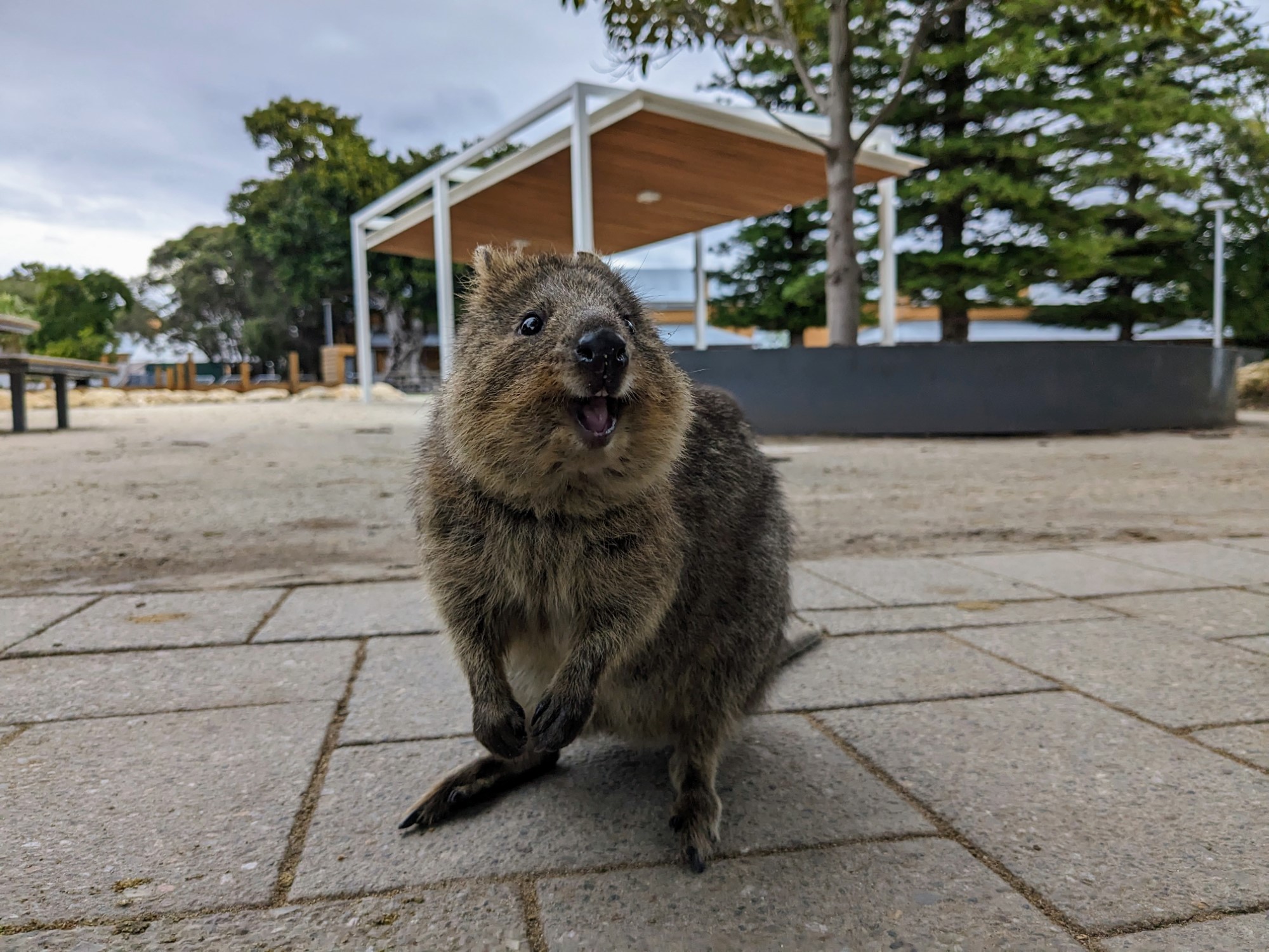
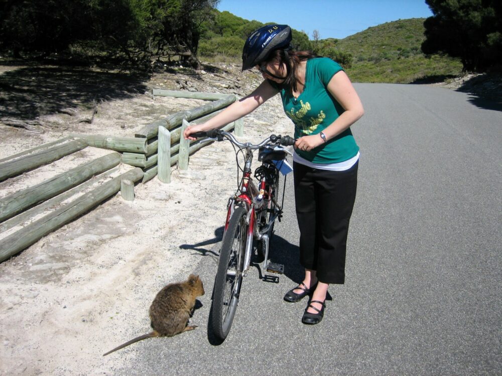
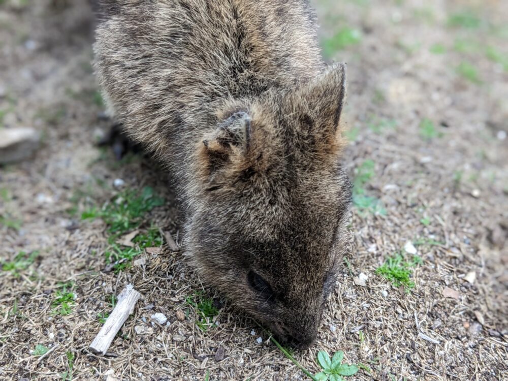
Quokkas

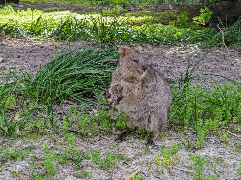
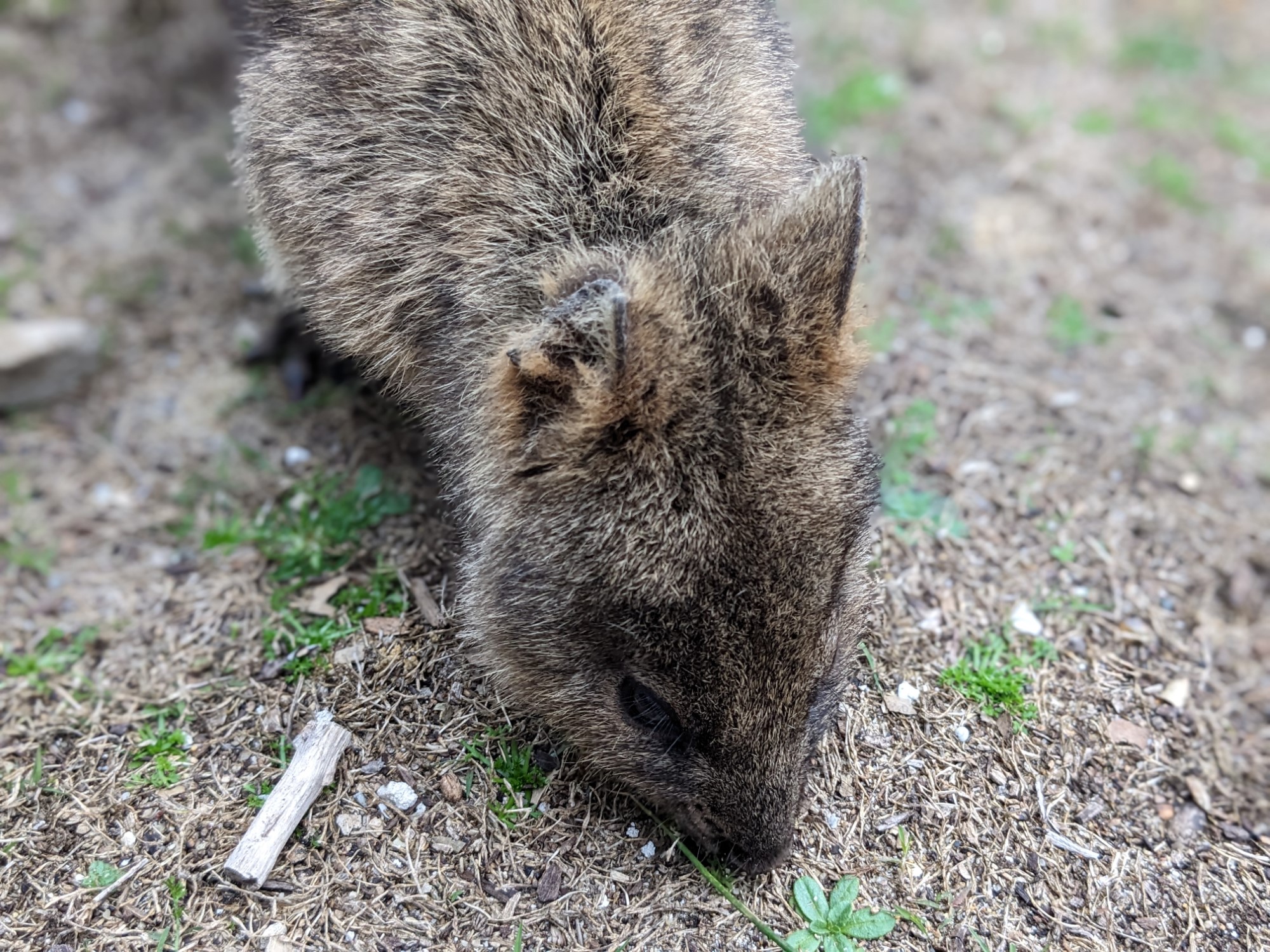
While there’s far more to do on Rottnest Island than just take photos of smiling marsupials, it’s the quokkas that have captured the hearts of Instagram users around the world. If they’re the main reason you’re visiting, the good news is you won’t have to wait long to see them: just like humans, you’ll find more of them in the main settlement than anywhere else.
We saw loads of them on the field near the bus stop, and even more of them around the cafes and restaurants. Let’s just say there’s a reason why there are fences around the outdoor terraces and quokka-proof doors at the entrances to anywhere selling food!
Of course, there’s a reason why the quokkas are so popular: they really are super-cute, and the ones around the settlement in particular have become so used to humans that they’ll often happily come very close to you as long as you’re calm and quiet.

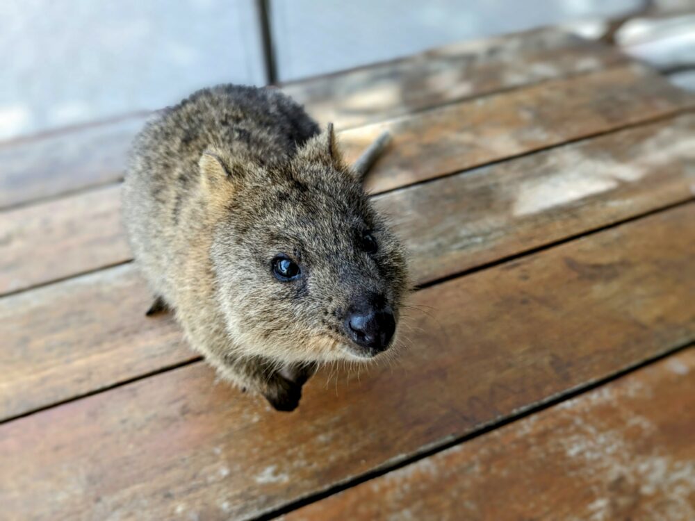

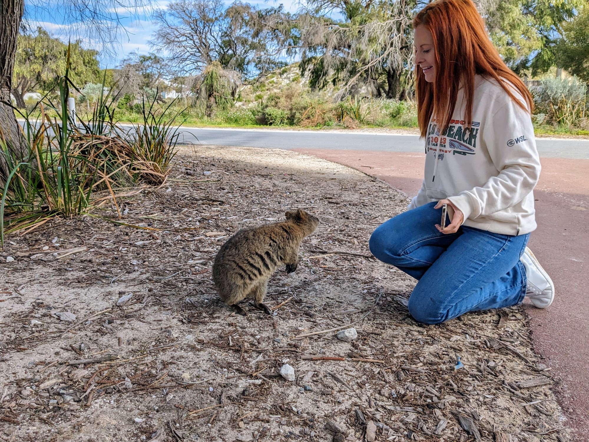
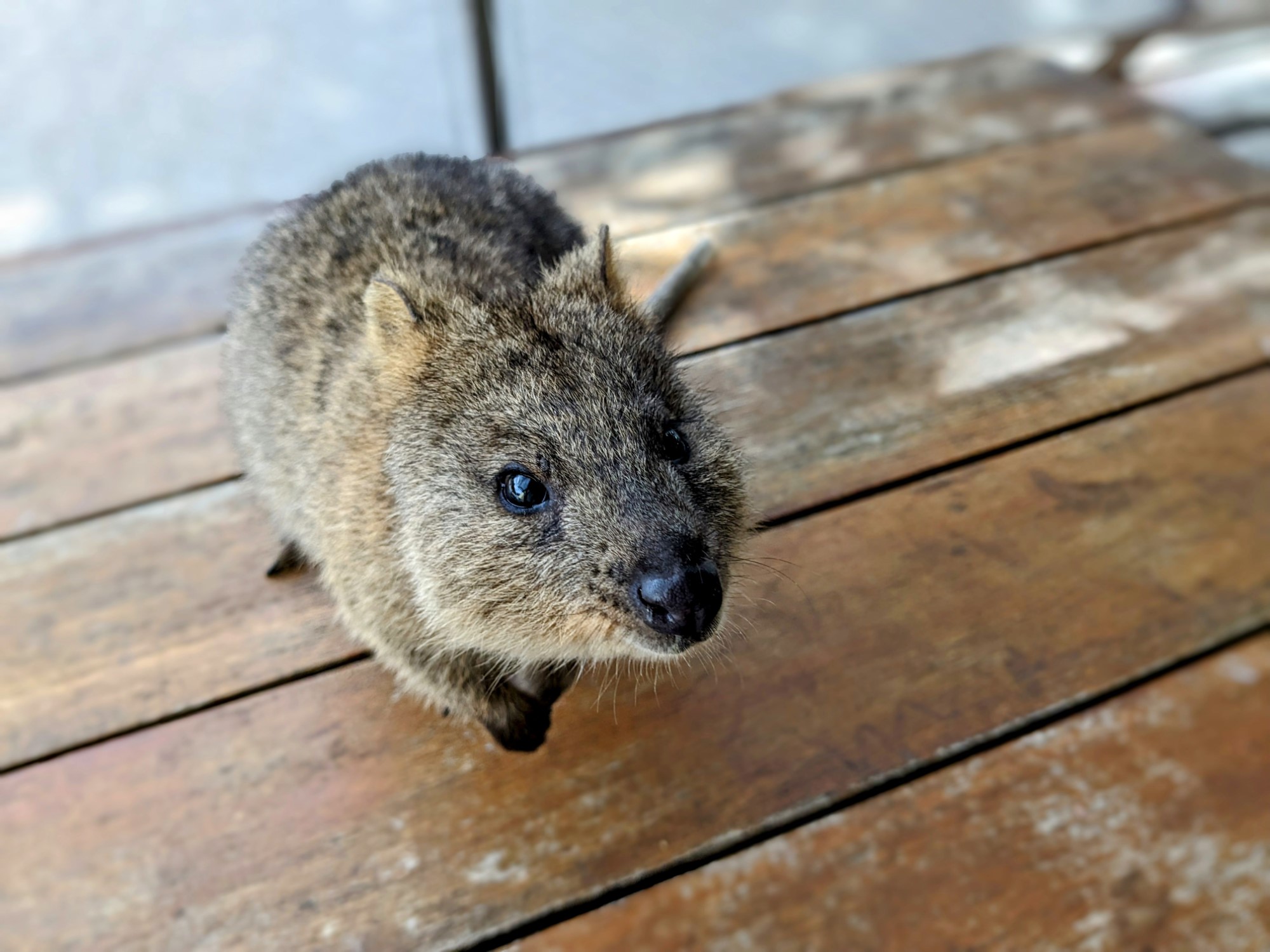

That said, they are still wild animals, with surprisingly sharp claws, and it’s illegal to feed, touch, or otherwise interfere with them. There are signs everywhere to remind you of this fact, and rangers hand out on-the-spot fines without much provocation, but it didn’t seem to be stopping people all that much.
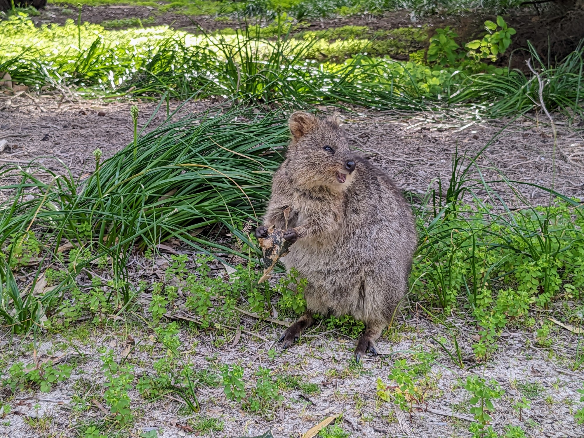
If you’re looking for a less-busy place to hang out with quokkas, just go for a walk through the back streets of the main settlement. We came across a dozen or more in random backyards and on the side of the road, and were able to take photos and chill out with the animals without anybody else around.
The further you get from the settlements, the less human food there is around, so the quokkas spread out more and can be harder to spot. Still, where there are people, there’ll be quokkas: don’t be surprised if you see quite a few them at some of the popular beaches and tourist sites as well.
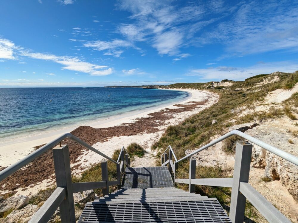
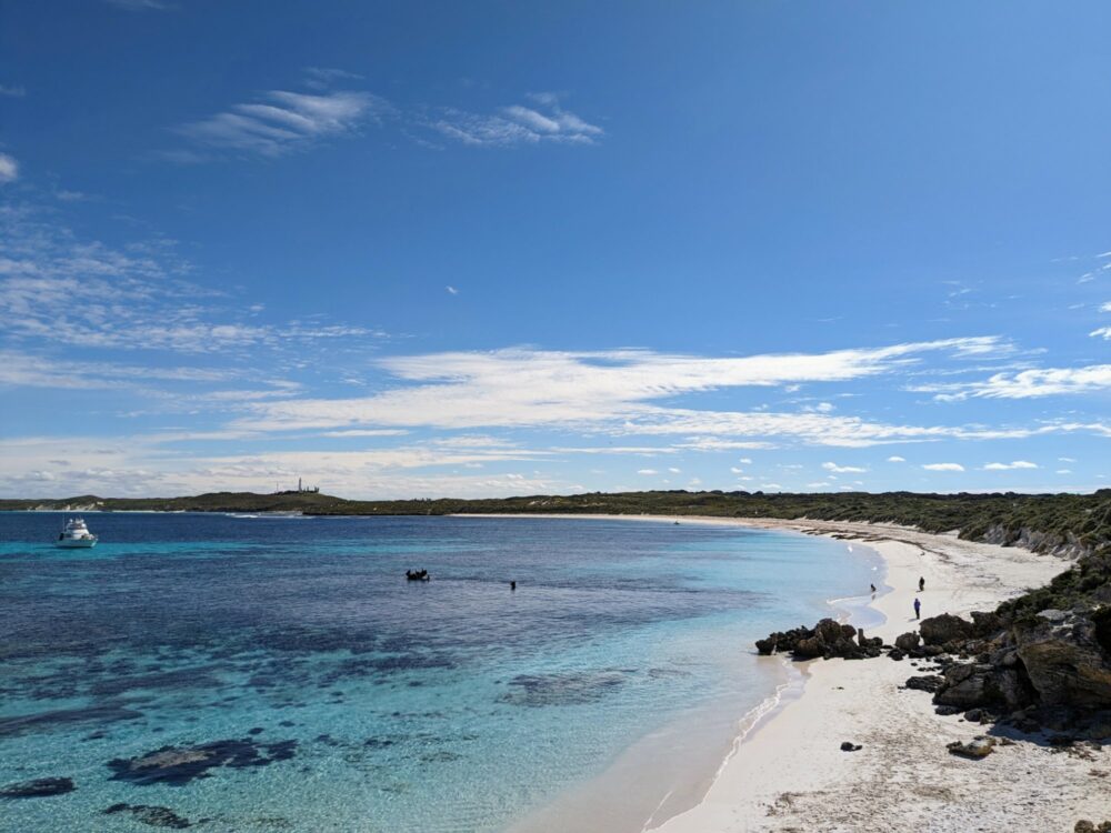
Bays and Beaches
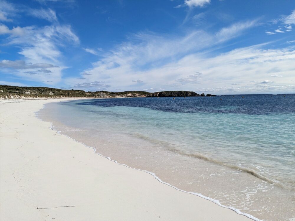
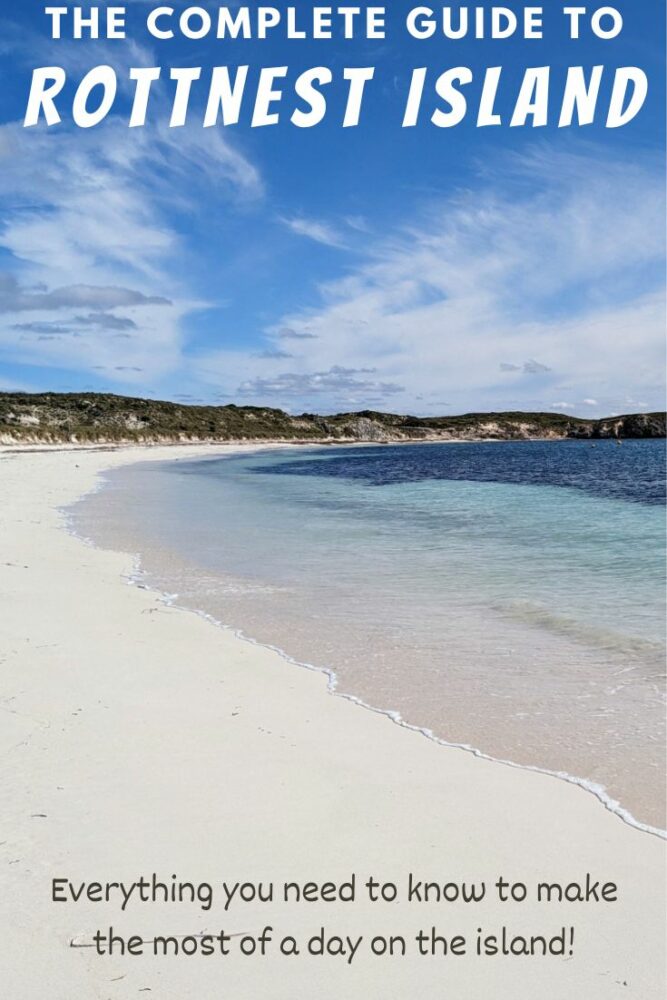
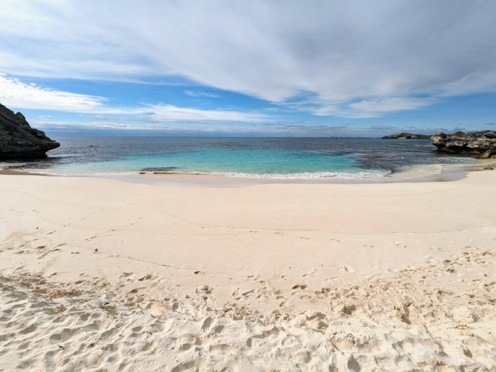
Every brochure you read about Rottnest Island proudly talks up the island’s 63 beaches and bays, and while I didn’t bother to count them all, I have no trouble believing the claim. For being so close to a major city, the beaches are absolutely stunning, most of them with the kind of white sand and gentle waves that sells a million postcards.
If you’re looking for somewhere to snorkel that’s within easy reach of the main settlement, head south towards Little Salmon Bay. This sheltered cove has an underwater snorkelling trail marked out through the submerged rocks and colourful coral, and there’s always plenty of fish and other marine life around.
On a sunny day, it’s one of my favourite spots on the island, although the beach and bay are pretty small, so it can get busy in the middle of the day. If that’s the case when you get there, head back to Parker Point: it’s not quite as sheltered, but there are invariably a lot fewer people around, and there’s an underwater snorkel trail to follow there as well.
Both Parker Point and Little Salmon Bay are stops on the hop-on, hop-off bus, and you can walk between them in less than five minutes. A few minute’s walk in the other direction is the stop for Salmon Bay, a much larger beach where you’re pretty much guaranteed to have a stretch of sand to yourself.
In the north of the island, my pick would have to be Little Parakeet Bay. It’s sheltered from the wind, which usually means very few waves, and the sand somehow seems even whiter than other nearby beaches. Despite being quite small and close to the little settlement of Geordie Bay, it’s never been busy when I’ve visited.
There’s plenty of bike parking, but you can also walk there in about half an hour from the main settlement, and there’s a bus stop alongside as well. Even better, if you get hungry or thirsty at any point, there’s a cafe and shop in Geordie Bay that’s just a three-minute cycle or 15-minute walk away. It’s expensive, like everywhere else on the island, but at least it exists.
If you’re on the island at a peak time and are finding the beaches near the main settlement a bit too hectic, don’t worry. As with everything else, things get quieter the further along the island you go, and by the time you get to the West End (which I talk more about below), there’ll be a lot fewer people around.
While some of the bays and beaches here are pretty wild and inaccessible, that doesn’t mean they all are. We got off the bus at the far tip of the island, checked out the fur seals just offshore, and then started to walk back along the northern coast. What a good decision that turned out be: if you like long stretches of deserted beach, you’re in for a treat.
The photo at the top of this section is of Majorie Bay, which is the kind of place that would be packed with people if it was closer to town. Instead, we shared it only with the birds: there wasn’t another human in sight along its entire length, and very few on the beaches around Rocky Bay or Stark Bay either.
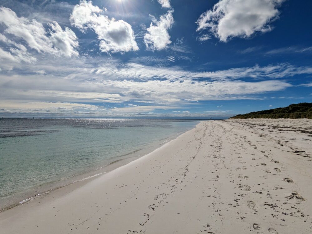
A set of footsteps in the sand and a mast on the horizon served as the only reminders we weren’t alone in the world. We basked in the sunshine, ate our packed lunch in the dunes, and commented on how glad we were to have made the (very small amount of) effort to get there.
Salt Lakes
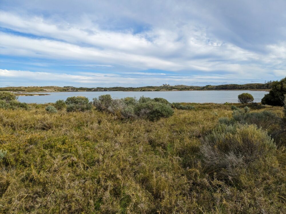
You wouldn’t know it when you’re hanging out on the beaches or paddling in the ocean, but around 10% of Rottnest’s inland area consists of lakes. There are a dozen pink and white salt lakes clustered near the settlements in the northeast, around half of which dry up in summer while others remain year-round.
Until the 1950s, salt production was an important industry here, collected from the dry lakes and exported to the mainland. Now, the lakes serve mainly as a wetland habitat for birds and animals, and as a backdrop for stunning photos in the evening as the sun sets over the ocean and reflects off the flat, shallow waters.
The closest lake to the main settlement, Garden Lake, is less than a five minute walk away, and you can easily cycle between and around the rest of them. There’s also a roughly 10km walking trail, the Gabbi Karniny Bidi, that winds through the wetlands and includes boardwalked sections along the edge of a few of the lakes.
If you only want a quick look, the Little Parakeet Bay stop on the hop-on, hop-off bus overlooks Lake Baghdad on the other side of the road.
The West End
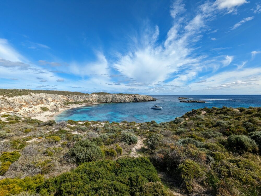
If sheltered beaches and calm bays aren’t your thing, just head west. Connected by a narrow strip of land called Narrow Neck, Rottnest’s West End feels very different to the rest of the island. With no shelter from the ocean waves and winds, much of it is rocky coastline and crashing surf, even on a relatively calm day.
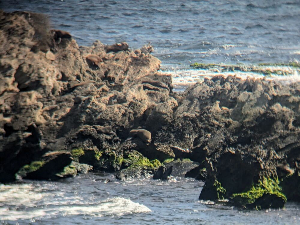
The main attraction for most people is the resident fur seal population that you’ll often see basking just offshore at Cathedral Rocks; there’s a viewing area up on the cliffs, a short walk from the bike parking and bus drop-off area. It’s about a half-hour ride straight through the middle of the island to get there, but more than double that if you go along the coast.
Don’t expect to get great photos unless you’ve got a camera with a long zoom, although you can try doing what I did and hold your phone up to the binoculars that have been installed there. I’m not saying you’ll be happy with the outcome, mind you.
Be sure to check out the Cape Vlamingh boardwalk and viewing area as well, which starts at the end of the road just past the bus stop. It’s a good spot to look out for migrating humpback whales between August and December, and for checking out the rock formations and bird life at any time of year.
Most people bike or bus back to the main part of the island after visiting the viewing areas, but we decided to walk a roughly 5km section of trail instead, from Cathedral Rocks to the end of Stark Bay. If it’s not too hot and you’re feeling up to it, I’d definitely recommend doing the same: as I mentioned earlier, there was hardly anybody else around, the beaches were stunning, and there were great views towards Eagle and Crocodile Rocks and along the coast.
Walking Trails
There are 45km of walking tracks that cross and circle the island, collectively known as the Wadjemup Bidi (Rottnest Trails). That’s too much for all but the most hardcore to tackle in a day, even if the ferry schedule allowed for it (it doesn’t), but that doesn’t mean you can’t get a good hike in even so.
Five separate trails make up the network, each one covering a different part of the island:
This page has links to more information for each trail, including the start and end points and downloadable PDF maps. If you’d rather have an interactive version that shows you where you are, I used AllTrails: all of the above tracks are included, along with a few other unofficial routes.
The tracks are all connected, so it’s really up to you how much or little you want to tackle, and with one exception they all start and finish near a stop for the hop-on, hop-off bus.
For the Ngank Yira Bidi, you can either take the scenic train back to the main settlement from the end at Oliver hill, or walk an extra 2km on the Wardan Nara Bidi to get to the nearest bus stop beside the lighthouse.
There really aren’t any bad options, but if you’re after a suggestion, I can recommend the Ngank Wen Bidi loop in the West End. Above rugged cliffs and along empty beaches, it takes around three hours to complete depending on how often you stop, with spectacular views the whole way.
There are toilets at the start/end point, but no water along the track, so bring plenty with you. That means at least two litres, more on hot days. I wore lightweight hiking shoes, but I’d expect most people could do it in running shoes. Just don’t wear flip-flops!
Other Highlights
All of those beaches, trails, quokkas, and lakes still not enough? No problem, check out some of Rotto’s other highlights!
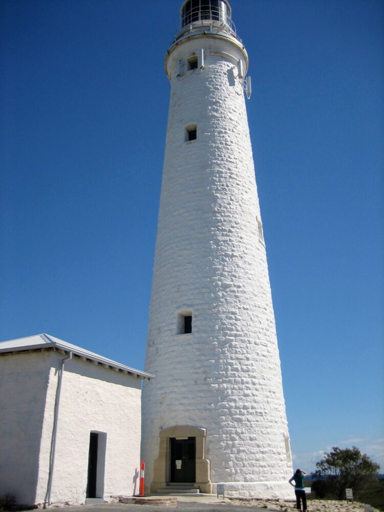
- Wadjemup Lighthouse: When choosing a site to build Rottnest’s 38m-high lighthouse in 1896, the authorities of the day unusually decided not to put it directly on the coast, but instead on an inland hill at the highest point on the island. You can take a tour ($15) between 10am and 2:30pm each day, or just admire it from outside. Bus stop 8 is directly alongside.
- Oliver Hill: I mentioned it briefly earlier, but the tunnels and gun emplacements on Oliver Hill are definitely worth a look if you’ve got a bit of spare time. Built in 1937 to defend the port of Fremantle from attack, the two 11-metre guns are now the only ones left in Australia. You can also take a tour of the tunnels underneath that housed the guns’ engine room and ammunition supply. To get there, take the historic train from the main settlement, or hike the 10km Ngank Yira Bidi track (above).
- Surfing at Strickland Bay: Strickland Bay, beside the entrance to the island’s West End, has one of the most consistent surf breaks in Western Australia. You need to be a pretty good surfer (and visit around high tide) to safely tackle the shallow reef break, but if you are, it’s easily the best surfing spot on the island. Bus stops 12 and 13 are both a short walk from the beach.
- Wadjemup Museum: If the weather isn’t great or you’re just looking for a way to kill half an hour while you wait for the ferry, pop into the Wadjemup Museum in the main settlement. Open daily in the Old Mill and Hay Store from 10am to 3:30pm (donation), the museum’s several rooms recount the island’s history from both a European and Aboriginal perspective. Be sure to visit the sculpture garden out the back before you leave!
- Snorkel the shipwreck at Henrietta Rocks: There’s good snorkelling in several of the bays around the island, but arguably the most interesting is at Henrietta Rocks. That’s thanks to the wreck of the Shark trawler that sits on the edge of a reef about 50m offshore. It broke free from its moorings in Fremantle in 1938 and drifted across to Rottnest, where it grounded itself on the reef, sunk, and has remained ever since. Because the water is so shallow, it’s a rare opportunity for people without a diving certification to explore a shipwreck, so be sure to check it out if it interests you! Henrietta Rocks is a half-hour walk from the main settlement, and bus stop 3 is alongside.
As you can see, there’s a vast amount to do on Rottnest Island, even if you’re only there on a day trip. I hope you found this guide useful, and if you’ve got any questions, feel free to leave them in the comments!