Hiking the Queen Charlotte Track in New Zealand
Articles on this site contain affiliate links, meaning I may be compensated if you buy a product or service after clicking them. The full privacy & disclosure policy is here.We’d arrived in Picton the day before, making the three hour ferry crossing across Cook Strait on the kind of perfect summer afternoon that the New Zealand tourism board dreams about.
Most people just pass through this little town. The state highway runs right up to the ferry terminal, and the majority of passengers take advantage of that fact. We, however, had other ideas.
Nestled at the head of the Queen Charlotte Sound, Picton is the starting point for the multi-day walk of the same name. The Queen Charlotte Track is a 71 km hike, one of New Zealand’s more popular long-distance options, and for the next few days we’d be somewhere along that trail.
Unlike most similar trails in the country, the track crosses some private land as it winds its way around the bays of the Marlborough Sounds. The upside of this for hikers is that there are accommodation options beyond tents and basic Department of Conversation huts.
Everything from dorm beds to luxury lodges is available for a price, making the walk popular with a wider demographic than you might expect.
My experience of hiking in New Zealand has typically involved carrying too much gear in an uncomfortable backpack for several days, surviving on a diet of packet noodles and powdered orange drinks, sleeping on flimsy bedrolls, and trying to avoid using stinking long-drop toilets as much as possible.
The folks at the Marlborough Sounds Adventure Company, however, offered a rather different way of doing things. Staying in comfortable beds? Having our gear transported by water taxi? Being able to order a decent meal and cold beer each night?!
Not gonna lie, it sounded pretty appealing.
Day 1: Ship Cove to Furneaux Lodge
And so it was that we found ourselves pulling away from the dock one sunny morning, our water taxi bound for the starting point of Ship Cove. The highlights began, however, before we even set foot on the track.
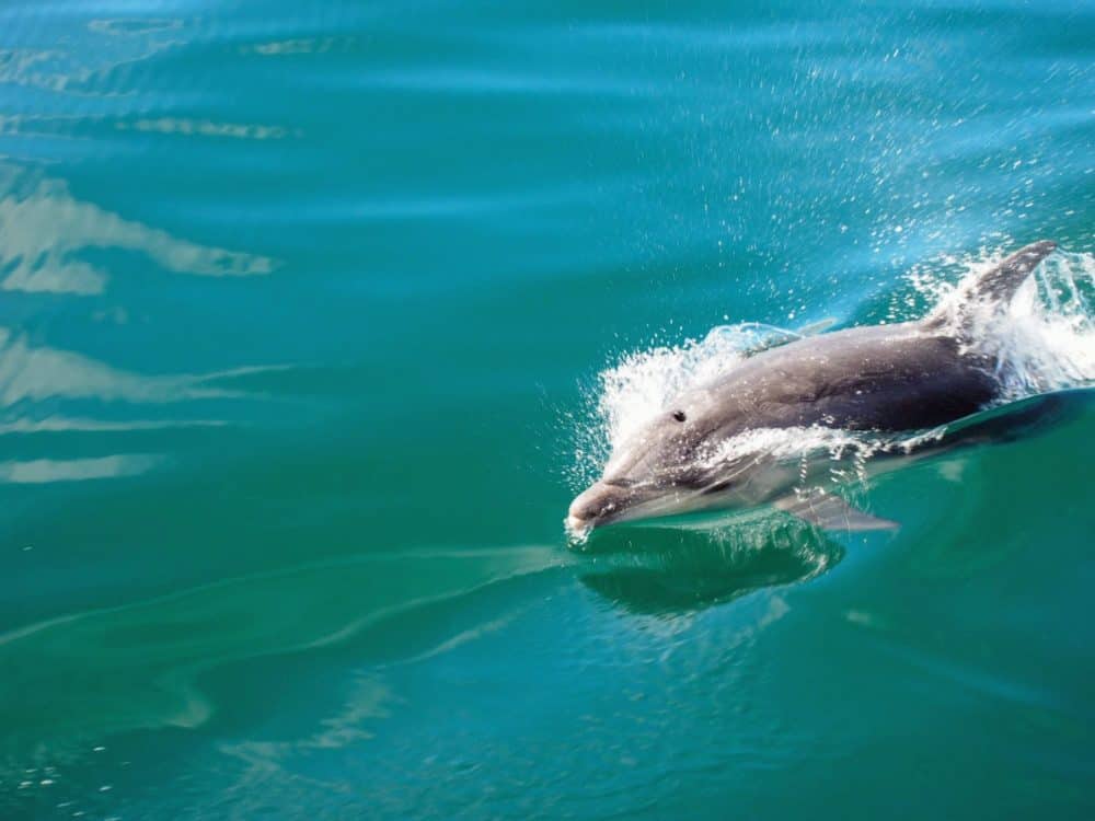
A pod of at least a dozen dolphins surrounded the boat, surfing the bow wave and leaping into the air as we went past. We sat watching them for a few minutes, before reluctantly continuing on our way.
I could have stayed looking at them all day. Getting bored with dolphins really does seem impossible, at least for me.
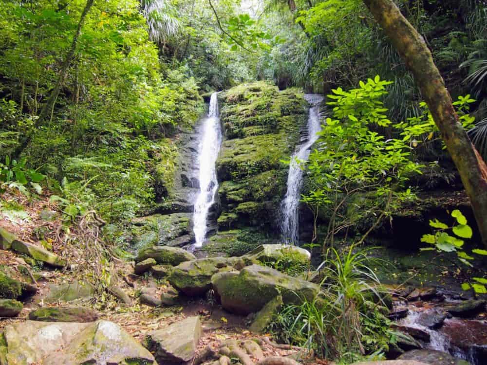
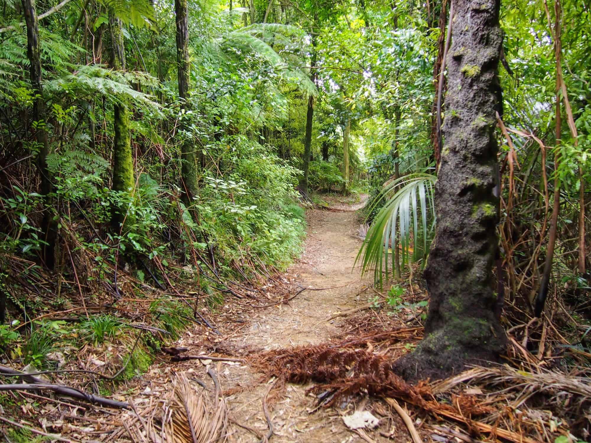
Just in case we weren’t going to be walking far enough over the next few days, we took a short side trip before we even began. The Waterfall Track led, shockingly, to a small waterfall, and was a good way to warm up our legs before hitting the trail proper.
Not a bad idea, since the track climbed steeply for about an hour from the very first step.
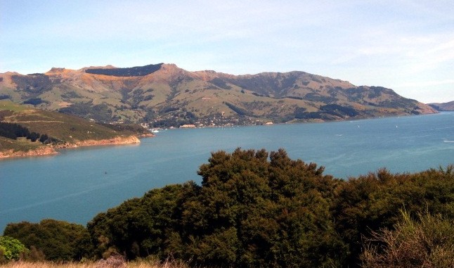
Hot and sweaty, we eventually crested the top of the saddle, and had our first proper view of the Marlborough Sounds. I’ve seen parts of it before from all sorts of vantage points, but this view over Resolution Bay was definitely one of the better ones.
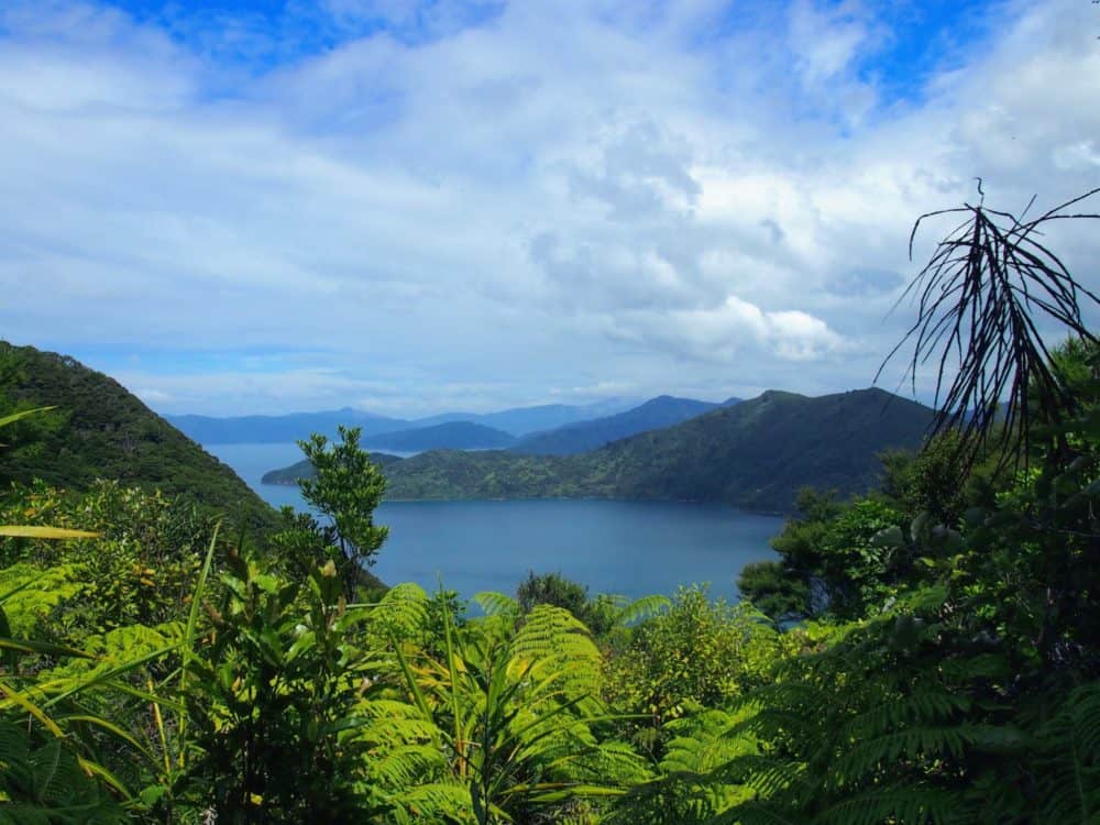
From the saddle we descended to the bay, dropping the 200m back to sea level considerably faster than we had gained them. The general rule about hiking in New Zealand, however, seems to be “what goes down will definitely go back up again,” and this track was no exception.
Climbing out of Resolution Bay and over the undulating terrain for the next couple of hours, I tried to ignore the quiet whimpering from somewhere behind me. Lauren was clearly having the time of her life.
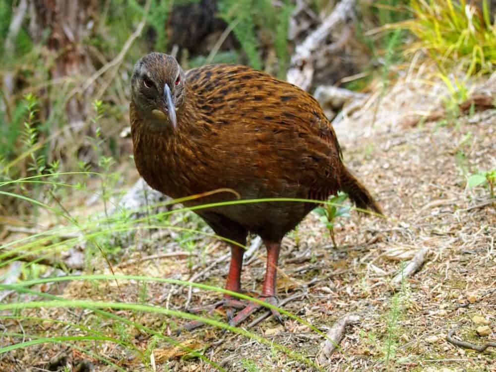
New Zealand has a few native birds beyond the most well-known one, and there was no shortage of them as we walked. Wekas were everywhere. With minimal fear of humans, they quickly appeared whenever we stopped moving, scuttling around just out of reach in case we dropped a few crumbs of food.
A ‘vulnerable’ species, I don’t remember seeing one in the wild before, but there must have been a couple of dozen on that first day alone.
The type of vegetation changed dramatically as we hiked, the forest thinning out in parts, only to return to being dense and impenetrable a little further along.
Our accommodation for the night was located at the head of Endeavour Inlet, and it took a deceptively long time to get to it.
The path finally flattened out, and the glimpses of water and rocky beaches between the trees were quite beautiful, but after close to 15 km of walking, we were all looking forward to taking our boots off by the end.
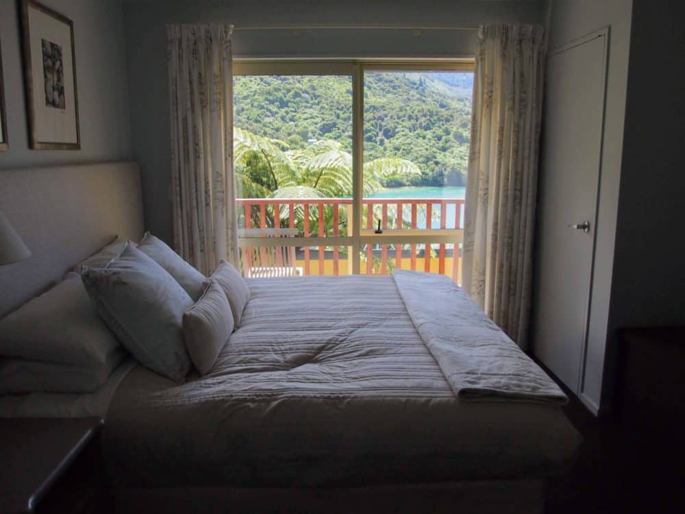
Finally making it to the manicured luxury of Furneaux Lodge late in the afternoon, we slouched past the other guests sitting on their balconies having an afternoon drink.
They sparkled with cleanliness compared to us, and we raced to see who would get to wash the dirt off first. Even if the concept of a hot shower on a hiking trip still seemed rather alien to me.
After walking for several hours, a decent meal and a couple of beers, a late night was never likely. Collapsing into bed, I only had time to think that it was a damn sight nicer than any sleeping bag I’d ever owned before quietly passing out.
[section background_image=”” text_color=”#666666″ background_color=”#eeeeee”]
Other Queen Charlotte Track Accommodation on Day 1
If you start hiking in the afternoon, or just fancy a shorter first day, a Department of Conservation (DOC) campsite is available in Schoolhouse Bay, about two hours from the starting point.
It’s first-come, first-served, with half a dozen spots available. The cost is $6 NZD per adult, payable via the self-registration box at the site or the DoC office in Picton.
Some basic cabins are also available at Resolution Bay Cabins. You’re best to book ahead by calling them.
While Furneaux Lodge is the nicest place to stay in that part of Endeavour Inlet, it’s not the only option. If you’re on a tighter budget, check out Seaview Apartments instead.
Located a mile or so back up the trail, it’s usually around half the price of Furneaux Lodge for a double or twin room, and a lot less per person if you have three or four people in your party like we did.
The chalet-style rooms have kitchens and private bathrooms, and there’s even Wi-Fi available. Not bad for the middle of nowhere!
[/section]
Day 2: Furneaux Lodge to Punga Cove Resort

With only a short 11km coastal walk ahead of us, we were in no hurry to leave the following morning. Eventually rousing ourselves and pulling our dusty boots back on four seconds before check-out time, we set off around the rest of Endeavour Inlet.
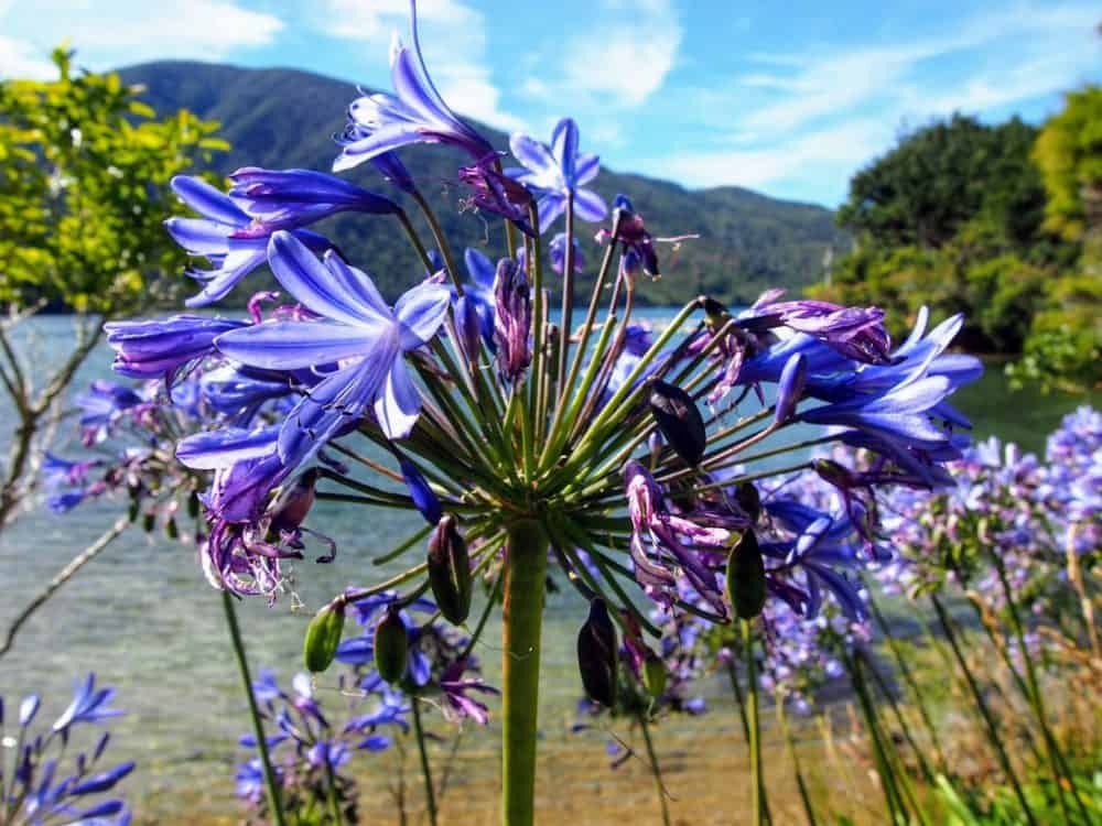
A more open, grassy section of the track, we maintained a fast pace no matter how many photo stops we made. And there were a lot.
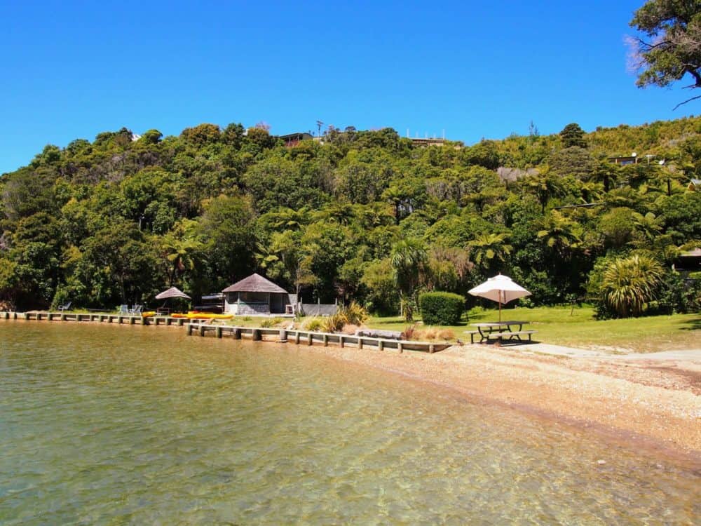
Arriving at our next destination, Punga Cove Resort in Camp Bay, a scant 3.5 hours later, I had plenty of time to sit on the pier with a plate of fish and chips for lunch and admire the view. With a cold beer. Just because I could.
Yeah, this hiking thing is tough.
Relaxing in the hot tub that night (because of course there was a hot tub), we were chatting about how well our first two days had gone. No injuries beyond the odd blister, no complaints beyond the odd whimper, no bad meals, and definitely no long-drop toilets. All in all, a total success.
Which was rather fortunate, really, since the next day we would be hiking 24 km. That’s a long way on flat ground. On a hiking trail that rises and falls several hundred metres over that distance?
Well, let’s just say it wasn’t going to be easy.
[section background_image=”” text_color=”#666666″ background_color=”#eeeeee”]
Other Queen Charlotte Accommodation on Day 2
There are a few other accommodation options on the western side of Endeavour Inlet, mostly clustered around Camp Bay.
Again, the cheapest option is the DOC campsite. There are 20 spaces available, with flush toilets and a cooking shelter. It’s $8/night per adult, payable in the registration box.
Mahana Lodge is a good, albeit expensive, alternative to Punga Cove Resort, and lies just slightly further along the track.
[/section]
Day 3: Punga Cove Resort to Portage
The briefing we’d been given back in Picton about the third day’s walking was low-key, in a typically Kiwi sort of way. “It’s quite long, and there are a few climbs.”
24 kilometres (15 miles) in fact, from our starting point at Punga Cove through to Portage, with several fairly steep ascents and descents along the way.
And no hot tub at the end. That was the real kicker.
Unlike the previous day, there would be no lounging around in bed this morning. We were up and out the door by 7:00 am, trying to beat the heat of the relentless New Zealand sun.
Hot weather and blue skies is perfect for almost every outdoor activity in the country, but walking seven or eight hours in it isn’t quite so great.
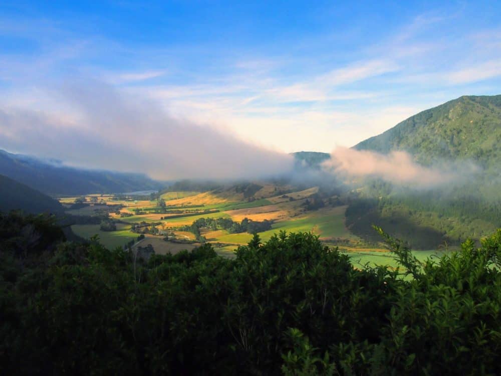
Misty cloud still hung over the valleys and hilltops as we headed out, with only a few longing gazes back towards the people in the resort restaurant tucking into breakfast.
There was a noticeable chill in the shadows as we crested our first hill, the dozens of spider webs in the bushes still wearing a coating of overnight dew. As the sun started to clear the mountains, however, things warmed up in a hurry.

Being such a popular walk, it’s rare to have it to yourself for long in the middle of summer. Still, at this hour we only passed the occasional other hiker, greeting each other with a smile or a grimace depending on the steepness of that section of track.
Stopping for a snack at a viewpoint with a conveniently-located table, we were soon joined by a couple of young Austrian guys who had been powering up the track behind us.
These two were seriously fit, looking like they probably ran marathons before breakfast each morning. When they discovered I was a local, they had a question for me.
“Are all of the walks in New Zealand like this?” one of them asked, waving his arm in the direction of the wide, flat track stretching off into the trees. When I enquired as to exactly what he meant, he replied with a smile “Well, you know … like a highway?”
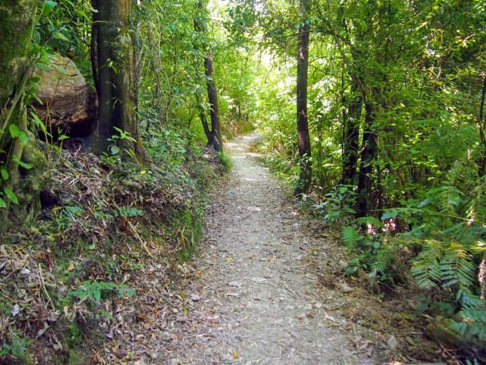
With blue ocean stretching to the horizon and native birds chirping in the background, it didn’t feel all that much like a highway to me, but I could see his point.
In Austria, he told me, you just buy a map and start hiking through the mountains until it’s time to stop. Compared to that, this path was all a bit easy, really.
“There are lots of places in New Zealand where you can just buy a map and walk through the mountains for a few days as well,” I told him, “but not the Great Walks. We’d lose too many tourists that way.”
With a laugh and a wave, they re-packed their bags and strode off down the track again. In seconds they’d disappeared around a corner and out of sight. Damn those guys were fit.
Half an hour further down the track was a side path, a steep 20-minute climb up to Eatwell’s Lookout. I was still feeling fresh enough to walk up there, while Lauren decided that continuing her slow plod down the main trail would be a far better option.
Halfway up the side track, I could kinda see her point…
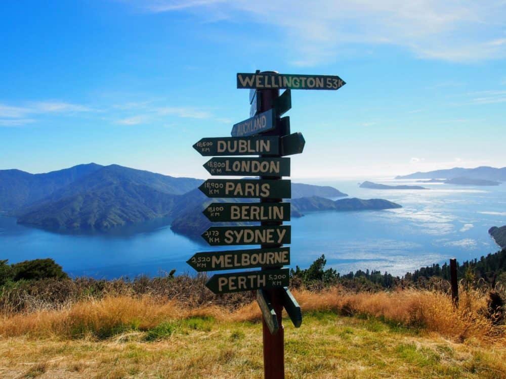
… until we got to the top, at least. A signpost had been erected pointing to major cities all over the world, but on a day like this, with views like that, I didn’t want to be in any of them.
Lauren had made surprisingly good pace, and we didn’t catch up until we found her lazing in the sun at the half-way point for the day. This was one of the most scenic parts of the track, with views around every corner.
With the sun now beating with full force, though, I was loathe to spend too much time taking photos if there wasn’t any shade. No more side trails, no more standing around. We needed to move.
Fortified by a quick lunch, we powered through the next, exposed section of track until we finally regained the shelter of the forest, and I was able to remove my extremely attractive t-shirt-based-headwear.
Although, really, it looked so good that I was tempted to make it a regular part of my fashion wardrobe.

As usual on these sorts of walks, it was the last hour that was the hardest. Lauren had done incredibly well up to this point, but this was easily the furthest she’d ever walked, and it was starting to show.
Descending from the ridgeline we’d been hiking along all day, it was on the home stretch towards Portage when she finally hit empty. We were all exhausted. It had been a long, hot day in the sun, and no amount of food, water, or coaxing was going to change that.
Eventually though, under duress, everyone made it to the Portage Resort Hotel alive and mostly well. This was to be our final stop on the track. A need to catch the train to Christchurch the following afternoon meant we’d have to take the water taxi out, and miss the last 20 km of the trail.
To be fair, though, I don’t think any of us were terribly upset about that. Especially not the person who was by this point lying face-down on the living room floor, saying that she would never be able to walk again.
Not even a meal of fish and chips, a cold beer, or a glorious sunset could convince her otherwise.
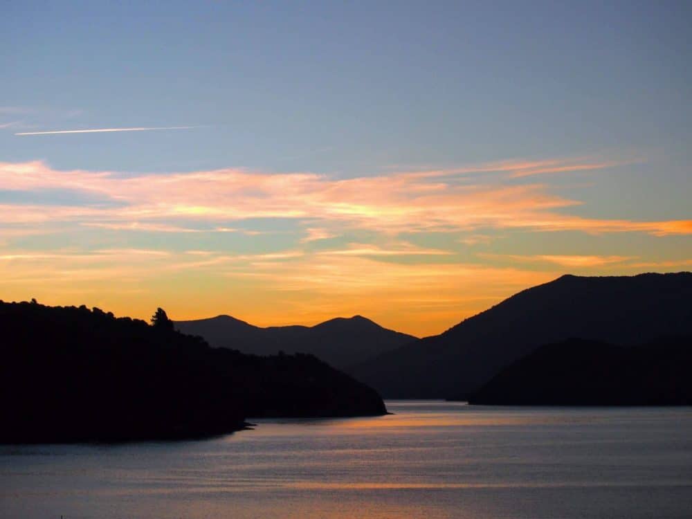
I was up early the next day, eager for one final photo before we jumped in the minivan for the short trip over to Torea Bay and the water taxi back to Picton. The bay was perfect, barely a ripple disturbing its glassy surface in the morning sun.
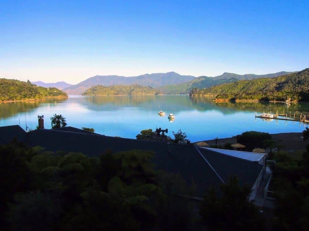
A lone bird soared overhead searching for food, the flags on boats in the harbour barely twitching in the non-existent breeze. It was a beautiful morning in a beautiful part of a beautiful country.
The previous day had been a challenge, but the pain in my legs was forgotten as I soaked it all in. This was exactly how I wanted to remember my homeland, and the three days of hiking that it took us to get to this place just made the memory more worthwhile.
If you make it to the Queen Charlotte Track, I reckon it will for you as well.
[section background_image=”” text_color=”#666666″ background_color=”#eeeeee”]
Other Queen Charlotte Track Accommodation on Day 3
There are three DOC campsites on the track between Camp Bay and Portage: Bay of Many Coves, Black Rock, and Cowshed Bay.
The first two are fairly basic, and cost $6/night. The site at Cowshed Bay has space for 20 tents, with a shelter, flush toilets, and cold shower, and costs $13/night.
[/section]
[section background_image=”” text_color=”#666666″ background_color=”#eeeeee”]
Things to Know About Walking the Queen Charlotte Track
Most people walk the Queen Charlotte Track in four days, with the first two being somewhat shorter and easier than the last two. If you started early enough, you might be able to squeeze those first two days into one, but it’d be a long day.
Because parts of the track cross private land, you need a Queen Charlotte Track Land Cooperative Pass for the section between Kenepuru Saddle and Davies Bay (typically, days three and four). The pass costs $10 for one day, or $18 for five consecutive days, with the fee going towards track maintenance.
There’s no road access to Ship Cove, so you’ll need to take a water taxi from Picton. Various companies offer that service, with details and bookings available at the Picton information centre and elsewhere.
Returning to Picton from Anikiwa at the end is easier, since buses and private vehicles can get there. Water taxis are also available from there, or many other places on the track, if (like us) you don’t have time to walk the entire distance.
This also makes day walks on the Queen Charlotte Track a viable option, where you get dropped off by a water taxi in one bay, and picked up somewhere else a few hours later. Timetables and locations vary by operator, letting you pick and choose to a reasonable degree.
The track is shared use, meaning that both hikers and mountain bikers can use it. The Ship Cove to Kenepuru Saddle section is closed to cyclists in the peak summer season (Dec 1 to Feb 28), with the rest of the track available year round.
If you don’t want to carry your backpack the entire way, water taxis can transport it between various points for you for a fee.
As with all walks in New Zealand, conditions can change quickly, even in the height of summer. Make sure you’ve got a hat, sunscreen, and sufficient water on hot, sunny days, along with warm clothes and a waterproof jacket or poncho in case things take a turn for the worse.
[/section]
As mentioned, our transport and accommodation was provided by the Marlborough Sounds Adventure Company, as part of Tourism New Zealand’s Explore media program.


Stunning photos Dave – such a beautiful part of the country!
I didn’t get a chance to do the walk, but the Marlborough Sounds was one of my favorite places in New Zealand. It just has a magical feel about it. You’re pictures are really bringing me back!