A Long Day in the Mountains: Hiking the Tongariro Crossing
Articles on this site contain affiliate links, meaning I may be compensated if you buy a product or service after clicking them. The full privacy & disclosure policy is here.Finally the day had come.
We were preparing to walk the Tongariro Alpine Crossing, a 20-odd kilometre trek in the central North Island that winds through alpine valleys, up steep volcanic mountains, and along exposed ridgelines.
On a good day, it is often called the best one-day hike in New Zealand. On a bad day, driving wind, rain, and snow pose a serious risk of hypothermia or worse. The difference between a good day and a bad day?
Sometimes, about half an hour.
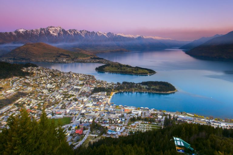
We’d chosen to stay in National Park village, the closest point to the start of the track, to give us the most flexibility in case of inclement weather. New Zealand was in the grip of a severe drought when we arrived, however, so while you never know what you’ll get in the mountains, our biggest risk was more likely to be dehydration or sunburn than freezing temperatures.
We had three nights at Manowhenua Lodge, a lovely sprawling, friendly hostel with a large fireplace in the common room and seemingly as many showers as bedrooms, a testament to the popularity of the place with ski bums in winter.
Wi-Fi was priced at a level that made me want to spend a whole lot of time offline, but for once that wasn’t a problem. I was there to hike, not update my Facebook status.

With a promising weather forecast, the large kitchen was getting quite a workout at 6:30am. Thermal tops and hiking boots stretched from one side to the other as hikers tried to fit as many calories as possible inside themselves before the shuttle bus left.
The morning cloud was already breaking up as we neared the trailhead, bright shards of sunlight picking out the snow-capped peak of Mount Ruapehu. It was going to be a good day.
The first hour or so of the walk was deceptively simple, a well-formed path slowly climbing up out of the tussocks and into the volcanic rock that defines the hike. Despite Lauren’s recently-awarded hiking credentials, she was more than a little nervous about what the day had in store, but everyone was feeling great as we took a break near Soda Springs to amuse ourselves with the clothing choices of some of our fellow hikers.
Apparently jeans, skin-tight long-sleeved shirt, running shoes, and a trilby is perfect alpine hiking attire. Who knew?

From that point, there was only one direction to go. Up.
The aptly-named Devil’s Staircase was a steep, sweaty climb, ascending around 300m up the rough volcanic path. Paces started to slow, and for some reason our friend in the jeans and trilby seemed to be finding it hard going. I can’t imagine why.
The cloudless sky didn’t do much for comfort levels, but it made for some incredible views. It’s pretty rare to have conditions like these all the way up, so we took an awful lot of photos along the way. And no, of course they weren’t an excuse to have a rest. Why do you ask?

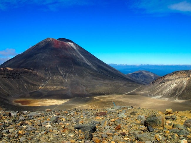
Finally stumbling sauntering over the top of the rise, we joined the few other groups taking a snack break at South Crater. We briefly considered the unmarked trail leading up towards Mount Ngauruhoe, but decided against it: the ascent involves a very steep, difficult climb on unstable terrain, and nobody was particularly in the mood for a broken ankle that day. We just had to settle for dramatic photos of “Mount Doom” instead.

We’d been told to make the most out of the next part of the track, as it was the only flat section of the entire crossing. Speeding across the vast dusty basin, all too soon we hit the other end and started to climb again. The good news is this ascent was much shorter than the one up the Devil’s Staircase, the bad news was much of it was loose, slippery ash and rock.
The worse news was, with a section of track closed ahead due to volcanic activity, we knew we were going to have to come back down it a few hours later.

Red Crater lay before us at the top of the rise, a massive scar on the landscape from prehistoric eruptions. A narrow, exposed part of the track, I was pleased we were doing this hike in good weather. This, the highest section of the main Tongariro crossing, regularly sees winds strong enough to blow the unwary straight off the mountain.
For us, though, the gentle breeze was just enough to dry the sweat on our faces as we climbed up to look over the crater lakes below.


After devouring the rest of our lunch and watching an over-eager photographer nearly kick his backpack into the crater while in search of the perfect shot, it was time to turn around and head back. Well, for the sensible member of the party, at least.

While Lauren slid on her ass carefully picked her way back down the scree slope, I decided to tackle the summit of Mount Tongariro itself. An easier option than Ngauruhoe, the undulating ridgeline only rises an extra 100m or so from Red Crater. I was concerned about the thick white cloud that was rapidly approaching as we began, but it blew straight past us and left bright blue skies in its wake once more.
It wasn’t a particularly challenging walk, just one that required a little care on the steeper sections. Obviously, therefore, I fell over at least three times in the process. Because that’s how I roll. Literally.

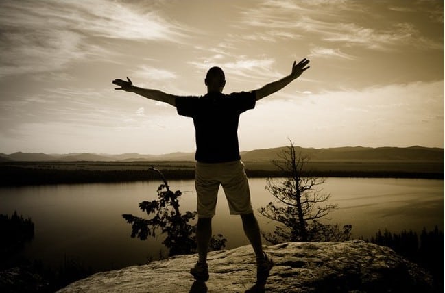
Still, as we clambered up the final few rocks to the summit and saw the view stretched out before us, any minor concerns about bruises, scrapes or dirt patches were quickly ignored. I’d forgotten up until that moment, but it was exactly fifteen years to the day since I had first boarded a plane and set off for the other side of the world.
A decade and a half later, I was standing at the top of a mountain, admiring the beauty that makes my homeland such an incredible place. If there was a better way to celebrate, I really couldn’t think of it.

If the slog to the top had been hard work, the walk back out again was remarkably easy. Reuniting with a napping Lauren back at South Crater, we seemed to almost fly down Devil’s Staircase. Knowing there was a shuttle back to the village at 3:30pm seemed to give us all an extra burst of energy, and we must have passed well over fifty people as we sped along the boardwalks and rocky trails.
It wasn’t hard to see why people speak so highly of the Tongariro Crossing. It’s easily one of the best day walks I’ve done, anywhere in the world. If you have a reasonable degree of fitness, and at least something approaching the right gear for all conditions (no, not jeans), it’s well worth building this hike into your New Zealand itinerary. It’ll end up one of the highlights of your trip.

Stunning photos, Dave!
Reminds me that I must go back and do this in summer… I gave it a go on a bright and sunny July morning in 2009…. but the weather turned to custard so quickly, we were forced to turn around and slide down the now snow covered mountain.
Wow … I guess that’s always the risk in a NZ winter (hell, it’s a risk in a Kiwi summer!), but still, must have made for an ‘interesting’ descent!
Yeh I have to agree that Tongariro Crossing is easily the best walk I’ve ever done. One of the most painful as well. Let’s just say that Converse is so not the right pair of shoes to be doing it in…My feet were sore for days…I bought proper shoes the week after.
Ooops! Yup, other than flip-flops I’m not sure that I can think of a worse footwear choice … no ankle or arch support probably isn’t great when you’re walking up and down a volcano! 🙂
Beautiful! Tongariro is on my life list … though I’m not much of a tramper, and I’m a little intimidated.
It’s definitely a challenging walk if you’re not used to hiking, but as long as the weather is good, it’s do-able by most people who have reasonable fitness. Give it a go!
Those are some seriously stunning photos! I can’t wait to be able to visit New Zealand and get some of those great views of Mount Doom.
Thanks Sam – and it’s definitely worth the visit.
Great photos Dave. Tongariro National Park is one of my favourite parts of NZ. Haven’t done the crossing but spent a lot of time on Ruapehu. Can’t wait to get back there!
Hi Dave, I just came across your blog. Have attempted Tongariro twice and got cancelled by the weather both times. Nice pics.. makes me want to give it another go. Maybe third time lucky.